Middlesex Township, Cumberland County, Pennsylvania

Last updated

Middlesex Township,
Cumberland County,
Pennsylvania
Carlisle Springs, Pennsylvania.jpg
Carlisle Springs is at a crossroads in the township on Pennsylvania Route 34 northeast of Carlisle.
Map of Cumberland County Pennsylvania Highlighting Middlesex Township.PNG
Map of Cumberland County, Pennsylvania highlighting Middlesex Township
Map of Pennsylvania highlighting Cumberland County.svg
Map of Cumberland County, Pennsylvania
Country United States
State Pennsylvania
County Cumberland
Government
  TypeBoard of Supervisors
Area
[1]
  Total25.96 sq mi (67.25 km2)
  Land25.69 sq mi (66.54 km2)
  Water0.27 sq mi (0.70 km2)
Population
 (2010)
  Total7,040
  Estimate 
(2016) [2]
7,367
  Density286.74/sq mi (110.71/km2)
Time zone UTC-5 (Eastern (EST))
  Summer (DST) UTC-4 (EDT)
Area code 717
FIPS code 42-041-49072
Website middlesextwp.com
Historical population
CensusPop.Note
2000 6,669
2010 7,0405.6%
2016 (est.)7,367 [2] 4.6%
U.S. Decennial Census [3]

Middlesex Township is a township located in Cumberland County, Pennsylvania, United States. As of the 2010 census, the township had a total population of 7,040. [4]

Contents

Geography

Middlesex Township is in northeastern Cumberland County, bordered to the north by Perry County along the crest of Blue Mountain. Conodoguinet Creek, a tributary of the Susquehanna River, crosses the center of the township. Unincorporated communities in the township include Donnellytown in the northeast, Carlisle Springs in the northwest, and part of the Schlusser census-designated place along the western border.

Interstate 76 (the Pennsylvania Turnpike), Interstate 81, and U.S. Route 11 cross in a triangle formation near the center of the township. There is no direct access between I-76 and I-81; instead, a 1-mile (1.6 km) stretch of US 11 connects Exit 226 on I-76 with Exit 52 on I-81. The borough of Carlisle, the county seat, is approximately 4 miles (6 km) southwest of the highway crossing area via US 11, and Harrisburg, the state capital, is about 16 miles (26 km) to the east.

The Appalachian Trail crosses the northern half of the Cumberland Valley following a route near the eastern border of Middlesex Township.

According to the United States Census Bureau, the township has a total area of 25.9 square miles (67.2 km2), of which 25.7 square miles (66.5 km2) is land and 0.27 square miles (0.7 km2), or 1.05%, is water. [4]

Demographics

As of the census [5] of 2000, there were 6,669 people, 2,298 households, and 1,730 families residing in the township. The population density was 257.2 inhabitants per square mile (99.3/km2). There were 2,392 housing units at an average density of 92.3 units per square mile (35.6 units/km2). The racial makeup of the township was 95.98% White, 1.50% African American, 0.10% Native American, 0.79% Asian, 0.04% Pacific Islander, 0.43% from other races, and 1.14% from two or more races. 1.26% of the population were Hispanic or Latino of any race.

There were 2,298 households, out of which 35.6% had children under the age of 18 living with them, 63.3% were married couples living together, 8.0% had a female householder with no husband present, and 24.7% were non-families. 20.0% of all households were made up of individuals, and 7.0% had someone living alone who was 65 years of age or older. The average household size was 2.61 and the average family size was 3.01.

In the township the population was spread out, with 23.7% under the age of 18, 6.8% from 18 to 24, 31.5% from 25 to 44, 24.5% from 45 to 64, and 13.5% who were 65 years of age or older. The median age was 39 years. For every 100 females, there were 105.0 males. For every 100 females age 18 and over, there were 101.3 males.

The median income for a household in the township was $50,471, and the median income for a family was $59,250. Males had a median income of $36,985 versus $24,554 for females. The per capita income for the township was $24,902. 5.7% of the population and 4.1% of families were below the poverty line. Out of the total population, 10.0% of those under the age of 18 and 4.6% of those 65 and older were living below the poverty line.

Related Research Articles

<span class="mw-page-title-main">Eden Township, Pennsylvania</span> Township in Pennsylvania, United States

Eden Township is a township in southeastern Lancaster County, Pennsylvania, United States. At the 2020 census, the population was 2,248. It is part of the Solanco School District.

<span class="mw-page-title-main">Latimore Township, Pennsylvania</span> Township in Pennsylvania, United States

Latimore Township is a township in Adams County, Pennsylvania, United States. The population was 2,580 at the 2010 census.

<span class="mw-page-title-main">Mount Pleasant Township, Adams County, Pennsylvania</span> Township in Pennsylvania, United States

Mount Pleasant Township is a township that is located in Adams County, Pennsylvania, United States. As of the 2010 census, the township population was 4,693.

<span class="mw-page-title-main">Woodbury Township, Bedford County, Pennsylvania</span> Township in Pennsylvania, United States

Woodbury Township is a township that is located in Bedford County, Pennsylvania, United States. As of the 2020 census, the population was 1,180.

<span class="mw-page-title-main">Union Township, Crawford County, Pennsylvania</span> Township in Pennsylvania, United States

Union Township is a township in Crawford County, Pennsylvania, United States. The population was 857 at the 2020 census, down from 1,010 at the 2010 census.

<span class="mw-page-title-main">Silver Spring Township, Pennsylvania</span> Township in Pennsylvania, United States

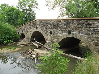
Silver Spring Township is a township in Cumberland County, Pennsylvania, United States. The population was 13,657 at the 2010 census, up from 10,592 at the 2000 census.

<span class="mw-page-title-main">Fannett Township, Pennsylvania</span> Township in Pennsylvania, United States

Fannett Township is a township in Franklin County, Pennsylvania, United States. The population was 2,483 at the 2020 census. The township derives its name as an older variant spelling of Fanad, County Donegal, from early Irish settlement in the area. It was formed before 1762, and until about 1795 included the area now in Metal Township.

<span class="mw-page-title-main">Franklin Township, Greene County, Pennsylvania</span> Township in Pennsylvania, United States

Franklin Township is a township in Greene County, Pennsylvania, United States. The population was 7,062 at the 2020 census, down from 7,280 at the 2010 census.

<span class="mw-page-title-main">Barnett Township, Jefferson County, Pennsylvania</span> Township in Pennsylvania, United States

Barnett Township is a township in Jefferson County, Pennsylvania, United States. The population was 231 at the 2020 census down from 254 at the 2010 census. It was named for Jefferson County pioneer Joseph Barnett.

<span class="mw-page-title-main">Rose Township, Jefferson County, Pennsylvania</span> Township in Pennsylvania, United States

Rose Township is a township in Jefferson County, Pennsylvania, United States. The population was 1,157 at the 2020 census. It was named for a prominent citizen named Dr. Rose.

<span class="mw-page-title-main">Paradise Township, Lancaster County, Pennsylvania</span> Township in Pennsylvania, United States

Paradise Township is a township that is located in east-central Lancaster County, Pennsylvania, United States. The population was 5,696 at the time of the 2020 census.

<span class="mw-page-title-main">West Cocalico Township, Pennsylvania</span> Township in Pennsylvania, United States

West Cocalico Township is a township that is located in northeastern Lancaster County, Pennsylvania, United States. The population was 7,491 at the time of the 2020 census.

<span class="mw-page-title-main">Deer Creek Township, Mercer County, Pennsylvania</span> Township in Pennsylvania, United States

Deer Creek Township is a township in Mercer County, Pennsylvania, United States. The population was 456 at the 2020 census, a decline from the figure of 502 in 2010.

<span class="mw-page-title-main">Lake Township, Mercer County, Pennsylvania</span> Township in Pennsylvania, United States

Lake Township is a township in Mercer County, Pennsylvania, United States. The population was 702 at the 2020 census, a decline from the figure of 780 in 2010.

<span class="mw-page-title-main">Greenwood Township, Perry County, Pennsylvania</span> Township in Pennsylvania, United States

Greenwood Township is a township in Perry County, Pennsylvania, United States. The population was 1,032 at the 2020 census.

<span class="mw-page-title-main">Howe Township, Perry County, Pennsylvania</span> Township in Pennsylvania, United States

Howe Township is a township in Perry County, Pennsylvania, United States. The population was 375 at the 2020 census.

<span class="mw-page-title-main">Wheatfield Township, Pennsylvania</span> Township in Pennsylvania, United States

Wheatfield Township is a township in Perry County, Pennsylvania, United States. The population was 3,194 at the 2020 census.

<span class="mw-page-title-main">Bloss Township, Pennsylvania</span> Township in Pennsylvania, United States

Bloss Township is a township in Tioga County, Pennsylvania, United States. The population was 344 at the 2020 census.

<span class="mw-page-title-main">Covington Township, Tioga County, Pennsylvania</span> Township in Pennsylvania, United States

Covington Township is a township in Tioga County, Pennsylvania, United States. The population was 1,031 at the 2020 census.

<span class="mw-page-title-main">North Strabane Township, Pennsylvania</span> Township in Pennsylvania, United States

North Strabane Township is a township in Washington County, Pennsylvania, United States. The population was 15,691 at the 2020 census. The township is named after the town of Strabane in County Tyrone, Northern Ireland. The township borders the borough of Canonsburg, Pennsylvania to the north. North Strabane is a part of Canon-McMillan School District.

References

  1. "2016 U.S. Gazetteer Files". United States Census Bureau. Retrieved August 13, 2017.
  2. 1 2 "Population and Housing Unit Estimates" . Retrieved June 9, 2017.
  3. "Census of Population and Housing". Census.gov. Retrieved June 4, 2016.
  4. 1 2 "Geographic Identifiers: 2010 Census Summary File 1 (G001): Middlesex township, Cumberland County, Pennsylvania". U.S. Census Bureau, American Factfinder. Archived from the original on February 13, 2020. Retrieved June 22, 2015.
  5. "U.S. Census website". United States Census Bureau . Retrieved January 31, 2008.

40°13′00″N77°06′59″W / 40.21667°N 77.11639°W / 40.21667; -77.11639