
Sherston is a village and civil parish about 5 miles (8 km) west of Malmesbury in Wiltshire, England. The parish is bounded to the north by the county boundary with Gloucestershire, and to the southeast by the Fosse Way, a Roman road. The parish includes the hamlets of Easton Town, immediately east of Sherston; Pinkney, further east along the Malmesbury road; and Willesley, to the north.

Easton Grey is a small village and civil parish in north Wiltshire, England, on the county boundary with Gloucestershire. The village lies just south of the B4040 road between Malmesbury and Sherston, about 3.5 miles (6 km) west of Malmesbury. The Church of England parish church has a 15th-century tower and was rebuilt in 1836.

Purton is a large village and civil parish in north Wiltshire, England, about 4 miles (6 km) northwest of the centre of Swindon. The parish includes the village of Purton Stoke and the hamlets of Bentham, Hayes Knoll, Purton Common, Restrop, The Fox and Widham.

Box is a large village and civil parish within the Cotswolds Area of Outstanding Natural Beauty in Wiltshire, England, about 3 miles (5 km) west of Corsham and 5 miles (8 km) northeast of Bath. Box also falls in the easternmost part of the Avon Green Belt. Besides the village of Box, the parish includes the villages of Ashley and Box Hill; Hazelbury manor; and the hamlets of Alcombe, Blue Vein, Chapel Plaister, Ditteridge, Henley, Kingsdown, Middlehill, and Wadswick. To the east the parish includes much of Rudloe, formerly a hamlet but now a housing estate, and the defence establishments and related businesses on the site of RAF Rudloe Manor.
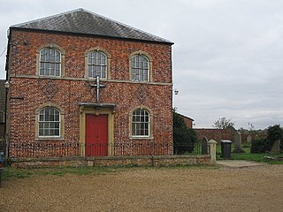
Southwick is a semi-rural village and civil parish 3 miles (4.8 km) southwest of the county town of Trowbridge, Wiltshire, England. It is separated from the southwest fringe of Trowbridge only by the Southwick Country Park, which consists of 380 acres (150 ha) of open fields. The majority of the village lies south of the A361, which runs through the village, linking Trowbridge with Frome.

Kington Langley is a village and civil parish about 2 miles (3.2 km) north of Chippenham in Wiltshire, England. The parish includes the hamlet of Bowldown.
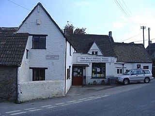
Luckington is a village and civil parish in the southern Cotswolds, in north-west Wiltshire, England, about 6+1⁄2 miles (10 km) west of Malmesbury. The village is on the B4040 road linking Malmesbury and Chipping Sodbury. The parish is on the county border with Gloucestershire and includes the village of Alderton and the hamlet of Brook End.
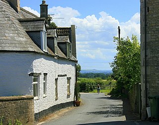
Atworth is a village and civil parish in west Wiltshire, England. The village is on the A365 road between Melksham and Box, about 2.5 miles (4 km) northwest of Melksham and 4 miles (6 km) northeast of Bradford on Avon. The hamlet of Purlpit lies east of Atworth village, and in the south of the parish are the small village of Great Chalfield and the hamlet of Little Chalfield.

Hullavington is a village and civil parish in Wiltshire, England, just to the north of the M4 motorway. The village lies about 4 miles (6 km) southwest of Malmesbury and 5+1⁄2 miles (9 km) north of Chippenham.

Allington is a hamlet in north Wiltshire, England. It is on the edge of the market town of Chippenham, about 2 miles (3 km) north-west of the town centre and about 0.3 miles (500 m) north of the A420 road towards Bristol.

Whitley is a village in the civil parish of Melksham Without, Wiltshire, England. It had a population of 1,914 in the 2011 census. This parish was formed in Local Government Act of 1894, when Whitley was united with the nearby settlements of Beanacre and Shaw, which are all primarily residential and agricultural communities. The village is about 2 miles (3.2 km) northwest of Melksham on the B3353 Shaw to Corsham road. The hamlet of West Hill is to the west, on the road to Atworth.
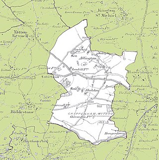
Chippenham Without is a civil parish in Wiltshire, England, created as a separate entity from the parish of Chippenham by the Local Government Act 1894 and largely consisting of farmland to the west of Chippenham, towards Biddestone. Of note within it are the ancient settlements of Allington and Sheldon, the latter with its manor house. The population taken at the 2011 census was 208.

Malmesbury is a town and civil parish in north Wiltshire, England, which lies approximately 14 miles (23 km) west of Swindon, 25 miles (40 km) northeast of Bristol, and 9 miles (14 km) north of Chippenham. The older part of the town is on a hilltop which is almost surrounded by the upper waters of the Bristol Avon and one of its tributaries.

Southwick is a semi-rural village and civil parish 3 miles (4.8 km) southwest of the county town of Trowbridge, Wiltshire, England. It is separated from the southwest fringe of Trowbridge only by the Southwick Country Park, which consists of 380 acres (150 ha) of open fields. The majority of the village lies south of the A361, which runs through the village, linking Trowbridge with Frome.

Crudwell is a village and civil parish in north Wiltshire, England. The nearest towns are Malmesbury, about 4 miles (6.4 km) to the south-west, and Cirencester, Gloucestershire 8 miles (13 km) to the north-east. Also to the north-east is Cotswold Airport. Kemble village, about 4 miles (6.4 km) away, has the nearest railway station, with services to London Paddington and Gloucester.
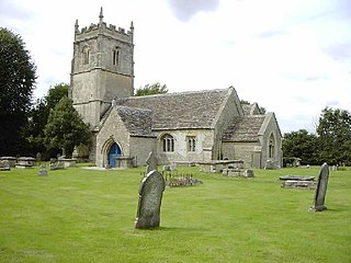
Hankerton is a village and civil parish in Wiltshire, England, 3 miles (4.8 km) northeast of Malmesbury. The parish includes the hamlets of Cloatley, Cloatley End and Bullock's Horn.

Blackland is a hamlet and former civil parish in Calne Without parish, just south-east of the town of Calne in Wiltshire, England. There is a 13th-century church and an 18th-century country house, Blackland House.

St Paul Malmesbury Without is a civil parish surrounding Malmesbury, Wiltshire, England. Its main settlements are the village of Corston and the hamlets of Milbourne and Rodbourne.

Rodbourne is a small village in Wiltshire, England, in the civil parish of St Paul Malmesbury Without about 2.5 miles (4.0 km) south of the town of Malmesbury. The hamlet of Rodbourne Bottom is 0.5 miles (0.80 km) south of the village.

Cole Park is a Grade II* listed moated country house off Grange Lane, in the parish of St Paul Malmesbury Without, about 1+1⁄4 miles (2.0 km) south of Malmesbury, Wiltshire, England. It stands on land once known as Cowfold that was owned in the Middle Ages by the Abbey of Malmesbury, and in the Tudor period was a royal stud.


