
The Borough of Harrogate was a local government district with borough status in North Yorkshire, England, from 1974 to 2023. Its council was based in the town of Harrogate, but it also included surrounding settlements, including the cathedral city of Ripon, and almost all of the Nidderdale Area of Outstanding Natural Beauty. At the 2011 Census, the borough had a population of 157,869.

Boroughbridge is a town and civil parish in North Yorkshire, England. Historically part of the West Riding of Yorkshire, it is 16 miles (26 km) north-west of York. Until a bypass was built the town lay on the main A1 road from London to Edinburgh, which crosses the River Ure here.

Aldborough is a village 7 miles (11 km) in the civil parish of Boroughbridge, to the north-east of Knaresborough, in North Yorkshire, England.

Bishop Monkton is a village and civil parish in the Harrogate district of North Yorkshire, England, about five miles south of Ripon. According to the 2001 census it had a population of 775, increasing slightly to 778 at the 2011 Census. In 2015, North Yorkshire County Council estimated the population to be 760.

Burton Leonard is a village and civil parish in the Harrogate district of North Yorkshire, England, and approximately 7 miles (11 km) south from Ripon. In the 2001 Census, the population of the village was 654, which had risen to 690 by the time of the 2011 Census. In 2015, North Yorkshire County Council estimated the population had dropped to 670.

North Stainley is a village in the Harrogate district of North Yorkshire, England 4 miles (6.4 km) north of Ripon. Historically part of the West Riding of Yorkshire, it is the closest settlement to the theme park Lightwater Valley which is 0.62 miles (1 km) to the south.

Myton-on-Swale is a village and civil parish in North Yorkshire, England. It is about 3 miles east of Boroughbridge and on the River Swale.

Farnham is a village and civil parish in the Harrogate district of North Yorkshire, England. It is situated 2 miles (3.2 km) north of Knaresborough.
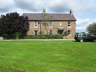
Humberton is a hamlet and civil parish in the Harrogate district of North Yorkshire, England. It is situated 2 miles (3.2 km) east from Boroughbridge and on the north side of the River Ure. The hamlet lies about one mile to the west of the Swale, and comprises 2,320 acres (9 km2) of land.

Kirk Hammerton is a village and civil parish in the Harrogate district of North Yorkshire, England. It is near the River Nidd and the A59 road, 10 miles (16 km) west of York. The village suffix refers to the Hamerton family who owned the land until the 16th century.

Kirby-on-the-Moor, also called Kirby, is a village in the Kirby Hill civil parish about 1 mile (1.6 km) north of the market town of Boroughbridge, in North Yorkshire, England. It was formerly in the Harrogate district until 2023.

Langthorpe is a village and civil parish in the Harrogate district of North Yorkshire, England. The population of the civil parish taken at the 2011 Census was 812. It is situated to the immediate north of Boroughbridge on the A168 road.

Little Ouseburn is a small village and civil parish in the Harrogate district of North Yorkshire, England. It is situated near the A1(M) motorway and 6 miles (9.7 km) south-east of Boroughbridge. It consists of two roads, Main Street which is the residential area, and Church Lane which contains a Holy Trinity Church that is a grade I listed building. It also has a small brick bridge over a stream which leads to Great Ouseburn. According to the 2011 census data the total population of Little Ouseburn is 264.
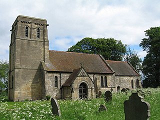
Moor Monkton is a village and civil parish in the former Harrogate District of North Yorkshire, England. It is situated on the River Nidd and 7 miles (11 km) north-west from York city centre.

Roecliffe is a village and civil parish in the Harrogate district of North Yorkshire, England. It is situated near the A1 road motorway which connects London with Edinburgh and is 1 mile west of Boroughbridge. It is on the banks of the River Ure and the village centres on the village green which doubles up as the school playing field.
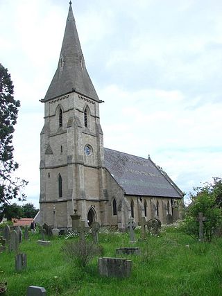
Staveley is a village and civil parish in the Harrogate district of North Yorkshire, England. It is situated 4 miles (6.4 km) north of Knaresborough and near the A1(M) motorway. In the 2001 census, the village had a population of 444, which had risen to 450 by the time of the 2011 census. In 2015, North Yorkshire County Council estimated the population to have dropped to 440.
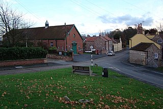
Whixley is a village and civil parish in the Harrogate district of North Yorkshire, England. It is near the A1(M) motorway and 10 miles (16 km) west of York. The ancient village of Whixley lies on Rudgate, the old Roman road along which the Roman “Hispania” Legion would have marched to nearby Isurium (Aldborough).
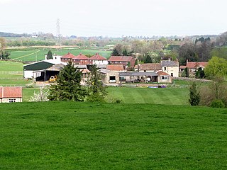
South Stainley is a small village in the Harrogate District, in the county of North Yorkshire, England. Nearby settlements include the city of Ripon, the town of Harrogate and the village of Markington. South Stainley is on the A61 road. South Stainley has a pub and a place of worship, St Wilfrid's Church, which is a grade II listed structure.

The Pilmoor, Boroughbridge and Knaresborough Railway was a railway line in North Yorkshire, England, that connected Pilmoor on the East Coast Main Line with the towns of Boroughbridge and Knaresborough. The first part of the branch headed south-westwards from the East Coast Main Line and terminated at Boroughbridge. In 1875, the branch was extended again to meet the line at Knaresborough.

The River Tutt is a 8.7-mile (14 km) long tributary of the River Ure in North Yorkshire, England. The river rises near to the villages of Nidd and Scotton draining mainly arable land north eastwards before emptying into the Ure at Boroughbridge. Where the river joins the Ure in Boroughbridge, has been the site of significant historic flooding. An Environment Agency project to alleviate flooding on the river has seen diversion schemes and pumps added to prevent this.


