Mill End, Rickmansworth

Last updated

Mill End, Rickmansworth
Hertfordshire UK location map.svg
Red pog.svg
Mill End, Rickmansworth
Location within Hertfordshire
  London 0 mi (0.0 km)The London Borough of Hillingdon is to the  S or SE
District
Shire county
Region
Country England
Sovereign state United Kingdom
Post town RICKMANSWORTH
Postcode district WD3
Dialling code 01923
Police Hertfordshire
Fire Hertfordshire
Ambulance East of England
UK Parliament
List of places
UK
England
Hertfordshire
51°38′12″N0°29′31″W / 51.63671°N 0.49187°W / 51.63671; -0.49187

Mill End is a suburb of Rickmansworth in Hertfordshire, England. Most of it is an unparished area, not being within a civil parish, although part of the built-up area comes under Chorleywood Parish Council. All of Mill End forms part of Three Rivers District and so is administered by Three Rivers District Council and Hertfordshire County Council. [1]

Contents

History

Mill End was historically a hamlet in the parish of Rickmansworth. By the 1870s, Mill End had church buildings and so had become a village; it was no longer a hamlet. It contained St. Peter's Church (built in 1874–5) and a Baptist chapel. St Peter's was a small flint building with Bath-stone dressings. The village also had a paper mill, tannery, and brewery. [2]

Mill End was included within the Rickmansworth Urban District from its creation in 1898 until it was abolished in 1974. [3]

Another notable ancient structure at Mill End was a timber-framed farmhouse called Shepherds Farm, mentioned in a 1294 subsidy roll with a reference to Robert Le Schephard. The subsidy roll of 1534 records the name of Robert Lane. The Lane family farmed there until 1773, when Joseph Lane sold the farm to Joseph Swannell. By 1839 the Thelluson trustees had bought it. They built a new farmhouse and used the original farmhouse as lodgings for single men employed on the farm. [4]

Tornado Cars used to manufacture kit cars at 90 Uxbridge Rd, Mill End. The company sold the cars either factory finished or in component form (in which case the buyer was responsible for assembling the car from the components). The first model was shown to the press in August 1958 and production of cars stopped in 1964. Tornado Cars won the 750 Motor Clubs' Six Hour Handicap Relay Race at Silverstone twice and, at its peak, employed 60 people. The new Fairway Tyre Services building on the site is called "Tornado House" as a tribute. [5]

Most of Mill End is unparished, but the part of it north of Oakfield is in Chorleywood Civil Parish. [6]

Geography

London is just to the south of Mill End (Mill End borders the London Borough of Hillingdon). [7]

Notable people

Harry Edwin Curtis

Harry Edwin Curtis JP (known as H.E. Curtis) was living in Springwell Lodge (276 Uxbridge Road) [8] Mill End when he died on 8 December 1948. [9] He had been a Hertfordshire County Council alderman and a chairman of Rickmansworth Urban District Council "who worked for the good of Mill End for many years and who had taken great interest in the welfare of old people". [10] :6

When Springwell Avenue, Mill End was built (in December 1925), Rickmansworth Urban District Council named it after Curtis' home, Springwell Lodge. [10] :16 In 1953 the council named Curtis Close (which contained bungalows for old people) in commemoration of Curtis. These road names were kept in 1972 when their pre-fabricated bungalows and houses were demolished and rebuilt. [10] :6

Job Lane

Job Lane (1620–1697) emigrated to America from Shepherds Farm, Mill End, in 1649 (with his brothers James and Edward). He was a carpenter who built bridges and houses in the Boston, Massachusetts area. He also imported goods from England. [11] [12]

In 1664 Lane became the owner of 1500 acres of land in Billerica in exchange for building a mansion at Norwich, Connecticut for Fitz John Winthrop, the grandson of Governor Winthrop. This land is now one-fifth of Bedford, Massachusetts. Lane also built one of the college buildings in Cambridge, Massachusetts. [13] [14]

Related Research Articles

<span class="mw-page-title-main">Hertfordshire</span> County of England

Hertfordshire is a ceremonial county in the East of England and one of the home counties. It borders Bedfordshire to the north-west, Cambridgeshire to the north-east, Essex to the east, Greater London to the south, and Buckinghamshire to the west. The largest settlement is Watford, and the county town is Hertford.
<span class="mw-page-title-main">Harefield</span> Human settlement in England

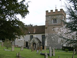
Harefield is a village in the London Borough of Hillingdon, England, 17 miles (27 km) northwest of Charing Cross near Greater London's boundary with Buckinghamshire to the west and Hertfordshire to the north. The population at the 2011 Census was 7,399. Harefield is the westernmost settlement in Greater London, and lies outside the capital's contiguous built-up area.

<span class="mw-page-title-main">Northwood, London</span> Area in the London Borough of Hillingdon

Northwood is an area in the London Borough of Hillingdon, located 14.5 miles (23.3 km) north-west of Charing Cross. Northwood was part of the ancient parish of Ruislip, Middlesex. The area was situated on the historic Middlesex boundary with Hertfordshire, and since being incorporated into Greater London in 1965, has been on the Greater London boundary with that county.

<span class="mw-page-title-main">Ruislip</span> Area of west London, England

Ruislip is an area in the London Borough of Hillingdon in West London. Prior to 1965 it was in Middlesex. Ruislip lies 13.8 miles (22.2 km) west-north-west of Charing Cross, London.
<span class="mw-page-title-main">Rickmansworth</span> Town in Hertfordshire, England

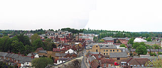
Rickmansworth, is a town in south-west Hertfordshire, England; it is located about 17 miles (27 km) north-west of central London, 5 miles (8 km) south-west of Watford and is inside the perimeter of the M25 motorway. The town is mainly to the north of the Grand Union Canal and the River Colne.

<span class="mw-page-title-main">Three Rivers District</span> Non-metropolitan district in England

Three Rivers is a local government district in south-west Hertfordshire, England. Its council is based in Rickmansworth. The district borders Hertsmere, Watford, St Albans, Dacorum, Buckinghamshire, and the London boroughs of Hillingdon and Harrow.

Croxley Green is both a village and a suburb of Rickmansworth in Hertfordshire, England. It is also a civil parish. Located on the A412 between Watford to the north-east and Rickmansworth to the south-west, it is approximately 20 miles (32 km) north-west of central London.

Chorleywood is both a village and a civil parish in the Three Rivers District, Hertfordshire, on the border with Buckinghamshire, approximately 20 miles (32 km) northwest of Charing Cross. The village is adjacent to the Chiltern Hills Area of Outstanding Natural Beauty and is part of the London commuter belt included in the government-defined Greater London Urban Area. Chorleywood was historically part of the parish of Rickmansworth, becoming a separate ecclesiastical parish in 1845 and a separate civil parish in 1898. The population of the parish was 11,286 at the 2011 census.

<span class="mw-page-title-main">South West Hertfordshire (UK Parliament constituency)</span> Parliamentary constituency in the United Kingdom, 1950 onwards

South West Hertfordshire is a constituency in the House of Commons of the UK Parliament, represented since 2019 by Gagan Mohindra, a Conservative.

<span class="mw-page-title-main">Sarratt</span> Human settlement in England

Sarratt is both a village and a civil parish in Three Rivers District, Hertfordshire, England. It is situated 4 miles (6.4 km) north of Rickmansworth on high ground near the county boundary with Buckinghamshire. The chalk stream, the River Chess, rising just north of Chesham in the Chiltern Hills, passes through Sarratt Bottom in the valley to the west of the village to join the River Colne in Rickmansworth. The conditions offered by the river are perfect for the cultivation of watercress. Sarratt has the only commercially operating watercress farm in Hertfordshire. The valley to the east of Sarratt is dry.

<span class="mw-page-title-main">Maple Cross</span> Human settlement in England

Maple Cross is a village in Hertfordshire, England, which up until the Second World War consisted of an inn, a blacksmith's shop and a few cottages. Today there are around 800 postwar council houses. Some of these have been sold into private ownership. The area is close by junction 17 of the M25 motorway, which makes up the western boundary of the village. It lies on the western fringe of Rickmansworth, about 5 miles (8.0 km) west of Watford and 6 miles north of Uxbridge.

<span class="mw-page-title-main">Batchworth</span> Human settlement in England

Batchworth was once a hamlet and is now a civil parish and part of Rickmansworth in Hertfordshire. The parish of Batchworth was created on 1 April 2017 consisting of two Three Rivers District Council wards: Rickmansworth Town, and Moor Park and Eastbury. The first election to Batchworth Parish Council was on 4 May 2017. There are eight councillors; four in each ward.

<span class="mw-page-title-main">Loudwater, Hertfordshire</span> Human settlement in England

Loudwater is a private housing estate in the parish of Chorleywood, separated from the latter by the River Chess, north of Rickmansworth, Hertfordshire and just to the east of Junction 18 of the M25 motorway. Loudwater is an old name for the River Chess. The 2001 population was 1,242.

Maple Cross and Mill End is a ward in Three Rivers, in England, the United Kingdom. It is located in the far south-west Hertfordshire, in the East of England region. The ward includes the eponymous villages of Maple Cross and Mill End, lying between Chorleywood West to the north; Penn, Rickmansworth, and Harefield to the east; and Chalfont St. Giles and Chalfont Common to the west.

This page provides brief details of primary schools in the borough of Three Rivers in Hertfordshire, England, United Kingdom.

<span class="mw-page-title-main">Lake Farm Country Park</span>

Lake Farm Country Park is an expanse of green belt land approximately 60 acres in size fringed by trees and the Grand Union Canal, situated in the south of Hayes in the London Borough of Hillingdon. Its formal status as a country park dates back to September 2002.

West Hyde is a village situated alongside the A412 road, in the Three Rivers District in south-west Hertfordshire, England. At the 2011 the population of the village was included in the Three Rivers ward of Maple Cross and Mill End.

<span class="mw-page-title-main">Chorleywood Common</span>

Chorleywood Common is a 75.6 hectare Local Nature Reserve in Chorleywood in Hertfordshire. It is owned and managed by Chorleywood Parish Council, and the declaring authority is Hertfordshire County Council. The common is part of the Chilterns Area of Outstanding Natural Beauty.

<span class="mw-page-title-main">Chorleywood House Estate</span>

Chorleywood House Estate is a 64.3 hectare Local Nature Reserve in Chorleywood in Hertfordshire. It is owned and managed by Three Rivers District Council, and the declaring authority is Hertfordshire County Council.

References

  1. "Mill End (Rickmansworth), Hertfordshire". UK Genealogy Archives. Retrieved 20 August 2013.
  2. An Old Inhabitant (Young Crawley) (1880). Guide to Hertfordshire, A Concise History of the County. Hertford, UK: Simson & Company. Retrieved 24 August 2013.
  3. 1898 Ordnance Survey 1:2500 map
  4. "Mill End". hertfordshire-genealogy.co.uk. Retrieved 20 August 2013.
  5. Malins, Dave. "The History of the Tornado". www.astruc.s.easynet.co.uk/tornado_register. Tornado Register. Archived from the original on 14 December 2001. Retrieved 28 August 2013.
  6. "Ordnance Survey Election Maps" . Retrieved 11 September 2021.
  7. "Hillingdon Borough Council - MapIt". mapit.mysociety.org. mySociety (Powered by MapIt). Retrieved 24 August 2013.
  8. "For the house number and street name see SPRINGWELL LODGE under the "Company directors and board members" tab for Jayfruit Limited". www.companieslist.co.uk. UK Companies List.
  9. "The London Gazette, 15 April 1949" (PDF). www.london-gazette.co.uk. The Stationery Office . Retrieved 22 August 2013.
  10. 1 2 3 Jacques, Adrienne (April 1987). Street Names of Rickmansworth. Rickmansworth, UK: Three Rivers District Council.
  11. "Three Rivers History, Rickmansworth". trmt.org.uk. Three Rivers Museum of Local History. Archived from the original on 24 October 2013. Retrieved 19 August 2013.
  12. "The Lane Family Papers, Biographies". www.bedfordmahistory.org. Bedford Historical Society. Retrieved 29 August 2013.
  13. "The Lane Family Papers, Home". www.bedfordmahistory.org. Bedford Historical Society. Retrieved 19 August 2013.
  14. Brown, Abram English (1891). History of the town of Bedford, Middlesex county, Massachusetts, from its earliest settlement to the year of Our Lord 1891. Bedford, Massachusetts: Published by the author. p.  7 . Retrieved 29 August 2013.