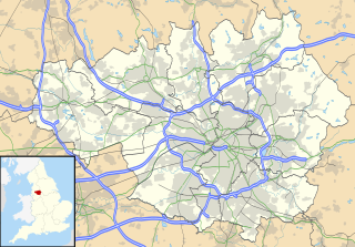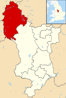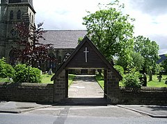
Longdendale is a valley in the Peak District of England, north of Glossop and southwest of Holmfirth. The name means "long wooded valley" and the valley is mostly in the counties of Derbyshire and Greater Manchester.

The Metropolitan Borough of Tameside is a metropolitan borough of Greater Manchester in North West England. It is named after the River Tame, which flows through the borough, and includes the towns of Ashton-under-Lyne, Audenshaw, Denton, Droylsden, Dukinfield, Hyde, Mossley and Stalybridge. Its western border is approximately 4 miles (6.4 km) east of Manchester city centre. Tameside is bordered by the metropolitan boroughs of Stockport and Oldham to the south and north respectively, the city of Manchester to the west and the borough of High Peak in Derbyshire to the east across Longdendale. As of 2011 the overall population was 219,324.

Stalybridge is a town in Tameside, Greater Manchester, England, with a population of 23,731 at the 2011 Census. Historically part of Cheshire, it is 8 miles (12.9 km) east of Manchester city centre and 6 miles (9.7 km) north-west of Glossop.

Mottram in Longdendale is a village in Tameside, Greater Manchester, England. At the 2011 census, the population for the ward of Longdendale, which includes Mottram and the surrounding area, was 9,950.

Ashton-under-Lyne is a market town in Tameside, Greater Manchester, England. The population was 45,198 at the 2011 census. Historically in Lancashire, it is on the north bank of the River Tame, in the foothills of the Pennines, 6.2 miles (10.0 km) east of Manchester.

High Peak is a borough in Derbyshire, England. Administered by High Peak Borough Council from Buxton and Glossop, it is mostly composed of high moorland plateau in the Dark Peak area of the Peak District National Park. The district stretches from Holme Moss in the north to Sterndale Moor in the south and from Hague Bar in the west to Bamford in the east. The population of the borough taken at the 2011 Census was 90,892.

The River Tame flows through Greater Manchester, England. It rises on Denshaw Moor and flows to Stockport where it joins the River Goyt to form the River Mersey.

Dukinfield is a town in Tameside, Greater Manchester, England, on the south bank of the River Tame opposite Ashton-under-Lyne, 6.3 miles (10.1 km) east of Manchester. At the 2011 Census, it had a population of 19,306.

Hyde is a town in Tameside, Greater Manchester, England, which had a population of 34,003 in 2011.

Mossley (/ˈmɒzli/) is a town and civil parish in Tameside, Greater Manchester, England, in the upper Tame Valley and the foothills of the Pennines, 3 miles (4.8 km) southeast of Oldham and 8.9 miles (14.3 km) east of Manchester.

Thomas Pendry, Baron Pendry, PC is a Labour politician and member of the House of Lords. He was previously the Labour member of parliament for Stalybridge and Hyde from 1970 to 2001. In 2000, prior to his retirement as an MP he was made a member of the Privy Council on the recommendation of Tony Blair. After the 2001 election he was elevated to the peerage on 4 July as Baron Pendry, of Stalybridge in the County of Greater Manchester under the Life Peerages Act 1958. He is president of the Football Foundation Ltd and was formerly sports advisor to Tameside District Council Sports Trust.

Denton and Reddish is a constituency represented in the House of Commons of the UK Parliament since 2005 by Andrew Gwynne of the Labour Party.

Stalybridge and Hyde is a constituency represented in the House of Commons of the UK Parliament since 2010 by Jonathan Reynolds, a member of Labour Co-op.

Carrbrook is a village in the east of Stalybridge, in Greater Manchester and Cheshire, England. The area still has many seventeenth and eighteenth century buildings. Much of the late-nineteenth and early-twentieth century village was built during the industrial boom brought by the printworks. Modern Housing estates were built next to the old village on the lower flank of Harridge Pike from the 1970s. The view to the east of Carrbrook is dominated by the steep-sided Buckton Hill, on the summit of which is located Buckton Castle. Neighbouring communities include Millbrook, Heyheads and Micklehurst.

Matley is a semi-rural area of Greater Manchester, England, between Stalybridge, Hyde and Dukinfield. Matley was a township of Mottram in Longdendale, one of the eight ancient parishes of the Macclesfield Hundred of Cheshire. Under the Poor Law Amendment Act 1886 the township became a civil parish in its own right.

Heyrod is a village in Tameside, Greater Manchester, England, between Stalybridge and Mossley. Historically in Lancashire, Heyrod was subsumed into the Municipal Borough of Stalybridge in 1881, a local government district which became part of the administrative county of Cheshire in 1889.

Longendale Urban District was, from 1936 to 1974, a local government district in the administrative county of Cheshire, England. It encompassed parts of Broadbottom, Hattersley, Hollingworth, Matley and Mottram in Longdendale, all of which form part of the non-statutory Longdendale Valley.

Stalybridge Mill, Stalybridge is a cotton spinning mill in Stalybridge, Tameside, Greater Manchester, England. It was built in 1868, and the engine reconfigured in around 1925. It was taken over by the Lancashire Cotton Corporation in the 1930s and passed to Courtaulds in 1964.

Tameside Metropolitan Borough Council is the local authority of the Metropolitan Borough of Tameside in Greater Manchester, England. It is a metropolitan district council, one of ten in Greater Manchester and one of 36 in the metropolitan counties of England, and provides the majority of local government services in Tameside.


