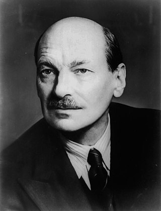
Clement Richard Attlee, 1st Earl Attlee, was a British statesman and Labour Party politician who served as Prime Minister of the United Kingdom from 1945 to 1951 and Leader of the Labour Party from 1935 to 1955. He was Deputy Prime Minister during the wartime coalition government under Winston Churchill, and served twice as Leader of the Opposition from 1935 to 1940 and from 1951 to 1955. Attlee remains the longest serving Labour leader.
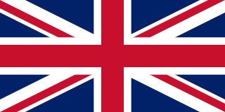
The United Kingdom of Great Britain and Northern Ireland, simply known as the United Kingdom (UK) or Britain, is a country in Northwestern Europe, off the north-western coast of the continental mainland. It comprises England, Scotland, Wales, and Northern Ireland. It includes the island of Great Britain, the north-eastern part of the island of Ireland, and most of the smaller islands within the British Isles. Northern Ireland shares a land border with the Republic of Ireland; otherwise, the United Kingdom is surrounded by the Atlantic Ocean, the North Sea, the English Channel, the Celtic Sea and the Irish Sea. The total area of the United Kingdom is 242,495 square kilometres (93,628 sq mi), with an estimated 2023 population of over 68 million people.
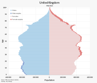
The population of the United Kingdom was estimated at over 67.0 million in 2020. It is the 21st most populated country in the world and has a population density of 270 people per square kilometre, with England having significantly greater density than Wales, Scotland, and Northern Ireland. Almost a third of the population lives in south east England, which is predominantly urban and suburban, with about 9 million in the capital city, London, whose population density is just over 5,200 per square kilometre.

The Kingdom of Great Britain, officially Great Britain, was a sovereign country in Western Europe from 1 May 1707 to the end of 31 December 1800. The state was created by the 1706 Treaty of Union and ratified by the Acts of Union 1707, which united the kingdoms of England and Scotland to form a single kingdom encompassing the whole island of Great Britain and its outlying islands, with the exception of the Isle of Man and the Channel Islands. The unitary state was governed by a single parliament at the Palace of Westminster, but distinct legal systems—English law and Scots law—remained in use.

The Atlantic Charter was a statement issued on 14 August 1941 that set out American and British goals for the world after the end of World War II. The joint statement, later dubbed the Atlantic Charter, outlined the aims of the United States and the United Kingdom for the postwar world as follows: no territorial aggrandizement, no territorial changes made against the wishes of the people (self-determination), restoration of self-government to those deprived of it, reduction of trade restrictions, global co-operation to secure better economic and social conditions for all, freedom from fear and want, freedom of the seas, abandonment of the use of force, and disarmament of aggressor nations. The charter's adherents signed the Declaration by United Nations on 1 January 1942, which was the basis for the modern United Nations.

There has not been a government of England since 1707 when the Kingdom of England ceased to exist as a sovereign state, as it merged with the Kingdom of Scotland to form the Kingdom of Great Britain. The Kingdom of Great Britain continued from 1707 until 1801 when it merged with the Kingdom of Ireland to form the United Kingdom of Great Britain and Ireland, which itself became the United Kingdom of Great Britain and Northern Ireland (UK) in 1922 upon independence for most of the island of Ireland. The UK since then has gone through significant change to its system of government, with devolved parliaments, assemblies and governments in Scotland, Wales and Northern Ireland. England, however, remains under the full jurisdiction, on all matters, of the Parliament of the United Kingdom of Great Britain and Northern Ireland and the UK government as no devolved administration has been created for England within the new structure. This situation led to the anomaly, known as the West Lothian question, which is that Scottish Members of Parliament (MPs) have been able to vote on legislation that affects only England whereas English MPs have been unable to vote on certain Scottish matters due to devolution. In some cases, such as top-up university tuition fees and foundation hospitals, the votes of Scottish MPs have been crucial in helping pass legislation for England that the majority of English MPs have opposed. An attempt was made to address this anomaly in 2015 through the use of an English votes for English laws procedure which aims to ensure that legislation affecting only England requires a majority vote of MPs representing English constituencies.

The historic counties of England are areas that were established for administration by the Normans, in many cases based on earlier kingdoms and shires created by the Angles, Saxons, Jutes, Celts and others. They are alternatively known as ancient counties, traditional counties, former counties or simply as counties. In the centuries that followed their establishment, as well as their administrative function, the counties also helped define local culture and identity. This role continued even after the counties ceased to be used for administration after the creation of administrative counties in 1889, which were themselves amended by further local government reforms in the years following.

A gazetteer is a geographical dictionary or directory used in conjunction with a map or atlas. It typically contains information concerning the geographical makeup, social statistics and physical features of a country, region, or continent. Content of a gazetteer can include a subject's location, dimensions of peaks and waterways, population, gross domestic product and literacy rate. This information is generally divided into topics with entries listed in alphabetical order.

The Welsh Office was a department in the Government of the United Kingdom with responsibilities for Wales. It was established in April 1965 to execute government policy in Wales, and was headed by the Secretary of State for Wales, a post which had been created in October 1964. It was disbanded on 1 July 1999 when most of its powers were transferred to the National Assembly for Wales, with some powers transferred to the Office of the Secretary of State for Wales, a department popularly known as the Wales Office.
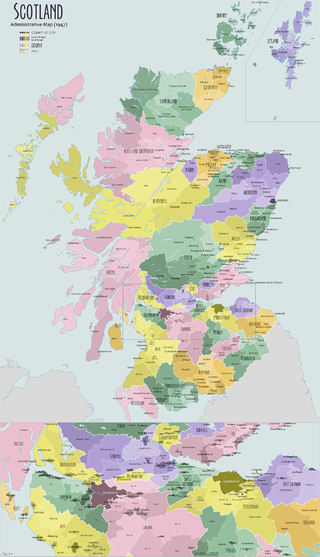
The shires of Scotland, or counties of Scotland, are historic subdivisions of Scotland established in the Middle Ages and used as administrative divisions until 1975. Originally established for judicial purposes, from the 17th century they started to be used for local administration purposes as well. The areas used for judicial functions (sheriffdoms) came to diverge from the shires, which ceased to be used for local government purposes after 1975 under the Local Government (Scotland) Act 1973.
Anglicisation or anglicization is a form of cultural assimilation whereby something non-English becomes assimilated into, influenced by or dominated by Englishness or Britishness. It can be socio-cultural, where a non-English person, people or place adopt(s) the English language or English customs; institutional, where institutions are modified to resemble or replaced with the institutions of England or the United Kingdom; or linguistic, where a foreign term or name is altered to become easier to say in English. It can also refer to the influence of English culture and business on other countries outside England or the United Kingdom, including media, cuisine, popular culture, technology, business practices, laws, or political systems.

The Board of Trade is a British government body concerned with commerce and industry, currently within the Department for Business and Trade. Its full title is The Lords of the Committee of the Privy Council appointed for the consideration of all matters relating to Trade and Foreign Plantations, but is commonly known as the Board of Trade, and formerly known as the Lords of Trade and Plantations or Lords of Trade, and it has been a committee of the Privy Council of the United Kingdom. The board has gone through several evolutions, beginning with extensive involvement in colonial matters in the 17th century, to powerful regulatory functions in the Victorian Era and early 20th century. It was virtually dormant in the last third of 20th century. In 2017, it was revitalised as an advisory board headed by the International Trade Secretary who has nominally held the title of President of the Board of Trade, and who at present is the only privy counsellor of the board, the other members of the present board filling roles as advisers.

The Uganda Scheme was a proposal to create a Jewish homeland in a portion of British East Africa. It was presented at the Sixth World Zionist Congress in Basel in 1903 by Theodor Herzl, the founder of the modern Zionist movement. He presented it as a temporary refuge for Jews to escape rising antisemitism in Europe. The proposal faced opposition from both the Zionist movement and the British Colony.

Clement Attlee was invited by King George VI to form the Attlee ministry in the United Kingdom in July 1945, succeeding Winston Churchill as Prime Minister of the United Kingdom. The Labour Party had won a landslide victory at the 1945 general election, and went on to enact policies of what became known as the post-war consensus, including the establishment of the welfare state and the nationalisation of some industries. The government's spell in office was marked by post-war austerity measures, the violent crushing of pro-independence and communist movements in Malaya, the grant of independence to India, the engagement in the Cold War against Soviet Communism as well as the creation of the country's National Health Service (NHS).

The regions, formerly known as the government office regions, are the highest tier of sub-national division in England. They were established in 1994 and follow the 1974–96 county borders. They are a continuation of the former 1940s standard regions which followed the 1889–1974 administrative county borders. Between 1994 and 2011, nine regions had partly devolved functions; they no longer fulfil this role, continuing to be used for limited statistical purposes.

In the United Kingdom, devolution is the Parliament of the United Kingdom's statutory granting of a greater level of self-government to the Scottish Parliament, the Senedd, the Northern Ireland Assembly and the London Assembly and to their associated executive bodies the Scottish Government, the Welsh Government, the Northern Ireland Executive and in England, the Greater London Authority and combined authorities.

The Constitution of Lesotho is the basic law governing the Kingdom of Lesotho. It provides the legal framework for the structure of the government and lays out the rights guaranteed to citizens. The Constitution was adopted in 1993. It aimed to distribute power among three branches of government, while preserving the power of the monarchy.

Federalism in the United Kingdom aims at constitutional reform to achieve a federal UK or a British federation, where there is a division of legislative powers between two or more levels of government, so that sovereignty is decentralised between a federal government and autonomous governments in a federal system.
James Alfred Steers (1899-1987) was a prominent coastal geomorphologist who was Professor of Geography at the University of Cambridge from 1949 to 1966.
Christie Willatts (OBE) (1908-2000) was an English cartographer and planner who had a long career in the Civil Service. He played a major role as Organising Secretary of the Land Use Survey of Britain as well as heading the Maps Office, at the Ministry of Town and Country Planning.