Minnesota State Highway 43

Last updated

MN-43.svg

Trunk Highway 43

Minn043.svg
MN 43 highlighted in red
Route information
Maintained by MnDOT
Length44.952 mi (72.343 km)
Existed1920–present
Major junctions
South endMN-44.svg MN 44 at Mabel
Major intersectionsMN-16.svg MN 16 at Rushford
MN-30.svg MN 30 at Rushford
I-90.svg I-90 at Wilson Township
US 14.svgUS 61.svg US 14  / US 61 at Winona
North endWIS 54.svg WIS 54 at the Mississippi River,
at Winona, MN
Location
Country United States
State Minnesota
Counties Fillmore, Winona
Highway system
  • Minnesota Trunk Highway System
MN-42.svg MN 42 MN-44.svg MN 44

Minnesota State Highway 43 (MN 43) is a highway in southeast Minnesota, which runs from its intersection with State Highway 44 in Mabel and continues north to its northern terminus at the Wisconsin state line at Winona, where it becomes Wisconsin Highway 54 upon crossing the Mississippi River.

Contents

Highway 43 is 45 miles (72 km) in length.

Route description

State Highway 43 serves as a northsouth route between Mabel, Rushford, and Winona in southeast Minnesota.

The route crosses the Root River in Fillmore County.

Highway 43 passes through the Richard J. Dorer State Forest.

The northern terminus of Highway 43 is at the Mississippi River at Winona, where the route becomes Wisconsin Highway 54 upon crossing the Main Channel and North Channel bridges over the river to Wisconsin.

History

State Highway 43 was authorized in 1920 between Rushford and Winona. [1] The remainder of the route between Rushford and Mabel was authorized in 1933. [2]

Highway 43 was paved from Wilson to Winona by 1929. The only gravel section remaining by 1940 was south of Rushford. The route was completely paved by 1953. [2]

A major project in the 1980s to rebuild Highway 43 from Interstate 90 to Winona as an expressway ran out of money. Only one carriageway was actually paved. [2] There is still visible road bed and bridges east of the roadway in this section. [3]

In response to the I-35W Bridge collapse in Minneapolis on August 1, 2007, all Minnesota bridges were ordered to be inspected. During an inspection, "gusset plate corrosion issues" were discovered in the Main Channel Bridge (Highway 43 / Highway 54), which crosses the Mississippi River between Winona, MN and nearby Fountain City, WI. The Main Channel Bridge (Bridge #5900) was closed to traffic on June 3, 2008. MnDOT made a statement this was due to gusset plate corrosion issues similar to those that caused the I-35W Bridge to collapse. [4] The Main Channel Bridge reopened to car traffic on June 14, 2008. Commercial vehicles were still directed to find alternate routes across the river. The bridge was scheduled for replacement in 2017, which has been moved up to 2014.

Major intersections

CountyLocationmikmDestinationsNotes
Fillmore Newburg Township 0.0000.000MN-44.svg MN 44  Caledonia, US 52 Southern Terminus
Rushford Village 21.67734.886MN-16.svg MN 16 (Historic Bluff Country Scenic Byway) Houston South end of MN 16 overlap
Rushford 22.21135.745MN-16.svg MN 16 (Historic Bluff Country Scenic Byway) Preston, Root River State Trail North end of MN 16 overlap
22.40136.051MN-30.svg MN 30
Winona Warren Township 32.38152.112West plate blue.svg
I-90.svg
I-90 west Austin
West end of I-90 overlap
Wilson Township 35.18656.626East plate blue.svg
I-90.svg
I-90 east La Crosse
East end of I-90 overlap
Winona 42.10067.753US 61.svgUS 14.svg US 61  / US 14
Mississippi River 45.33472.958 Main Channel Bridge and North Channel Bridge; Minnesota–Wisconsin state line
Buffalo Town of Buffalo WIS 54.svg WIS 54  Galesville Continuation into Wisconsin
1.000 mi = 1.609 km; 1.000 km = 0.621 mi

Gallary

MN-43 and MN-16 junction in Rushford MN-43 and MN-16 junction.jpg
MN-43 and MN-16 junction in Rushford
Northern terminus in Winona at the Main Channel Bridge Winona, Minnesota 5.jpg
Northern terminus in Winona at the Main Channel Bridge
MN-43 and I-90 junction in Winona County MN-43 and I-90 junction.jpg
MN-43 and I-90 junction in Winona County

Related Research Articles

<span class="mw-page-title-main">Interstate 94</span> Interstate Highway across the upper Midwestern US

Interstate 94 (I-94) is an east–west Interstate Highway connecting the Great Lakes and northern Great Plains regions of the United States. Its western terminus is just east of Billings, Montana, at a junction with I-90; its eastern terminus is in Port Huron, Michigan, where it meets with I-69 and crosses the Blue Water Bridge into Sarnia, Ontario, Canada, where the route becomes Ontario Highway 402. It thus lies along the primary overland route from Seattle to Toronto and is the only east–west Interstate Highway to have a direct connection to Canada.

<span class="mw-page-title-main">Interstate 494</span> Highway in Minnesota

Interstate 494 (I-494) is an auxiliary Interstate Highway making up part of a beltway of I-94, circling through the southern and western portions of the Minneapolis–Saint Paul metropolitan area in Minnesota. The 42.94-mile (69.11 km) road is coupled with I-694 at each end and composes more than half of the major beltway of the region. I-694/I-494 also act as loop routes for I-35E and I-35W.

<span class="mw-page-title-main">Minnesota State Highway 36</span> Highway in Minnesota

Minnesota State Highway 36 (MN 36) is a 21.718-mile-long (34.952 km) highway in Minnesota, which runs from its interchange with Interstate 35W in Roseville and continues east to its eastern terminus at the Wisconsin state line, where it becomes Wisconsin Highway 64 upon crossing the St. Croix River at the St. Croix Crossing bridge. A portion of Highway 36 is a major freeway in suburban Minneapolis – Saint Paul.

<span class="mw-page-title-main">Interstate 694</span> Highway in Minnesota

Interstate 694 (I-694) is an east–west auxiliary Interstate Highway located in the Minneapolis–Saint Paul metropolitan area in the US state of Minnesota. The western terminus of the route is at its junction with I-94, I-494, and US Highway 52 (US 52) in Maple Grove. The eastern terminus of I-694 is at its junction with I-94 and I-494 at the Woodbury–Oakdale city line. I-694 comprises the northern and northeastern portions of a beltway around the Twin Cities, with I-494 forming the remainder of the beltway. The speed limit is 60 mph (97 km/h). Interstate Highways outside of the loop in Minnesota may be signed as high as 70 mph (110 km/h) but can only reach 60 mph (97 km/h) inside the loop.

<span class="mw-page-title-main">Minnesota State Highway 65</span> Highway in Minnesota

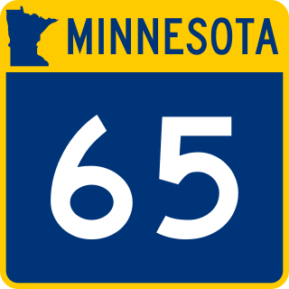
Minnesota State Highway 65 is a highway in the east–central and northeast parts of the U.S. state of Minnesota, which starts at its split from I-35W, skipping past the downtown Minneapolis core, only to resume at the intersection with Washington Avenue at the north end of downtown Minneapolis to continue north to its northern terminus at its intersection with U.S. Highway 71 (US 71) in Littlefork near International Falls.

<span class="mw-page-title-main">Minnesota State Highway 23</span> State highway in Minnesota, United States

Minnesota State Highway 23 (MN 23) is a state highway that stretches from southwestern to northeastern Minnesota. At 343.723 miles (553.169 km) in length, it is the second longest state route in Minnesota, after MN 1.

<span class="mw-page-title-main">Minnesota State Highway 16</span> State highway in Minnesota, United States

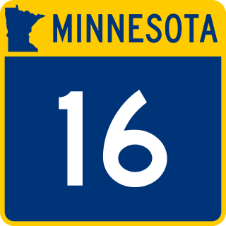
Minnesota State Highway 16 is an 87.671-mile-long (141.093 km) two-lane highway in southeast Minnesota, which runs from its interchange with Interstate Highway 90 in Dexter and continues east to its eastern terminus at the Wisconsin state line concurrent with U.S. Highways 14 and 61 outside La Crescent just west of La Crosse, Wisconsin.

<span class="mw-page-title-main">Wisconsin Highway 54</span> Highway in Wisconsin

State Trunk Highway 54 is a Wisconsin state highway running east–west across central Wisconsin. It is 243.12 miles (391.26 km) in length.

<span class="mw-page-title-main">Interstate 35W (Minnesota)</span> Interstate Highway in Minnesota, United States

Interstate 35W (I-35W) is an Interstate Highway in the US state of Minnesota, passing through downtown Minneapolis. It is one of two through routes for I-35 through the Twin Cities of Minneapolis and Saint Paul, the other being I-35E through downtown Saint Paul.

<span class="mw-page-title-main">North Channel Bridge</span> Bridge in Winona, Minnesota

The North Channel Bridge crosses the north channel of the Mississippi River between Latsch Island and Buffalo County, Wisconsin.

<span class="mw-page-title-main">Minnesota State Highway 74</span> State highway in Minnesota, United States

Minnesota State Highway 74 (MN 74) is a 34.956-mile-long (56.256 km) highway in southeast Minnesota that runs from its intersection with U.S. Highway 52 and State Highway 30 in Chatfield and continues north to its northern terminus at its intersection with U.S. Highway 61 at Weaver along the Mississippi River. It is the only remaining road in the state highway system that is still partially unpaved.

<span class="mw-page-title-main">Main Channel Bridge (Winona)</span> Bridge


Main Channel Bridge (Winona) consists of a pair of bridges, the original cantilever bridge, and a concrete box girder bridge completed in 2016, that span the main channel of the Mississippi River in the United States between Winona, Minnesota, and Latsch Island. Another bridge, the North Channel Bridge, connects the island to rural Buffalo County, Wisconsin. The bridge carries Minnesota State Highway 43, which continues as Wisconsin Highway 54 at the Minnesota/Wisconsin state line on the nearby North Channel Bridge; in Winona, it connects to Winona Street.

<span class="mw-page-title-main">Wisconsin Highway 35</span> Highway in Wisconsin

State Trunk Highway 35 is a Wisconsin state highway running north–south across western Wisconsin. It is 412.15 miles in length, and is the longest state highway in Wisconsin. Portions of WIS 35 are part of the Great River Road.

<span class="mw-page-title-main">I-35W Mississippi River bridge</span> Bridge in Minneapolis, Minn., US, that collapsed in 2007

The I-35W Mississippi River bridge was an eight-lane, steel truss arch bridge that carried Interstate 35W across the Mississippi River one-half mile downstream from the Saint Anthony Falls in Minneapolis, Minnesota, United States. The bridge opened in 1967 and was Minnesota's third busiest, carrying 140,000 vehicles daily. It experienced a catastrophic failure during the evening rush hour on August 1, 2007, killing 13 people and injuring 145. The NTSB cited a design flaw as the likely cause of the collapse, noting that an excessively thin gusset plate ripped along a line of rivets, and that additional weight on the bridge at the time contributed to the catastrophic failure.

<span class="mw-page-title-main">Minnesota State Highway 11</span> State highway in Minnesota, United States

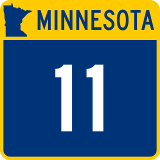
Minnesota State Highway 11 is a 209.971-mile-long (337.916 km) highway in northwest and north-central Minnesota, which runs from North Dakota Highway 66 at the North Dakota state line and continues east to its eastern terminus at the community of Island View on Dove Island, near International Falls.

<span class="mw-page-title-main">Minnesota State Highway 26</span> State highway in Minnesota, United States

Minnesota State Highway 26 is a state highway in southeastern corner of the U.S. state of Minnesota. At 21 miles (34 km) in length, Highway 26 runs parallel to the Mississippi River and is a portion of the Great River Road. The route begins at the Iowa state line where it continues as Iowa Highway 26, and ends at an intersection with Minnesota State Highway 16 south of La Crescent.

<span class="mw-page-title-main">State Highway 243 (Minnesota–Wisconsin)</span> Multiple State highways in the Northern United States

Trunk Highway 243 and State Trunk Highway 243 are two short state highways in the U.S. states of Minnesota and Wisconsin. They connect MN 95 in Franconia Township, Minnesota with WIS 35 in Osceola, Wisconsin. The two highways meet at the state line on a bridge across St. Croix River. The combined highway is 1.53 miles (2.46 km) in length, 1.23 miles (1.98 km) in Minnesota and 0.30 miles (0.48 km) in Wisconsin. The two highways were designated in 1949. The bridge across the St. Croix River dates to 1953.

<span class="mw-page-title-main">Interstate 94 in Minnesota</span> Interstate Highway in Minnesota, United States

Interstate 94 (I-94) in the US state of Minnesota runs 259 miles (417 km) east–west through the central portion of the state. The highway connects the cities of Moorhead, Fergus Falls, Alexandria, St. Cloud, Minneapolis, and Saint Paul. Authorized in 1956, it was mostly constructed in the 1960s. For its whole length, it runs concurrently with either US Highway 52 (US 52) or US 12.

<span class="mw-page-title-main">County Road 122 (Hennepin County, Minnesota)</span> Highway in Minneapolis, Minnesota, US

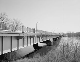
Hennepin County Road 122 (CR 122) or County State-Aid Highway 122 (CSAH 122) is an unsigned county state-aid highway within the city of Minneapolis, Hennepin County, Minnesota, United States, crossing the Mississippi River on the Washington Avenue Bridge.

<span class="mw-page-title-main">U.S. Route 61 in Minnesota</span>

U.S. Highway 61 (US 61) is a U.S. Highway in southeastern and east-central Minnesota, which runs from the Mississippi River Bridge at La Crescent and continues north to its northern terminus at its junction with Interstate 35 (I-35) at the city of Wyoming.

References

Template:Attached KML/Minnesota State Highway 43
KML is from Wikidata
  1. Minnesota State Legislature (2010). "§ 161.114, Constitutional Trunk Highways". Minnesota Statutes. Minnesota Office of the Revisor of Statutes. Retrieved October 20, 2010.
  2. 1 2 3 Riner, Steve. "Details of routes 26–50". The Unofficial Minnesota Highways Page. Retrieved October 20, 2010.[ self-published source ]
  3. Google (October 20, 2010). "Minnesota State Highway 43" (Map). Google Maps . Google. Retrieved October 20, 2010.
  4. Minnesota Highway 43 / Wisconsin Highway 54 - Mississippi River Crossing at Winona - project status Archived 2008-06-08 at the Wayback Machine MnDOT. Accessed June 5, 2008.