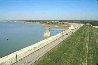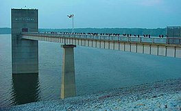
Table Rock Lake is an artificial lake or reservoir in the Ozarks of southwestern Missouri and northwestern Arkansas in the United States. Designed, built and operated by the U.S. Army Corps of Engineers, the lake is impounded by Table Rock Dam, which was constructed from 1954 to 1958 on the White River.

Raystown Lake is a reservoir in Huntingdon County, Pennsylvania. It is the largest lake that is entirely within Pennsylvania. The original lake was built by the Simpson family of Huntingdon as a hydroelectric project. The current 8,300-acre (34 km2) Raystown Lake was completed in 1973 by the Army Corps of Engineers. Raystown is around 200 feet (61 m) deep in the deepest area near the dam. The lake was created primarily to control floods, provide electricity, and support recreational activities. Allegheny Electric Cooperative operates the Raystown Hydroelectric Project and William F. Matson Generating Station at the Raystown Dam, a 21 MW, two-unit hydroelectric project.

Dworshak Dam is a concrete gravity dam in the western United States, on the North Fork of the Clearwater River in north central Idaho. In Clearwater County, the dam is located approximately four miles (6 km) northwest of Orofino and impounds the Dworshak Reservoir for flood control and hydroelectricity generation.

Yatesville Lake is a reservoir in Lawrence County, Kentucky in the far eastern part of the state, close to the town of Louisa.

Wilson Lake is a reservoir in the U.S. state of Kansas, on the border of Russell County and Lincoln County. Built and managed by the U.S. Army Corps of Engineers for flood control, it is also used for wildlife management and recreation. Several parks are located along its shoreline, including Wilson State Park.

Isabella Dam is an embankment dam located in the Kern River Valley, about halfway down the Kern River course, between the towns of Kernville and Lake Isabella in Kern County, California.

Lavon Lake is a freshwater reservoir located in southeast Collin County, Texas, on the East Fork of the Trinity River near Wylie, off State Highway 78. It is commonly called Lake Lavon for commercial and recreational purposes, but Lavon Lake is its official name according to the U.S. Army Corps of Engineers. It was originally called Lavon Reservoir.

The Cochiti Dam is an earthen fill dam located on the Rio Grande in Sandoval County, New Mexico, approximately 50 miles (80 km) north of Albuquerque, New Mexico, in the United States. By volume of material, it is the 23rd largest dam in the world at 62,849,000 yd3 of material, one of the ten largest such dams in the United States, and the eleventh largest such dam in the world. Cochiti Dam is one of the four United States Army Corps of Engineers projects for flood and sediment control on the Rio Grande system, operating in conjunction with Abiquiu Dam, Galisteo Dam and Jemez Canyon Dam.

Grapevine Lake is a reservoir located in the North Texas region, about 20 mi (32 km) northwest of Dallas and northeast of Fort Worth. It was impounded in 1952 by the US Army Corps of Engineers when they dammed Denton Creek, a tributary of Trinity River.

Senecaville Lake is a reservoir in Guernsey and Noble Counties, Ohio. It is located approximately 13 miles (21 km) southeast of Cambridge near the village of Senecaville, Ohio. The lake is popular among recreation and fishing enthusiasts. It is often referred to locally as Seneca Lake.

J. Edward Roush Lake is a reservoir in Huntington, Indiana, United States. The lake is found at an elevation of 748 feet (228 m).

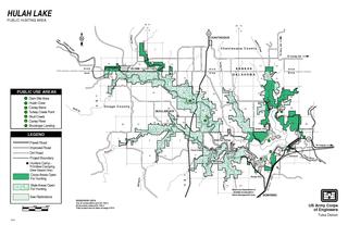
Hulah Lake is a man-made reservoir that was created by the United States Army Corps of Engineers damming the Caney River in northeastern Osage County, Oklahoma, within the Osage Indian Reservation. Hulah is an Osage word meaning "eagle”, and was the name of the farming community that was located in the valley before the construction of the dam. The primary purpose of the lake is flood control. It has become a popular recreation area. According to the U. S. Army Corps of Engineers, the Hulah Lake project includes a public hunting area, bringing the total project area to 21,510 acres (8,700 ha).

Baldhill Dam is a dam in Barnes County, North Dakota, about 10 miles north-northwest of Valley City in the eastern part of the state.

Council Grove Lake is a reservoir on the Neosho River in east-central Kansas. Built and managed by the U.S. Army Corps of Engineers, it is used for flood control, recreation, and water supply.

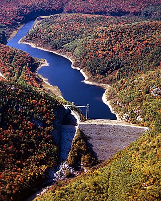
Ball Mountain Dam is a dam in Jamaica, Windham County, Vermont, in the southeastern part of the state.

Abiquiu Dam is a dam on the Rio Chama, located about 60 miles (97 km) northwest of Santa Fe in Rio Arriba County, New Mexico, USA. Built and operated by the U.S. Army Corps of Engineers (USACE), the dam is an earth embankment structure 354 feet (108 m) high and 1,800 feet (550 m) long, containing 11.8 million cubic yards of fill. The dam forms Abiquiu Lake, one of the largest lakes in New Mexico, with a full storage capacity of 1,369,000 acre-feet (1,689,000 dam3) and 5,200 acres (2,100 ha) of water. To date, the reservoir has never filled to capacity, with a record high of 402,258 acre-feet (496,178 dam3), 29.4% of full pool, on June 22, 1987. The dam's primary purpose is flood control, in addition to irrigation and municipal water storage, and hydroelectric generation.

Brookville Lake Dam is a dam in Brookville Township, Franklin County, Indiana, just north of Brookville, in the southeastern part of the state.

Orwell Dam is a dam in Otter Tail County, Minnesota, about six miles southwest of Fergus Falls.

The Mahoning Creek Dam is a dam in Armstrong County, Pennsylvania.

North Hartland Dam is a dam on the Ottauquechee River in Hartland, Windsor County, Vermont.


