Morgan Hill is a city in Santa Clara County, California, at the southern tip of Silicon Valley, in the San Francisco Bay Area. Morgan Hill is a residential community for Silicon Valley, as well as the seat of several high-tech companies. Morgan Hill is a dining, entertainment, and recreational destination in Silicon Valley, owing to its Michelin-star chefs, luxury hospitality, wineries, nature parks, and the numerous noteworthy events the city hosts, such as the Tour of California. According to Forbes, Morgan Hill is one of the most expensive places to live in the United States. Business Insider ranked Morgan Hill as the 17th most expensive housing market in the United States, owing to its concentration of high-net-worth individuals and restrictive growth policies.

Pacheco Pass, elevation 1,368 ft (417 m), is a low mountain pass located in the Diablo Range in southeastern Santa Clara County, California. It is the main route through the hills separating the Santa Clara Valley and the Central Valley.

Henry W. Coe State Park is a state park of California, USA, preserving a vast tract of the Diablo Range. The park is located closest to the city of Morgan Hill, and is located in both Santa Clara and Stanislaus counties. The park contains over 87,000 acres (35,000 ha), making it the largest state park in northern California, and the second-largest in the state. Managed within its boundaries is a designated wilderness area of about 22,000 acres (8,900 ha). This is officially known as the Henry W. Coe State Wilderness, but locally as the Orestimba Wilderness. The 89,164-acre (36,083 ha) park was established in 1959.

Ed R. Levin County Park is the largest park in Milpitas, California. It is run by the Santa Clara County Parks and Recreation Department and is located in the chaparral foothills of Diablo Range east of the Santa Clara Valley. Monument Peak can be accessed through trails in the park. The park's recreational facilities include a hang gliding and paragliding area, a dog park, and horseback riding areas. Ed R. Levin County Park has two lakes, Sandy Wool Lake and Spring Valley Pond. Both of them are reservoirs which collect runoff water from the hills to the east. It is home to some of the East Bay Walls.

Coyote Creek is a river that flows through the Santa Clara Valley in California, United States.

The Diablo Range is a mountain range in the California Coast Ranges subdivision of the Pacific Coast Ranges. It is located in the eastern San Francisco Bay area south to the Salinas Valley area of northern California, the United States.

The San Luis Reservoir is an artificial lake on San Luis Creek in the eastern slopes of the Diablo Range of Merced County, California, approximately 12 mi (19 km) west of Los Banos on State Route 152, which crosses Pacheco Pass and runs along its north shore. It is the fifth largest reservoir in California. The reservoir stores water taken from the San Joaquin-Sacramento River Delta. Water is pumped uphill into the reservoir from the O'Neill Forebay which is fed by the California Aqueduct and is released back into the forebay to continue downstream along the aqueduct as needed for farm irrigation and other uses. Depending on water levels, the reservoir is approximately nine miles long from north to south at its longest point, and five miles (8 km) wide. At the eastern end of the reservoir is the San Luis Dam, or the B.F. Sisk Dam, the fourth largest embankment dam in the United States, which allows for a total capacity of 2,041,000 acre feet (2,518,000 dam3).

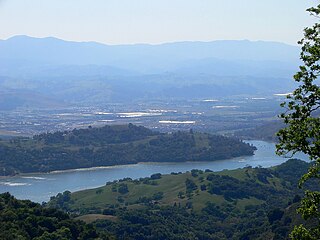
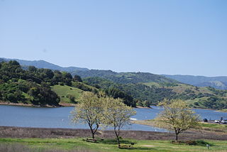
Anderson Lake, also known as Anderson Reservoir, is an artificial lake in Santa Clara County, California, United States, near Morgan Hill. A 4,275-acre (1,730 ha) county park surrounds the reservoir and provides limited fishing, picnicking, and hiking activities. Although swimming is prohibited, boating, water-skiing and jet-skiing are permitted in the reservoir.

Calero Reservoir is an artificial lake in the Santa Teresa Hills south of San Jose, California, United States. A 4,471-acre (1,809 ha) county park surrounds the reservoir and provides limited fishing ("catch-and-release"), picnicking, hiking, and horseback riding activities. Although swimming is prohibited, boating, water-skiing and jet-skiing are permitted in the reservoir.

Pacheco Creek is a 28 miles (45 km) west by southwest flowing stream which heads in the Diablo Range in southeastern Santa Clara County and flows to San Felipe Lake, the beginning of the Pajaro River mainstem, in San Benito County, California.

Diablo Range is an unincorporated census county division (CCD) located in the Diablo Mountains Range, on the eastern side of Santa Clara County, California.
San Felipe Creek is a 14 miles (23 km) stream that originates in the western Diablo Range in Santa Clara County, California. It flows south by southeast through two historic ranchos, Rancho Los Huecos and Rancho Cañada de San Felipe y Las Animas before it joins Las Animas Creek just above Anderson Reservoir. One of the nine major tributaries of Coyote Creek, the creek’s waters pass through the Santa Clara Valley and San Jose on the way to San Francisco Bay.

Santa Clara County Parks and Recreation Department, sometimes referred to as Santa Clara County Parks Department or Santa Clara County Parks, is a government department in Santa Clara County, California. The department manages 29 parks with a total area over 52,000 acres (21,000 ha).
La Vereda del Monte was a backcountry route through remote regions of the Diablo Range, one of the California Coast Ranges. La Vereda del Monte was the upper part of La Vereda Caballo,, used by mesteñeros from the early 1840s to drive Alta California horses to Sonora for sale.
Mississippi Creek is a tributary stream to Pacheco Creek in Santa Clara County, California.
Valle Atravesado,, a small, east-west running valley that crosses the north-south running valley of the upper reach of Mississippi Creek in the Diablo Range, in Santa Clara County, California.

North Fork Pacheco Creek is a 19 miles (31 km) tributary stream of Pacheco Creek, in Santa Clara County, California. Originally it was considered the upper reach of Pacheco Creek. Its source is at an elevation of 2,360 feet (720 m) at 37°11′17″N121°25′42″W on a mountain side in Henry W. Coe State Park and is the headwaters of the Pajaro River watershed.
Valle Hondo, a small flat in the canyon along the course of North Fork Pacheco Creek in Henry W. Coe State Park in Santa Clara County, California. It lies at an elevation of 1,698 feet / 518 meters. Formerly an Native American rancheria, then an overnight camp along La Vereda del Monte, and then for local ranchers, it is now the site of Pacheco Camp in the state park and is located where the Pacheco Creek Trail meets Coit Road, which borders the flat on its south side.
County Line Road is an unimproved road between the San Antonio Valley and Fifield Ranch that closely follows the east-west divide of the Diablo Range and the County boundary of Santa Clara County, and Stanislaus County, California. This road followed the route called La Vereda del Monte, used by Californio mesteñeros and the gang of Joaquin Murrieta and other bandits and horse-thieves, and sites of three of their camps along the route are found along it. Two sites are now state park campgrounds, the last is at ranch dating back to the 1860s.

Cañada de los Osos is an 8 miles (13 km) stream that flows west and then north to join Coyote Creek in the Diablo Range south of Henry Coe State Park in southern Santa Clara County, California, United States. It is now protected within the 5,800 acre Cañada de los Osos Ecological Preserve, managed by the California Department of Fish and Wildlife about 10 miles (16 km) east of Gilroy, California.


