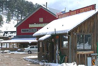
The historic City of Central, commonly known as Central City, is a home rule municipality located in Gilpin and Clear Creek counties, Colorado, United States. Central City is the county seat and the most populous municipality of Gilpin County. The city population was 779, all in Gilpin County, at the 2020 United States Census. The city is a historic mining settlement founded in 1859 during the Pike's Peak Gold Rush and came to be known as the "Richest Square Mile on Earth". Central City and the adjacent city of Black Hawk form the federally designated Central City/Black Hawk Historic District. The city is now a part of the Denver-Aurora-Lakewood, CO Metropolitan Statistical Area and the Front Range Urban Corridor.

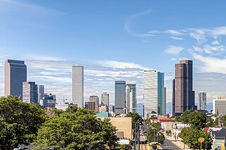
Denver is the central city of a conurbation region in the U.S. state of Colorado. The conurbation includes one continuous region consisting of the six central counties of Adams, Arapahoe, Broomfield, Denver, Douglas, and Jefferson. The Denver region is part of the Front Range Urban Corridor.

Gilpin County is a county located in the U.S. state of Colorado, smallest in land area behind only the City and County of Broomfield. As of the 2020 census, the population was 5,808. The county seat is Central City. The county was formed in 1861, while Colorado was still a Territory, and was named after Colonel William Gilpin, the first territorial governor.

Clear Creek County is a county located in the U.S. state of Colorado. As of the 2020 census, the population was 9,397. The county seat is Georgetown.

Coal Creek, commonly known as Coal Creek Canyon, is an unincorporated community and a census-designated place (CDP) located in and governed by Jefferson, Boulder, and Gilpin counties, Colorado, United States. The population of the Coal Creek CDP was 2,400 at the United States Census 2010. The Golden post office serves the area.

The historic City of Black Hawk is a home rule municipality located in Gilpin County, Colorado, United States. The city population was 127 at the 2020 United States Census, making Black Hawk the least populous city in Colorado. The tiny city is a historic mining settlement founded in 1859 during the Pike's Peak Gold Rush. Black Hawk is now a part of the Denver-Aurora-Lakewood, CO Metropolitan Statistical Area and the Front Range Urban Corridor.

The Territory of Jefferson was an extralegal and unrecognized United States territory that existed from October 24, 1859 until the creation of the Colorado Territory on February 28, 1861. The Jefferson Territory, named for Founding Father and United States president Thomas Jefferson, included land officially part of the Kansas Territory, the Nebraska Territory, the New Mexico Territory, the Utah Territory, and the Washington Territory, but the area was remote from the governments of those five territories.

Rollinsville is an unincorporated town, a post office, and a census-designated place (CDP) located in and governed by Gilpin County, Colorado, United States. The CDP is a part of the Denver–Aurora–Lakewood, CO Metropolitan Statistical Area. The Rollinsville post office has the ZIP Code 80474. At the United States Census 2010, the population of the Rollinsville CDP was 181.

William Gilpin was a 19th-century US explorer, politician, land speculator, and futurist writer about the American West. He served as military officer in the United States Army during several wars, accompanied John C. Frémont on his second expedition through the West, and was instrumental in the formation of the government of the Oregon Territory. As a politician and writer, he was an inveterate believer in Manifest Destiny and was a visionary booster of new settlement to the West, helping lay the groundwork in his writings for a modern theory of the succession of civilizations.

Colorado's 2nd congressional district is a congressional district in the U.S. state of Colorado. The district is located in the north-central part of the state and encompasses the northwestern suburbs of Denver including Boulder, Broomfield and much of western Jefferson County. The district also includes the mountain towns of Vail, Grand Lake and Idaho Springs. Redistricting in 2011 has moved Larimer County, including the cities of Fort Collins and Loveland, to the 2nd from the 4th district for the 2012 election.

The Gilpin Railroad, earlier the Gilpin Tramway Company, was a 2 ft narrow gauge railway in Gilpin County, Colorado, in operation from 1887 to 1917.

The North Central Colorado Urban Area comprises the four contiguous metropolitan statistical areas in the north central region of the State of Colorado: the Denver–Aurora Metropolitan Statistical Area, the Boulder Metropolitan Statistical Area, the Fort Collins-Loveland Metropolitan Statistical Area, and the Greeley Metropolitan Statistical Area. With the exception of southeastern Elbert County, southeastern Park County, and tiny portions of southern Douglas County, the entire North Central Colorado Urban Area is drained by the South Platte River and its tributaries. The North Central Colorado Urban Area is the central, and the most populous, of the three primary subregions of the Front Range Urban Corridor.

Robert Williamson Steele was governor of the extralegal Territory of Jefferson, which existed in the western United States of America from 1859 to 1861, when it was replaced by the Territory of Colorado.

The Central City/Black Hawk Historic District is a National Historic Landmark District that encompasses the developed areas of Central City and Black Hawk, Colorado. They are adjacent former gold mining camps in the Front Range of the Rocky Mountains in Gilpin County, Colorado, United States. For a time, the area was known as the Richest Square Mile on Earth, and was the largest urban area of the Colorado Territory in the 1870s.

Sebastian Harrison White was a U.S. Representative from Colorado and a Justice of the Colorado Supreme Court.

George T. Clark was an American banker and politician.


