Moline, Texas

Last updated
Moline, Texas
USA Texas location map.svg
Red pog.svg
Moline
Usa edcp location map.svg
Red pog.svg
Moline
Coordinates: 31°23′2″N98°18′38″W / 31.38389°N 98.31056°W / 31.38389; -98.31056 Coordinates: 31°23′2″N98°18′38″W / 31.38389°N 98.31056°W / 31.38389; -98.31056
Country United States
State Texas
Counties Mills, Lampasas
Elevation
1,398 ft (426 m)
Time zone UTC-6 (Central (CST))
  Summer (DST) UTC-5 (CDT)
Area code 325
GNIS feature ID1380203 [1]

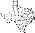
Moline is an unincorporated community in Lampasas and Mills counties in the U.S. state of Texas. [1] According to the Handbook of Texas, the community had a population of 12 in 2000. It is located within the Killeen-Temple-Fort Hood metropolitan area.

Contents

History

Moline was first settled in 1884, with the first home being built by Jack Cook. A combination blacksmith shop/corn mill was built here, then another mill was built by a Mr. Robinson. The community may have been named for Moline, Illinois, where some of the early settlers came from, or was given at a meeting held at the blacksmith shop and was acquired from the label on a plow that was for sale. Jack Bullock built a cotton gin in Moline in the early 1900s, causing more residents and new businesses to relocate here. A post office was established at Moline in 1910 in J.W. Trussell's store, with him serving as the postmaster. A doctor surnamed Hicks built a medical office with a drugstore and an emergency operating room. A Methodist church was established by a Mr. Patterson. Then, two more churches for the Baptist and Church of Christ congregations were built. The first cars came in the early 1920s. Jim Tom Brown built a garage where the old blacksmith shop stood. Its population was 35 in 1930 and had three stores and two churches. Five years later, the community got a home economics building and an agricultural shop. The population grew to 100 in the early 1940s. The post office closed in 1976 and the community also had two stores that same decade. Income was driven mainly by farming and livestock raising in the 1980s. The population went down to 60 in 1949, 40 from 1970 to the early 1990s, and 12 in 2000. [2]

Geography

Moline is located near Bennett Creek on Farm to Market Road 1047, two miles northwest of Castle Peak and 15 mi (24 km) northeast of Lometa in northern Lampasas County and Mills County. [3]

Education

A one-room school building was erected 2 ½ miles south of Moline and was soon replaced by a larger building. It continued to operate in 1930 and had a house for educators five years later. Declining enrollment caused the school to join the schools in Lometa and Star in 1943. It continued to be used as a community center. [2] Today, the community is served by the Star Independent School District.

Related Research Articles

<span class="mw-page-title-main">Mills County, Texas</span> County in Texas, United States


Mills County is a county located in Central Texas. It was created on March 15, 1887, from parts of four existing counties—Brown, Comanche, Hamilton, and Lampasas. The 2020 census reported a population of 4,456. The county seat is Goldthwaite.

<span class="mw-page-title-main">Lampasas County, Texas</span> County in Texas, United States

Lampasas County is a county located on the Edwards Plateau in the U.S. state of Texas. As of the 2020 census, its population was 21,627. Its county seat is Lampasas. The county is named for the Lampasas River.

<span class="mw-page-title-main">Antoine, Arkansas</span> Town in Arkansas, United States

Antoine is a town in Pike County, Arkansas, United States, along the Antoine River. The population was 117 according to the 2010 census.

<span class="mw-page-title-main">Brady, Texas</span> City in Texas, United States

Brady is a city in McCulloch County, Texas, United States. Brady refers to itself as the "Heart of Texas", as it is the city closest to the geographical center of the state, which is about 15 miles northeast of Brady. Its population was 5,528 at the 2010 census. It is the county seat of McCulloch County.

<span class="mw-page-title-main">Ben Franklin, Texas</span>

Ben Franklin is an unincorporated community in Delta County, Texas, United States, four miles (6 km) northeast of Pecan Gap and 77 miles (124 km) northeast of Dallas. The town's ZIP Code is 75415.

<span class="mw-page-title-main">New Ulm, Texas</span> Unincorporated community in Texas, United States

New Ulm is an unincorporated community in Austin County, Texas, United States. According to the Handbook of Texas, the community had an estimated population of 650 in 2000.

Martin's Mill is an unincorporated community in south-central Van Zandt County, Texas, United States. According to the Handbook of Texas, the community had a population of 125 in 2000. It is located within the Dallas/Fort Worth Metroplex.

Star Independent School District was a public school district based in the community of Star, Texas, USA.

Bend is an unincorporated community in Lampasas and San Saba counties in western Central Texas. Its population was 1,678 as of the 2010 census.

Prairie Lea is an unincorporated community in Caldwell County, Texas, United States. According to the Handbook of Texas, the community had an estimated population of 255 in 2000. It is part of the Austin–Round Rock Metropolitan Statistical Area.

Holmesville is a hamlet in Chenango County, New York, United States. It is situated on the Unadilla River, in the south-east corner of the town of New Berlin.

Ellery is an unincorporated community on the border of Edwards and Wayne counties in the U.S. state of Illinois. The eastern side lies in Edwards and the west side in Wayne; the county line runs down the main street.

<span class="mw-page-title-main">Alum Creek, Texas</span> Unincorporated community in Texas, United States

Alum Creek is an unincorporated community in Bastrop County, Texas, United States. According to the Handbook of Texas, the community had a population of 70 in 2000. It is located within the Greater Austin metropolitan area.

Fentress is an unincorporated community in Caldwell County, Texas, United States. According to the Handbook of Texas, the community had an estimated population of 291 in 2000. It is part of the Austin–Round Rock Metropolitan Statistical Area.

Oakalla is an unincorporated community in Burnet County, Texas, United States. According to the Handbook of Texas, the community had an estimated population of 45 in 2000.

Joppa is an unincorporated community located in Burnet County, Texas, United States. According to the Handbook of Texas, the community had a population of 34 in 2000.

Jacket is an unincorporated community in the southeastern corner of McDonald County, Missouri, United States. It is located on Missouri Route KK, approximately one-half mile north of the Missouri-Arkansas border and one mile west of the McDonald and Barry county border. The community is on the east bank of Big Sugar Creek.

<span class="mw-page-title-main">Nix, Texas</span> Unincorporated community in Texas, United States

Nix is an unincorporated community in southwestern Lampasas County, Texas, United States. It was once a stop on a stagecoach route. According to the Handbook of Texas, it had a population of only 6 in 2000. It is located within the Killeen-Temple-Fort Hood metropolitan area.
Adamsville is an unincorporated community in Lampasas County, Texas, United States. According to the Handbook of Texas, the community had a population of 41 in 2000. It is located within the Killeen-Temple-Fort Hood metropolitan area.

Izoro is an unincorporated community in Lampasas County, in the U.S. state of Texas. According to the Handbook of Texas, the community had a population of 17 in 2000. It is located within the Killeen-Temple-Fort Hood metropolitan area.

References

  1. 1 2 U.S. Geological Survey Geographic Names Information System: Moline, Texas
  2. 1 2 Rhoades, Alice J. "Moline, TX". tshaonline.org. Retrieved 2023-03-17.
  3. "Moline, Texas". Texas Escapes Online Magazine. Retrieved 2023-03-17.