
Hispaniola is an island in the Caribbean archipelago which is known as the Greater Antilles. It is the most populous island in the West Indies and the region's second largest after Cuba.
Maritime archaeology is a discipline within archaeology as a whole that specifically studies human interaction with the sea, lakes and rivers through the study of associated physical remains, be they vessels, shore-side facilities, port-related structures, cargoes, human remains and submerged landscapes. A specialty within maritime archaeology is nautical archaeology, which studies ship construction and use.
Underwater archaeology is archaeology practiced underwater. As with all other branches of archaeology, it evolved from its roots in pre-history and in the classical era to include sites from the historical and industrial eras. Its acceptance has been a relatively late development due to the difficulties of accessing and working underwater sites, and because the application of archaeology to underwater sites initially emerged from the skills and tools developed by shipwreck salvagers. As a result, underwater archaeology initially struggled to establish itself as bona fide archaeological research. The situation changed when universities began teaching the subject and when a theoretical and practical base for the sub-discipline was firmly established. Underwater archaeology now has a number of branches including, after it became broadly accepted in the late 1980s, maritime archaeology: the scientifically based study of past human life, behaviours and cultures and their activities in, on, around and (lately) under the sea, estuaries and rivers. This is most often effected using the physical remains found in, around or under salt or fresh water or buried beneath water-logged sediment. In recent years, the study of submerged WWII sites and of submerged aircraft in the form of underwater aviation archaeology have also emerged as bona fide activity.

Mona is the third-largest island of the Puerto Rican archipelago, after the main island of Puerto Rico and Vieques. It is the largest of three islands in the Mona Passage, a strait between the Dominican Republic and Puerto Rico, the others being Monito Island and Desecheo Island. It measures about 7 miles by 4 miles, and lies 41 mi (66 km) west of Puerto Rico, of which it is administratively a part. It is one of two islands that make up the Isla de Mona e Islote Monito.
The Dominican Republic is divided into thirty–one provincias, while the national capital, Santo Domingo, is contained within its own Distrito Nacional.
The Institute of Nautical Archaeology (INA) is the world's oldest organization devoted to the study of humanity's interaction with the sea through the practice of archaeology.

Tropical Storm Odette was a rare off-season tropical storm that affected the Caribbean Sea in early December 2003. The fifteenth named storm of the 2003 Atlantic hurricane season, Odette formed near the coast of Panama a few days after the official end of the Atlantic hurricane season, and ultimately made landfall on the Dominican Republic as a moderate tropical storm, before becoming extratropical on December 7, dissipating two days later.

Queen Anne's Revenge was an early-18th-century ship, most famously used as a flagship by Edward Teach, better known by his nickname Blackbeard. Although the date and place of the ship's construction are uncertain, it was originally believed she was built for merchant service in Bristol, England in 1710 and named Concord, later captured by French privateers and renamed La Concorde. This origin hypothesis was found to be incorrect and has been dismissed by the project crew. After several years' service with the French, she was captured by Blackbeard in 1717. Blackbeard used the ship for less than a year, but captured numerous prizes using her as his flagship.

San Fernando de Monte Cristi is the capital of Monte Cristi Province in the Dominican Republic. It is located in the northwest region of the country in the coastal lowlands near the border with Haiti.

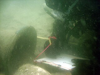
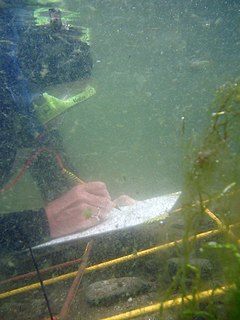
The archaeology of shipwrecks is the field of Archaeology specialized most commonly in the study and exploration of shipwrecks. Its techniques combine those of archaeology with those of diving to become Underwater archaeology. However, shipwrecks are discovered on what have become terrestrial sites.

Île-à-Vache, is a Caribbean island, one of Haiti's satellite islands. It lies in the Baie de Cayes about 6.5 miles (10.5 km) off the coast of the country's southwest peninsula, roughly between the town of Les Cayes and Pointe l'Abacou. It was formerly known by the name of Abacca. Administratively, it became a commune in 1976 as part of the Les Cayes Arrondissement in the Sud department.

Monte Cristi National Park is a national park on the Caribbean Island of Hispaniola that extends from the borders of Haiti to Punta Rucia in the Dominican Republic and covers an area of 550 km². It contains coastal lagoons, beaches, mangrove swamps, a 237 m (777 ft) limestone mesa from which can be seen offshore keys and forested slopes of the mesa's northern side.

The following outline is provided as an overview of and topical guide to the Dominican Republic:

The Dalarö wreck is a shipwreck of a 17th-century ship lying in the waters off Edesön near Dalarö, southeast of Stockholm, Sweden. It is the remains of a three-masted armed vessel. It was discovered in 2003 but it was not made public until March 2007.
Charles T. Meide, Jr., known as Chuck Meide, is an underwater and maritime archaeologist and currently the Director of LAMP, the research arm of the St. Augustine Lighthouse & Maritime Museum located in St. Augustine, Florida. Meide, of Syrian descent on his father's side, was born in Jacksonville, Florida, and raised in the nearby coastal town of Atlantic Beach. He earned BA and MA degrees in Anthropology with a focus in underwater archaeology in 1993 and 2001 from Florida State University, where he studied under George R. Fischer, and undertook Ph.D. studies in Historical Archaeology at the College of William and Mary starting the following year. Meide has participated in a wide array of shipwreck and maritime archaeological projects across the U.S., especially in Florida, and throughout the Caribbean and Bermuda and in Australia and Ireland. From 1995 to 1997 he participated in the search for, discovery, and total excavation of La Salle's shipwreck, La Belle, lost in 1686. From December 1997 to January 1998 he served as Co-Director of the Kingstown Harbour Shipwreck Project, an investigation sponsored by the Institute of Maritime History and Florida State University into the wreck of a French frigate lost in 1780 in St. Vincent and the Grenadines. In 1999 he directed the Dog Island Shipwreck Survey, a comprehensive maritime survey of the waters around a barrier island off the coast of Franklin County, Florida, and between 2004 and 2006 he directed the Achill Island Maritime Archaeology Project off the coast of County Mayo, Ireland. Since taking over as Director of LAMP in 2006, he has directed the First Coast Maritime Archaeology Project, a state-funded research and educational program focusing on shipwrecks and other maritime archaeological resources in the offshore and inland waters of Northeast Florida. In 2009, during this project, Meide discovered the "Storm Wreck," a ship from the final fleet to evacuate British troops and Loyalist refugees from Charleston at the end of the Revolutionary War, which wrecked trying to enter St. Augustine in late December 1782. He led the archaeological excavation of this shipwreck site each summer from 2010 through 2015. Starting in 2016, Meide has directed the ongoing excavation of the "Anniversary Wreck," another 18th-century shipwreck believed to represent a merchant vessel lost while trying to enter St. Augustine.
The Molasses Reef Shipwreck is the site of a ship which wrecked in the Turks and Caicos Islands early in the 16th century. It is the oldest wreck of a European ship in the Americas to have been scientifically excavated.
The Society for Underwater Historical Research (SUHR) was an amateur maritime archaeology organisation operating in South Australia (SA). It was formed in 1974 by recreational scuba divers and other persons to pursue an interest in maritime archaeology and maritime history. The SUHR was renamed as the South Australian Archaeology Society in March 2012 as part of a plan to expand its activities beyond maritime archaeology to include other archaeological disciplines.
Ralph K. Pedersen is a nautical archaeologist from Levittown New York, United States. He was the DAAD Gastdozent für Nautische Archäologie at Philipps-Universität Marburg 2010-2013, and has been Distinguished Visiting Professor in Anthropology and Knapp Chair in Liberal Arts at the University of San Diego, and the Whittlesey Chair Visiting Assistant Professor in the Department of History and Archaeology at the American University of Beirut.
The following is a timeline of the history of the city of Santo Domingo in the Dominican Republic.

