References
- ↑ U.S. Geological Survey Geographic Names Information System: Montrose, Nebraska
- 1 2 3 4 5 6 7 8 9 Louis Berger Group (August 2005). Nebraska Historic Buildings Survey Sioux County (PDF). Nebraska State Historical Society. Archived from the original on November 16, 2006. Retrieved June 26, 2017.
- ↑ Fitzpatrick, Lillian L.; Link, J. T. (1960). Fairclough, G. Thomas (ed.). Nebraska Place-Names. Lincoln, Nebraska: University of Nebraska Press. p. 137. ISBN 0-8032-5060-6.
{{cite book}}: CS1 maint: ignored ISBN errors (link) A 1925 edition is available for download at University of Nebraska—Lincoln Digital Commons. - ↑ "Sioux County". Jim Forte Postal History. Retrieved August 23, 2014.
Municipalities and communities of Sioux County, Nebraska, United States | ||
|---|---|---|
| Village | 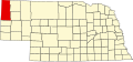 | |
| Unincorporated communities | ||
42°55′21″N103°43′44″W / 42.92250°N 103.72889°W
| | This Sioux County, Nebraska state location article is a stub. You can help Wikipedia by adding missing information. |