Montville, Maine

Last updated

Montville, Maine
Motto: 
"The Way Life Is" [1]
Waldo County Maine Incorporated Areas Montville Highlighted.png
Location of Montville (in yellow) in Waldo County and the state of Maine
Coordinates: 44°25′48″N69°17′6″W / 44.43000°N 69.28500°W / 44.43000; -69.28500
Country United States
State Maine
County Waldo
Area
[2]
  Total43.14 sq mi (111.73 km2)
  Land42.66 sq mi (110.49 km2)
  Water0.48 sq mi (1.24 km2)
Elevation
469 ft (143 m)
Population
 (2020)
  Total1,020
  Density24/sq mi (9.2/km2)
Time zone UTC-5 (Eastern (EST))
  Summer (DST) UTC-4 (EDT)
ZIP code
04941
Area code 207
FIPS code 23-46790
GNIS feature ID0582605
Website Town of Montville, Maine

Montville is a town in Waldo County, Maine, United States. The population was 1,020 at the 2020 census. [3]

Contents

History

The area that is now the town of Montville was originally inhabited by the Wawenoec Indians.

Between 1629 and 1631 The Council of New England divided Maine into three major regions, and the region that now contains Montville was purchased by the brigadier general Samuel Waldo, for whom Waldo County in now named. The first evidence of European activity in Montville itself comes from about 1720, when timber was harvested in the area. Among the trees cut were white pines, which were used as ship masts by the British Royal Navy. The first permanent settlement by Europeans in Montville occurred in 1780, when James Davis moved to the area from Massachusetts. The settlement he founded was named the Davistown Plantation, after James Davis, and grew to encompass all of modern day Montville & Liberty. By 1790 there were six families living on the Davistown Plantation, by 1800 that number had grown to 50 families. Davistown was incorporated on February 18, 1807, under the name Montville, the French word for "mountain town". Twenty years later the southern part of Montville split off, and was incorporated as the town of Liberty.

The patent originally claimed by Samuel Waldo later came under the ownership of Henry Knox, George Washington's secretary of war. In the late 18th and early 19th century, there was an ongoing dispute between the settlers of the region and Knox over who held rightful ownership of the land. This was part of a larger conflict between the poor settlers of Mid Coast Maine and the proprietors who owned the land. The settlers believed that ownership of land meant that you had "improved" it by clearing it of trees, planting crops or building fences. Conversely, the proprietors believed that ownership of land was decided by government-granted deeds. The proprietors attempted to divide the land they claimed into lots so that they could tax the settlers there, but the settlers resisted this and banded together to stop surveying in their settlements. The homesteaders called themselves Liberty Men (likely where the town Liberty's name comes from), and used mainly intimidation tactics to scare off surveyors who entered into their dominion. On September 5, 1815, a group of Liberty men attacked the Marshall Springs hotel in Montville, in a raid against Joseph H. Pierce Jr, an agent for the twenty associates. The twenty associates were the group that took over Henry Knox's land claims after he died in 1806.

Through the first four decades of the 19th century, Montville's population rapidly increased. The land was largely deforested, and many farms were started in the area. Saw mills in Montville and Liberty processed wood, which was then transported to the coast to be used in shipbuilding. Montville and Liberty also became a center of coopering, (barrel making) with many of the barrels produced there either being used by fishermen to store their catch, or as lime casts by brick masons in cites to the south, such as Portland Maine or Boston Massachusetts. Montville reached its peak population in 1840, at which time there were 2,153 people living in the area. After this Montville's population went into a steady decline for the next 120 years, reaching its low in 1960 with just 366 people. Its population has since rebounded somewhat, and as of the 2020 census sits at 1,020 people. The drastic decrease in population meant that former farmland was allowed to re-wild, and today the vast majority of Montville's land is forested.


Geography

According to the United States Census Bureau, the town has a total area of 43.14 square miles (111.73 km2), of which 42.66 square miles (110.49 km2) is land and 0.48 square miles (1.24 km2) is water. [2] Principle bodies of water are Trues Pond (173 acres), Kingdom Bog (90 acres), Ledge Pond (24 acres) and Mud Pond (15 acres). The town is crossed by state routes SR 220 and SR 3. It borders the towns of Knox to the northeast, Morrill to the east, Searsmont to the southeast, Liberty to the southwest, Palermo to the west and Freedom to the northwest. The Town Office is located on 414 Center Road.

Montville is home to part of Frye Mountain Wildlife Management Area. It is also home to part of James Dorso (Ruffingham Meadow) WMA.

Demographics

Historical population
CensusPop.Note
1810 864
1820 1,26646.5%
1830 1,74337.7%
1840 2,15323.5%
1850 1,881−12.6%
1860 1,682−10.6%
1870 1,467−12.8%
1880 1,255−14.5%
1890 1,049−16.4%
1900 982−6.4%
1910 850−13.4%
1920 743−12.6%
1930 664−10.6%
1940 605−8.9%
1950 466−23.0%
1960 366−21.5%
1970 43017.5%
1980 63146.7%
1990 87739.0%
2000 1,00214.3%
2010 1,0323.0%
2020 1,020−1.2%
U.S. Decennial Census [4]

2010 census

As of the census [5] of 2010, there were 1,032 people, 433 households, and 294 families living in the town. The population density was 24.2 inhabitants per square mile (9.3/km2). There were 553 housing units at an average density of 13.0 per square mile (5.0/km2). The racial makeup of the town was 96.1% White, 0.4% African American, 0.1% Native American, 0.4% Asian, 0.7% from other races, and 2.3% from two or more races. Hispanic or Latino of any race were 2.2% of the population.

There were 433 households, of which 32.1% had children under the age of 18 living with them, 55.0% were married couples living together, 6.9% had a female householder with no husband present, 6.0% had a male householder with no wife present, and 32.1% were non-families. 25.6% of all households were made up of individuals, and 8.3% had someone living alone who was 65 years of age or older. The average household size was 2.38 and the average family size was 2.83.

The median age in the town was 43.6 years. 22.4% of residents were under the age of 18; 4.9% were between the ages of 18 and 24; 25.1% were from 25 to 44; 32.8% were from 45 to 64; and 14.8% were 65 years of age or older. The gender makeup of the town was 49.7% male and 50.3% female.

2000 census

As of the census [6] of 2000, there were 1,002 people, 391 households, and 279 families living in the town. The population density was 23.5 people per square mile (9.1 people/km2). There were 483 housing units at an average density of 11.3 per square mile (4.4/km2). The racial makeup of the town was 98.00% White, 0.10% African American, 0.10% Native American, 0.10% Asian, 0.90% from other races, and 0.80% from two or more races. Hispanic or Latino of any race were 1.00% of the population.

There were 391 households, out of which 35.8% had children under the age of 18 living with them, 59.1% were married couples living together, 5.9% had a female householder with no husband present, and 28.4% were non-families. 21.0% of all households were made up of individuals, and 6.9% had someone living alone who was 65 years of age or older. The average household size was 2.56 and the average family size was 3.00.

In the town, the population was spread out, with 26.4% under the age of 18, 6.7% from 18 to 24, 29.7% from 25 to 44, 27.3% from 45 to 64, and 9.8% who were 65 years of age or older. The median age was 37 years. For every 100 females, there were 102.4 males. For every 100 females age 18 and over, there were 100.3 males.

The median income for a household in the town was $32,434, and the median income for a family was $37,917. Males had a median income of $25,391 versus $23,583 for females. The per capita income for the town was $14,112. About 9.9% of families and 14.5% of the population were below the poverty line, including 18.0% of those under age 18 and 12.2% of those age 65 or over.

Historic Sites in Montville

Notable people

Related Research Articles

<span class="mw-page-title-main">Waldo County, Maine</span> County in Maine, US

Waldo County is a county in the state of Maine, United States. As of the 2020 census, the population was 39,607. Its county seat is Belfast. The county was founded on February 7, 1827, from a portion of Hancock County and named after Brigadier-General Samuel Waldo, proprietor of the Waldo Patent.

<span class="mw-page-title-main">Verona Island, Maine</span> Town in Maine, United States

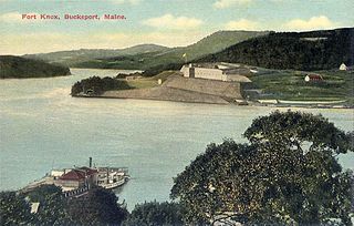
Verona Island is a town located on an island of the same name in the Penobscot River in Hancock County, Maine, United States. The population was 507 at the 2020 census.

<span class="mw-page-title-main">Appleton, Maine</span> Town in the state of Maine, United States

Appleton is a town in Knox County, Maine, United States. It is about 15 miles inland from Penobscot Bay and coastal towns such as Camden and Rockland, about 30 miles east of the state capital of Augusta. The population was 1,411 at the 2020 census.

<span class="mw-page-title-main">Cushing, Maine</span> Town in the state of Maine, United States

Cushing is a town in Knox County, Maine, United States. The population was 1,502 at the 2020 census. A favorite of artists for its unspoiled natural setting, Cushing includes the villages of North Cushing, Cushing, South Cushing, and Pleasant Point.

<span class="mw-page-title-main">Union, Maine</span> Town in the state of Maine, United States

Union is a town in Knox County, Maine, United States. The population was 2,383 at the 2020 census. It is home to the Matthews Museum of Maine Heritage and annual Union Fair.

<span class="mw-page-title-main">Warren, Maine</span> Town in the state of Maine, United States

Warren is a town in Knox County, Maine, United States. The population was 4,865 at the 2020 census. It includes the villages of East Warren, Warren and South Warren, the latter home to the Maine State Prison and minimum security Bolduc Correctional Facility.

<span class="mw-page-title-main">Brooks, Maine</span> Town in the state of Maine, United States

Brooks is a town in Waldo County, Maine, United States. The population was 1,010 at the 2020 census.

<span class="mw-page-title-main">Frankfort, Maine</span> Town in the state of Maine, United States

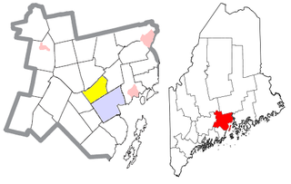
Frankfort is a town on the Penobscot River estuary in Waldo County, Maine, United States. The population was 1,231 at the 2020 census.

<span class="mw-page-title-main">Knox, Maine</span> Town in the state of Maine, United States

Knox is a town in Waldo County, Maine, United States. The town was named for General Henry Knox, the first United States Secretary of War. The population was 811 at the 2020 census.

<span class="mw-page-title-main">Liberty, Maine</span> Town in the state of Maine, United States

Liberty is a town in Waldo County, Maine, United States. The population was 934 at the 2020 census.

<span class="mw-page-title-main">Monroe, Maine</span> Town in the state of Maine, United States

Monroe is a town in Waldo County, Maine, United States named for President James Monroe. The population was 931 at the 2020 census.

<span class="mw-page-title-main">Morrill, Maine</span> Town in the state of Maine, United States

Morrill is a town in Waldo County, Maine, United States. The population was 971 at the 2020 census.

<span class="mw-page-title-main">Palermo, Maine</span> Town in Maine, United States

Palermo is a town in Waldo County, Maine, United States. The population was 1,570 at the 2020 census. Palermo is included in the Augusta, Maine, micropolitan New England City and Town Area.

<span class="mw-page-title-main">Prospect, Maine</span> Town in the state of Maine, United States

Prospect is a town in Waldo County, Maine, United States. The population was 698 at the 2020 census.

<span class="mw-page-title-main">Searsmont, Maine</span> Town in the state of Maine, United States

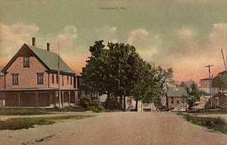
Searsmont is a town in Waldo County, Maine, United States. The population was 1,400 at the 2020 census.

<span class="mw-page-title-main">Swanville, Maine</span> Town in the state of Maine, United States

Swanville is a town in Waldo County, Maine, United States. The population was 1,377 at the 2020 census.

<span class="mw-page-title-main">Thorndike, Maine</span> Town in the state of Maine, United States

Thorndike is a town in Waldo County, Maine, United States. The town was named after Israel Thorndike, a landowner. The population was 774 at the 2020 census.

<span class="mw-page-title-main">Troy, Maine</span> Town in the state of Maine, United States

Troy is a town in Waldo County, Maine, United States. The population was 1,018 at the 2020 census.

<span class="mw-page-title-main">Waldo, Maine</span> Town in the state of Maine, United States

Waldo is a town in Waldo County, Maine, United States. The population was 795 at the 2020 census. It is the home town of Heather Hemmens, who is known for her role on Hellcats.

Unity is a town in Waldo County, Maine, United States. The population was 2,292 at the 2020 census. The town is the service center for the northern portion of Waldo County. Outside of Waldo County, it is best known as the home of the Maine Organic Farmers and Gardeners Association, its Common Ground Country Fair and Unity College. Unity College was founded in 1965 to offset the economic effects of the declining chicken farming industry. As of 2007, the college is the town's largest employer.

References

  1. "Town of Montville, Maine". Town of Montville, Maine. Retrieved August 26, 2012.
  2. 1 2 "US Gazetteer files 2010". United States Census Bureau . Retrieved December 16, 2012.
  3. "Census - Geography Profile: Montville town, Waldo County, Maine" . Retrieved January 21, 2022.
  4. "Census of Population and Housing". Census.gov. Retrieved June 4, 2015.
  5. "U.S. Census website". United States Census Bureau . Retrieved December 16, 2012.
  6. "U.S. Census website". United States Census Bureau . Retrieved January 31, 2008.
  7. "Knowlton, Ebenezer, (1815 - 1874)". Biographical Directory of the United StatesCongress. Retrieved August 26, 2012.

http://www.davistownmuseum.org/publications/volume2.html#DavistownChron

http://www.davistownmuseum.org/publications/volume2.html#DavistownChron