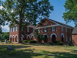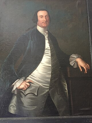
Middlesex County is a county located on the Middle Peninsula in the U.S. state of Virginia. As of the 2020 census, the population was 10,625. Its county seat is Saluda.

Lancaster County is a county located on the Northern Neck in the Commonwealth of Virginia. As of the 2020 census, the population sits at 10,919. Its county seat is Lancaster.

The Northern Neck is the northernmost of three peninsulas on the western shore of the Chesapeake Bay in the Commonwealth of Virginia. The Potomac River forms the northern boundary of the peninsula; the Rappahannock River demarcates it on the south. The land between these rivers was formed into Northumberland County in 1648, prior to the creation of Westmoreland County and Lancaster County. The Northern Neck encompasses the following Virginia counties: Lancaster, Northumberland, Richmond, King George and Westmoreland; it had a total population of 50,158 as of the 2020 census.

Powhatan, whose proper name was Wahunsenacawh, was the leader of the Powhatan, an alliance of Algonquian-speaking Native Americans living in Tsenacommacah, in the Tidewater region of Virginia at the time when English settlers landed at Jamestown in 1607.

Colonel Robert Carter I was a planter, merchant, and government official and administrator who served as Acting Governor of Virginia, Speaker of the Virginia House of Burgesses, and President of the Virginia Governor’s Council. An agent for the Northern Neck Proprietary, Carter emerged as the wealthiest Virginia colonist and received the sobriquet “King” from his contemporaries connoting his autocratic approach and political influence. Involved in the founding of the College of William and Mary, he acquired at least 300,000 acres and engaged one thousand enslaved laborers on fifty plantations.

Wickford is a small village in the town of North Kingstown, Rhode Island, United States, which is named after Wickford in Essex, England. Wickford is located on the west side of Narragansett Bay, just about a 20-minute drive across two bridges from Newport, Rhode Island. The village is built around one of the most well-protected natural harbors on the eastern seaboard, and features one of the largest collections of 18th century dwellings to be found anywhere in the Northeast. Today the majority of the village's historic homes and buildings remain largely intact upon their original foundations.

Augustine Washington Sr. was an American planter and merchant. He was the father of the first president of the United States, George Washington. Born into the planter class of the British colony of Virginia, Washington owned several slave plantations, from which he derived the primary source of his wealth. He also speculated in land development and owned an iron mine. Although Washington never sat in the House of Burgesses, unlike his father and son, he served in various government positions in the counties where he owned land.

The Rappahannock are a federally recognized tribe in Virginia and one of the eleven state-recognized tribes. They are made up of descendants of several small Algonquian-speaking tribes who merged in the late 17th century. In January 2018, they were one of six Virginia tribes to gain federal recognition by passage of the Thomasina E. Jordan Indian Tribes of Virginia Federal Recognition Act of 2017.

Belle Isle State Park is located in Lancaster County, Virginia, on the Rappahannock River. It sits between Deep Creek and Morattico Creek and is currently under public ownership. The park has an area of 892 acres (3.61 km2) and has facilities for camping, fishing, boating and picnics. As of 2015, the yearly visitation was 44,502.

Rippon Lodge is one of the oldest houses remaining in Prince William County, Virginia, and listed on the National Register of Historic Places since 1971. Built around 1747 by Richard Blackburn (1705-1757) as the main residence and headquarters of his plantation, it lies on high ground overlooking Neabsco Creek at the south end of what is now the unincorporated town of Woodbridge at 15520 Blackburn Road. The house takes its name from Richard Blackburn's birthplace, the small city of Ripon in North Yorkshire, England.
Kiskiack was a Native American tribal group of the Powhatan Confederacy in what is present-day York County, Virginia. The name means "Wide Land" or "Broad Place" in the native language, one of the Virginia Algonquian languages. It was also the name of their village on the Virginia Peninsula.

Richard Lee I was the first member of the Lee family to live in America. Poor when he arrived in Virginia in 1639 on a ship with the colony's newly reappointed governor and the woman who became his future wife, by the time of his death, Lee may have been both the Virginia Colony's wealthiest inhabitant as well as its largest landholder. Lee had a varied career, for in addition to several important government and military posts, he became a merchant, planter and politician who served one term in the Virginia House of Burgesses as well as managed to negotiate several major political upheavals—both successfully and to his economic advantage.

Norris Dam State Park is a state park in Anderson County and Campbell County, Tennessee, in the southeastern United States. The park is situated along the shores of Norris Lake, an impoundment of the Clinch River created by the completion of Norris Dam in 1936. The park consists of 4,038 acres (16.34 km2) managed by the Tennessee Department of Environment and Conservation. The park also administers the Lenoir Museum Complex, which interprets the area's aboriginal, pioneer, and early 20th-century history.

Corotoman was a 17th and 18th century plantation on the Rappahannock River in Lancaster County, Virginia, United States. Corotoman was the residence of Robert Carter I, a colonial Governor of Virginia and one of the wealthiest men in the British colonies in North America. Corotoman was located on a point overlooking the Rappahannock River, and flanked by Carter's Creek and Corrotoman River to its east and west respectively.

Colonel John Tayloe II was the premier Virginia planter; a politician, and colonial Colonel in the Virginia Militia. Virginia. He served in public office including the Virginia Governor's Council, also known as the Virginia Council of State.
The Broadneck Peninsula is an area in Anne Arundel County, Maryland. The area is north of the Severn River, south of the Magothy River and west of the Chesapeake Bay. At the lower end of the Broadneck Peninsula is the 4.3 mile Chesapeake Bay Bridge.

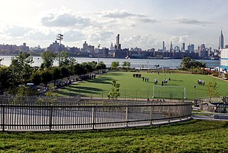
Bushwick Inlet Park is a public park in the Williamsburg neighborhood of Brooklyn, New York City. The park currently consists of two non-contiguous sections along the East River and is eventually planned to reach into Greenpoint at Quay Street. The park is named for the nearby Bushwick Inlet, which it is planned to encompass upon completion.

Davenport Neck is a peninsula in New Rochelle, New York, extending southwesterly from the mainland into Long Island Sound, and running parallel to the main shore. It divides the city's waterfront into two, with New Rochelle Harbor to the south and southwest, and Echo Bay, to the north and northeast. Glen Island and Neptune Island lie just to the west of the Neck, and Davids and Huckleberry islands lie to the south.
Totuskey Creek is a tributary of the Rappahannock River located in Richmond County, Virginia. The creek meets the river near Wellford, Virginia.
Charles Grymes or Grimes was Virginia planter and politician who represented Richmond County on Virginia's Northern Neck in the House of Burgesses (1728–1734).


