Related Research Articles

The Moray Firth is a roughly triangular inlet of the North Sea, north and east of Inverness, which is in the Highland council area of north of Scotland. It is the largest firth in Scotland, stretching from Duncansby Head in the north, in the Highland council area, and Fraserburgh in the east, in the Aberdeenshire council area, to Inverness and the Beauly Firth in the west. Therefore, three council areas have Moray Firth coastline: Highland to the west and north of the Moray Firth and Highland, Moray and Aberdeenshire to the south. The firth has more than 800 kilometres of coastline, much of which is cliff.

Insh Marshes are an area of floodplain of the River Spey between Kingussie and Kincraig in Badenoch and Strathspey, Highland, Scotland. The marshes are said to be one of the most important wetlands in Europe. They lie at altitude of approximately 240 to 220 m above sea level, and form one of the largest areas of floodplain mire and fen vegetation in Scotland.

Roebuck Bay is a bay on the coast of the Kimberley region of Western Australia. Its entrance is bounded in the north by the town of Broome, and in the south by Bush Point and Sandy Point. It is named after HMS Roebuck, the ship captained by William Dampier when he explored the coast of north-western Australia in 1699. The Broome Bird Observatory lies on the northern coast of the bay.

The Great Sandy Strait is a strait in the Australian state of Queensland of 70 kilometres (43 mi) length which separates mainland Queensland from Fraser Island. It is also a locality in the Fraser Coast Region local government area. In the 2016 census, Great Sandy Strait had a population of 4 people.

Deben Estuary is a 981.1 hectare biological Site of Special Scientific Interest (SSSI) covering the River Deben and its banks 12 kilometres from its mouth north of Felixstowe to Woodbridge in Suffolk. It is a Ramsar internationally important wetland site and a Special Protection Area under the European Union Directive on the Conservation of Wild Birds. It is also in the Suffolk Coast and Heaths Area of Outstanding Natural Beauty. It partly overlaps two geological SSSIs, Ferry Cliff, Sutton and Ramsholt Cliff.

Colne Estuary is a 2915 hectare biological and geological Site of Special Scientific Interest near Brightlingsea in Essex. It is also a Nature Conservation Review site, a National Nature Reserve, a Ramsar wetland site of international importance, a Special Protection Area, a Special Area of Conservation, and a Geological Conservation Review site. Three areas in the site are managed by the Essex Wildlife Trust, Colne Point, Fingringhoe Wick and Howlands Marsh.
Matsalu National Park is a nature reserve and national park situated in Lääne and Pärnu Counties, Estonia. Matsalu National Park spans an area of 486.1 km2 (187.7 sq mi), comprising Matsalu Bay, the Kasari River delta, the village of Matsalu and surrounding areas.

The Edithvale-Seaford Wetlands is a collection of principally freshwater swamps and marshlands totalling 261 hectares in southeastern Melbourne, Victoria, Australia, about 30 km (19 mi) southeast of Melbourne CBD. It is the largest natural wetland of its type in the Port Phillip and Western Port basins, and is all that remains of the historic Carrum Carrum Swamp, which once covered more than 4,000 hectares from present-day Mordialloc in the north to Frankston in the south.

The Jagdishpur Reservoir is a reservoir in Jahadi Village Development Committee, Kapilvastu District, Nepal. With a surface area of 225 ha (2.25 km2) , it is the largest reservoir in the country and an important wetland site. It is situated at an altitude of 197 m (646 ft). The maximum water depth varies between 2 m (6.6 ft) in the dry season and 7 m (23 ft) in the monsoon season.

The Jiwani Coastal Wetland is a wetland located in Balochistan, Pakistan, near the town of Jiwani. The site is one of the 19 Ramsar sites in Pakistan and was inducted in 2001.

Logan Lagoon is a 2172 ha wetland Conservation Area on Flinders Island, the largest of the Furneaux Group at the eastern end of Bass Strait, which is part of the Australian state of Tasmania.

Salinas of the English Port is a saline wetland in the southwestern part of the island of Maio, Cape Verde, northwest of the city Porto Inglês. It is a 5.34 km2 (2.06 sq mi) protected area and a Ramsar site. It encompasses ecological, landscape, historical and cultural values. The site is frequented by species of birds of conservation interest, some of them protected by national laws and international conventions, and some endemic to the archipelago.

Caithness Lochs is a protected wetland area in the historic county of Caithness in the far north of Scotland. With a total area of 1,379 hectares, it covers six freshwater lochs and a complex area of fen and swamp, and has been protected as a Ramsar Site since 1998.
The East Sanday Coast is a protected wetland area on and around the island of Sanday, the third-largest of the Orkney islands off the north coast of Scotland. With a total protected area of 1,515 hectares, the 55 kilometre stretch of coast includes rocky and sandy sections, sand dunes, machair habitats, intertidal flats, and saltmarsh. It has been protected as a Ramsar Site since 1997.
Eilean na Muice Duibhe, also known as Duich Moss, is an area of low-level blanket mire on the island of Islay, off the west coast of Scotland. Located south of the town of Bowmore and with an area of 576 hectares, the area has been protected as a Ramsar Site since 1988.

Loch Eye is a shallow freshwater loch, located close to the east coast of Scotland between the Moray Firth, Dornoch Firth and Cromarty Firth. Covering an area of 205 hectares, it is an important site for waterfowl and has been protected since 1986 as a Ramsar Site, a Special Protection Area and a Site of Special Scientific Interest.

Loch of Kinnordy is a small loch located just west of town of Kirriemuir in Angus, Scotland, which is an important wildlife habitat. The loch itself is approximately 22 hectares, though this has varied over time with drainage attempts and the silting up of the outflow stream. Including surrounding fen, swamp and mire, 85 hectares are protected as a Ramsar Site.
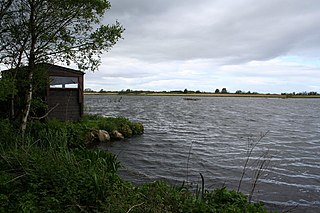
Loch Spynie is a small loch located between the towns of Elgin and Lossiemouth in Moray, Scotland. Close to Spynie Palace, the ancient home of the bishops of Moray, it is an important wildlife habitat which is protected as a Ramsar Site.

South Tayside Goose Roosts is a composite wetland site to the west of Perth in central Scotland, covering a total of 331 hectares, which has been protected as a Ramsar Site since 1993. Incorporating three disconnected sections, separated by several kilometres, the site contains seven freshwater lochs along with other wetland habitats, including one of the largest raised bogs in the region.

The North Uist Machair and Islands is a protected wetland area in the Outer Hebrides of Scotland. A total of 4,705 hectares comprises seven separate areas: four sites on the west and north coasts of North Uist, as well as the whole of the island of Boreray and parts of Berneray and Pabbay in the Sound of Harris. The site primarily contains machair areas, with a range of habitats including sand dunes, acid grassland and freshwater wetlands, including nutrient-rich marshes and fens, wet and dry machair and saltmarsh. It has been protected as a Ramsar Site since 1999.
References
- 1 2 3 "Moray and Nairn Coast". Ramsar Sites Information Service. Retrieved 21 June 2019.
- ↑ "UK Moray and Nairn Coast 13048 RIS 2006" (PDF). Ramsar Sites Information Service. Retrieved 21 June 2019.
- 1 2 "Moray and Nairn Coast". Joint Nature Conservation Committee . Retrieved 21 June 2019.
| | This Scottish location article is a stub. You can help Wikipedia by expanding it. |