
Route 21 is a state highway in Northern New Jersey, running 14.35 mi (23.09 km) from the Newark Airport Interchange with US 1-9 and US 22 in Newark, Essex County to an interchange with US 46 in Clifton, Passaic County. The route is a four- to six-lane divided highway known as McCarter Highway on its southern portion in Newark that serves as a connector between the Newark and Paterson areas, following the west bank of the Passaic River for much of its length. It also serves as the main north–south highway through the central part of Newark, connecting attractions in Downtown Newark with Newark Airport. The portion of Route 21 through Newark is a surface arterial that runs alongside the elevated Northeast Corridor rail line through the southern part of the city and continues north through Downtown Newark while the portion north of Downtown Newark is a freeway. Route 21 intersects many major roads including I-78, Route 27, and I-280 in Newark, Route 7 in Belleville, and Route 3 in Clifton.

Route 23 is a state highway in the northern part of New Jersey, United States. The route runs 52.6 mi (84.65 km) from Bloomfield Avenue and Prospect Avenue in Verona, Essex County northwest to the border with New York at Montague Township in Sussex County, where the road continues to Port Jervis, New York, as Orange County Route 15. Route 23 heads through Essex and Passaic counties as a two- to four-lane surface road and becomes a six-lane freeway north of a complex interchange with US 46 and I-80 in Wayne. The freeway carries Route 23 north to a concurrency with US 202. Past the freeway portion, the route heads northwest along the border of Morris and Passaic counties as a four- to six-lane arterial road with a wide median at places, winding through mountainous areas and crossing I-287 in Riverdale. The route continues northwest through Sussex County as a mostly two-lane surface road that passes through farmland and woodland as well as the communities of Franklin, Hamburg, and Sussex before reaching the New York state line, just south of an interchange with I-84 and US 6 in Port Jervis, in Montague Township near High Point State Park.
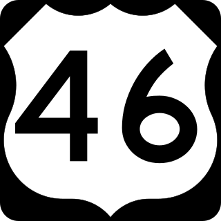
U.S. Route 46 (US 46) is an east–west U.S. Highway completely within the state of New Jersey, running for 75.34 mi (121.25 km), making it the shortest signed, non-spur U.S. Highway. The west end is at an interchange with Interstate 80 (I-80) and Route 94 in Columbia, Warren County, on the Delaware River. The east end is in the middle of the George Washington Bridge over the Hudson River in Fort Lee, Bergen County, while the route is concurrent with I-95 and US 1-9. Throughout much of its length, US 46 is closely paralleled by I-80. US 46 is a major local and suburban route, with some sections built to or near freeway standards and many other sections arterials with jughandles. The route runs through several communities in the northern part of New Jersey, including Hackettstown, Netcong, Dover, Parsippany-Troy Hills, Wayne, Clifton, Ridgefield Park, Palisades Park, and Fort Lee. It crosses over the Upper Passaic River at several points. The road has been ceremonially named the United Spanish–American War Veterans Memorial Highway.
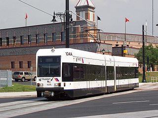
The Newark Light Rail (NLR) is a light rail system serving Newark, New Jersey, and surrounding areas, owned by New Jersey Transit and operated by its bus operations division. The service consists of two segments, the original Newark City Subway (NCS), and the extension to Broad Street station. The City Subway opened on May 16, 1935, while the combined Newark Light Rail service was officially inaugurated on July 17, 2006.

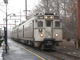
NJ Transit Rail Operations is the rail division of NJ Transit. It operates commuter rail service in New Jersey, with most service centered on transportation to and from New York City, Hoboken, and Newark. NJ Transit also operates rail service in Orange and Rockland counties in New York under contract to Metro-North Railroad. The commuter rail lines saw 57,179,000 riders in 2023, making it the third-busiest commuter railroad in North America and the longest commuter rail system in North America by route length.
The Gladstone Branch is a commuter rail line operated by NJ Transit from Gladstone station, in the U.S. state of New Jersey, to either Hoboken Terminal or New York Penn Station. It is one of two branches of the Morris & Essex Lines.

The Morristown Line is an NJ Transit commuter rail line connecting Morris and Essex counties to New York City, via either New York Penn Station or Hoboken Terminal. Out of 60 inbound and 58 outbound daily weekday trains, 28 inbound and 26 outbound Midtown Direct trains use the Kearny Connection to Penn Station; the rest go to Hoboken. Passengers can transfer at Newark Broad Street or Summit to reach the other destination. On rail system maps the line is colored dark green, and its symbol is a drum, a reference to Morristown's history during the American Revolution.
The Morris and Essex Railroad was a railroad across northern New Jersey, later part of the main line of the Delaware, Lackawanna and Western Railroad.

Pittsburgh Railways was one of the predecessors of Pittsburgh Regional Transit. It had 666 PCC cars, the third largest fleet in North America. It had 68 streetcar routes, of which only three are used by the Port Authority as light rail routes. With the Port Authority's Transit Development Plan, many route names will be changed to its original, such as the 41D Brookline becoming the 39 Brookline. Many of the streetcar routes have been remembered in the route names of many Port Authority buses.
Paterson Plank Road is a road that runs through Passaic, Bergen and Hudson Counties in northeastern New Jersey. The route, originally laid in the colonial era, connects the city of Paterson and the Hudson River waterfront. It has largely been superseded by Route 3, but in the many towns it passes it has remained an important local thoroughfare, and in some cases been renamed.

Mountain View, signed on the platform as Mountain View–Wayne, is a station on the Montclair-Boonton Line of NJ Transit in Wayne, New Jersey. Prior to the Montclair Connection in 2002, the station was served by the Boonton Line. The station is located on Erie Avenue, just off of US 202 and Route 23 in Downtown Wayne. Since January 2008, Mountain View station is the second of two stations in Wayne, the other being the Wayne Route 23 Transit Center, a station off the Westbelt interchange.

Kingsland is a railroad station on New Jersey Transit's Main Line. It is located under Ridge Road (Route 17) between New York and Valley Brook Avenues in Lyndhurst, New Jersey, and is one of two stations in Lyndhurst. The station is not staffed, and passengers use ticket vending machines (TVMs) located at street level to purchase tickets. The station is not handicapped-accessible. Originally part of the Delaware, Lackawanna and Western Railroad's Boonton Branch, the current Kingsland station was built in 1918.

Passaic is a NJ Transit rail station served by Main Line trains in Passaic, New Jersey. The station is located in the Passaic Park section of Passaic at an intersection that links Passaic Avenue and Van Houten Avenue with Lackawanna Place. The Hoboken bound platform is located on the Passaic Avenue side of the station and the Suffern bound platform is located at the intersection of Van Houten Avenue and Lackawanna Place. Pedestrian access to both platforms is available on Passaic Avenue, but an underpass is also available to connect both sides.

The Montclair-Boonton Line is a commuter rail line of New Jersey Transit Rail Operations in the United States. It is part of the Hoboken Division. The line is a consolidation of three individual lines: the former Delaware, Lackawanna & Western Railroad's Montclair Branch, which ran from Hoboken Terminal to Bay Street, Montclair. The Erie Railroad's Greenwood Lake Division, a segment from Montclair to Mountain View-Wayne, originally ran from the Jersey City Terminal to Greenwood Lake, NY, and the former Lackawanna Boonton Line ran from Hoboken to Hackettstown, New Jersey.

Morristown & Erie Railway is a short-line railroad based in Morristown, New Jersey, chartered in 1895 as the Whippany River Railroad. It operates freight rail service in Morris County, New Jersey and surrounding areas on the original Whippany Line between Morristown and Roseland, as well as the Morris County-owned Dover & Rockaway Branch, Chester Branch, and High Bridge Branch. The M&E also operated the Maine Eastern Railroad from November 2003 to December 31, 2015.

North Newark was a former commuter railroad train station in the Woodside section of the city of Newark, Essex County, New Jersey. Located at the intersection of Broadway and Verona Avenue, the station served trains on NJ Transit's Boonton Line, which operated at the time between Netcong and Hoboken Terminal. The station consisted of two low-level side platforms, accessible by stairs from Broadway. The next station to the east was Arlington in nearby Kearny, with the next station to the west being Rowe Street in Bloomfield.

The Essex–Hudson Greenway is a planned state park and greenway in the northerneastern New Jersey counties of Essex and Hudson. It will follow an abandoned railroad right of way (ROW) across the New Jersey Meadowlands, over the Hackensack and Passaic rivers, as well pass through densely-populated neighborhoods. The nearly 9-mile (14 km) long shared-use linear park/rail trail will encompass about 135 acres (55 ha) and will average 100 feet (30 m) in width. Running between Jersey City and Montclair it will pass through Secaucus, Arlington in northern Kearny, North Newark, Belleville, Bloomfield and Glen Ridge. The initial phase in Newark and Kearny is expected to open in late 2025