Mortonsville, Kentucky

Last updated

Mortonsville is an unincorporated community in Woodford County, in the U.S. state of Kentucky. [1]
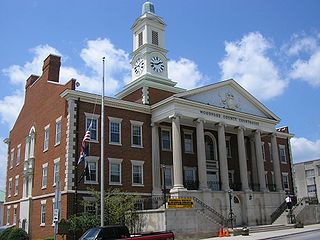
Woodford County, Kentucky County in the United States

Woodford County is a county located in the U.S. state of Kentucky. As of the 2010 census, the population was 24,939. Its county seat is Versailles.

U.S. state constituent political entity of the United States

In the United States, a state is a constituent political entity, of which there are currently 50. Bound together in a political union, each state holds governmental jurisdiction over a separate and defined geographic territory and shares its sovereignty with the federal government. Due to this shared sovereignty, Americans are citizens both of the federal republic and of the state in which they reside. State citizenship and residency are flexible, and no government approval is required to move between states, except for persons restricted by certain types of court orders. Four states use the term commonwealth rather than state in their full official names.

Kentucky State of the United States of America

Kentucky, officially the Commonwealth of Kentucky, is a state located in the east south-central region of the United States. Although styled as the "State of Kentucky" in the law creating it, (because in Kentucky's first constitution, the name state was used) Kentucky is one of four U.S. states constituted as a commonwealth. Originally a part of Virginia, in 1792 Kentucky became the 15th state to join the Union. Kentucky is the 37th most extensive and the 26th most populous of the 50 United States.

History

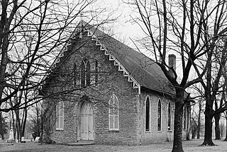
A post office was established at Mortonsville in 1828, and remained in operation until 1921. [2] [3] The community was named for its founder, Jeremiah Morton. [4]

Related Research Articles

Millville, Kentucky Unincorporated community in Kentucky, United States

Millville is an unincorporated community located in Woodford County, Kentucky. It is situated about 5 miles (8 km) southeast of Frankfort, Kentucky. Glenns Creek runs through the town, and it is near the Kentucky River.

Richwood is an unincorporated community in Boone County, in the U.S. state of Kentucky.

Beefhide, Kentucky Unincorporated community in Kentucky, United States

Beefhide is an unincorporated community spanning across a county line between Letcher County and Pike County, Kentucky, United States.

Brumfield is an unincorporated community in Boyle County, Kentucky, in the United States.

Boreing is an unincorporated community in Laurel County, in the U.S. state of Kentucky.

Ballard is an unincorporated community in Anderson County, in the U.S. state of Kentucky.

Pisgah, Kentucky human settlement in United States of America

Pisgah is an unincorporated community in Woodford County, in the U.S. state of Kentucky.

Schumm is an unincorporated community in Van Wert County, in the U.S. state of Ohio.

Ringgold is an unincorporated community in Pulaski County, in the U.S. state of Kentucky.

Roundstone is an unincorporated community in Rockcastle County, in the U.S. state of Kentucky.

Rowland is an unincorporated community in Lincoln County, in the U.S. state of Kentucky.

Ruckerville is an unincorporated community in Clark County, in the U.S. state of Kentucky.

Fayetteville is an unincorporated community in Johnson County, in the U.S. state of Missouri.

Dillon is an unincorporated community in Phelps County, in the U.S. state of Missouri. The community is located along the BNSF railroad line between Rolla and St. James.

Westcott is an extinct town in northwestern Phelps County, in the U.S. state of Missouri.

Pointer is an unincorporated community in Pulaski County, Kentucky.

Million is an unincorporated community in Madison County, Kentucky.

Limaburg is an unincorporated community in Boone County, in the U.S. state of Kentucky.

Norfleet is an unincorporated community in Pulaski County, in the U.S. state of Kentucky.

Nugent Crossroads is an unincorporated community in Woodford County, in the U.S. state of Kentucky.

References

Coordinates: 37°58′19″N84°45′23″W / 37.97194°N 84.75639°W / 37.97194; -84.75639

Geographic coordinate system Coordinate system

A geographic coordinate system is a coordinate system that enables every location on Earth to be specified by a set of numbers, letters or symbols. The coordinates are often chosen such that one of the numbers represents a vertical position and two or three of the numbers represent a horizontal position; alternatively, a geographic position may be expressed in a combined three-dimensional Cartesian vector. A common choice of coordinates is latitude, longitude and elevation. To specify a location on a plane requires a map projection.