References
- ↑ U.S. Geological Survey Geographic Names Information System: Mose, North Dakota
- ↑ "Griggs County". Jim Forte Postal History. Retrieved October 23, 2015.
- ↑ Federal Writers' Project (1938). North Dakota, a Guide to the Northern Prairie State. WPA. p. 311. ISBN 978-1-62376-033-5.
{{cite book}}: ISBN / Date incompatibility (help)
Municipalities and communities of Griggs County, North Dakota, United States | ||
|---|---|---|
| Cities | 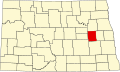 | |
| Townships | ||
| CDPs | ||
| Other communities | ||
47°34′43″N98°27′17″W / 47.57861°N 98.45472°W
| | This Griggs County, North Dakota location article is a stub. You can help Wikipedia by expanding it. |