
Cottesloe is a western suburb of Perth, Western Australia, within the Town of Cottesloe. Cottesloe was named for Thomas Fremantle, 1st Baron Cottesloe, a prominent Tory politician and the brother of Admiral Sir Charles Fremantle for whom the city of Fremantle was named. The nearby suburb of Swanbourne was named for the Fremantle family seat, Swanbourne House, in Swanbourne, Buckinghamshire.

Peppermint Grove is an affluent western suburb of Perth, Western Australia on the north bank of the Swan River at Freshwater Bay. Its local government area, the smallest in the country, is the Shire of Peppermint Grove. The suburb was named after its trademark Swan River peppermint trees lining many streets. The suburb has long been associated with Western Australia's wealthiest and oldest families. Their prosperity is reflected in the many historical houses in the area, such as The Cliffe and the Federation Queen Anne style St Just. Colin Barnett, a former Premier of Western Australia, dubbed the suburb "Monaco of WA" due to its small size and concentration of wealth.
The Midland line is a suburban rail service on the Transperth network in Perth, Western Australia. It runs on the Eastern Railway through Perth's eastern suburbs and connects Midland with Perth. Travelling from Midland, the trains terminate at Fremantle on the Fremantle line.
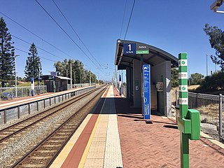
The Fremantle line is a suburban railway and service in Western Australia that connects the central business district (CBD) of Perth with Fremantle.

Perth railway station is the largest station on the Transperth network, serving the central business district of Perth, Western Australia. It serves as an interchange between the Airport, Armadale, Fremantle, Joondalup, Mandurah and Midland lines as well as Transwa's Australind service.

Stirling railway station is a railway station on the Transperth network. It is located on the Joondalup line, nine kilometres from Perth station serving the suburb of Stirling.
Shenton Park railway station is a commuter railway station in Shenton Park, a suburb of Perth, Western Australia. The station is on the Fremantle and Airport lines, which are part of the Transperth public transport network. It has an island platform, accessed by a pedestrian underpass. The station is only partially accessible due to a steep ramp. Services on each line run every 12 minutes during peak hour and every 15 minutes outside peak hour and on weekends and public holidays. At night, trains are every half-hour or hour. The journey to Perth railway station is 6.0 kilometres (3.7 mi), and takes 9 minutes.

Daglish railway station is a commuter railway station on the boundary of Daglish and Subiaco, suburbs of Perth, Western Australia. Opened on 14 July 1924, the station was named after Henry Daglish, who had been a mayor of Subiaco, a member for the electoral district of Subiaco, and a premier of Western Australia in the 1900s. Daglish was a resident of Subiaco for 22 years before he died in 1920. The station consists of an island platform accessed by a pedestrian underpass. Two small buildings are on the platform which operated as a parcels office and ticket office until 1970. The station is only partially accessible due to a steep access ramp and lack of tactile paving.

Subiaco railway station is a railway station on the Transperth network in Western Australia. It is located on the Fremantle line and Airport line, 3.7 kilometres (2.3 mi) from Perth station serving the suburbs of Subiaco and Wembley.

City West railway station is a railway station on the Transperth network in Western Australia. It is located on the Fremantle line and Airport line, 1.6 kilometres from Perth station serving the suburb of West Perth.

Fremantle railway station is the terminus of Transperth's Fremantle line in Western Australia.

North Fremantle railway station is a railway station on the Transperth network. It is located on the Fremantle line, 16.2 kilometres from Perth, serving the Fremantle suburb of North Fremantle.
Victoria Street railway station is a railway station on the Transperth network. It is located on the Fremantle line, 14.2 kilometres from Perth station serving the suburbs of Mosman Park and Cottesloe.

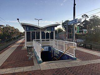
Cottesloe railway station is a railway station on the Transperth network. It is located on the Fremantle line, 12.4 kilometres from Perth station serving the suburbs of Cottesloe and Peppermint Grove.

Grant Street railway station is a railway station on the Transperth network. It is located on the Fremantle line, 11.1 kilometres from Perth station serving the suburb of Cottesloe.

Swanbourne railway station is a railway station on the Transperth network. It is located on the Fremantle line, 10.4 kilometres from Perth station serving the suburbs of Swanbourne, Claremont and Cottesloe.

Claremont railway station is a railway station on the Transperth network in Western Australia. It is located on the Fremantle and Airport lines, 9.3 kilometres from Perth station serving the suburb of Claremont.

Stirling Highway is, for most of its length, a four-lane single carriageway and major arterial road between Perth, Western Australia and the port city of Fremantle in Western Australia on the northern side of the Swan River. The speed limit is 60 km/h (37 mph). East of Crawley, it continues as Mounts Bay Road which links Crawley and the nearby University of Western Australia to the Perth central business district.

Rockingham railway station is a railway station in Rockingham, a suburb of Perth, Western Australia. It is on the Mandurah railway line, which is part of the Transperth commuter rail network. It has two side platforms, linked by a pedestrian overpass accessed by stairs, a lift, and escalators. Services run every 10 minutes during peak, and every 15 minutes between peak. The journey to Perth railway station is 43.2 kilometres (26.8 mi), and takes 34 minutes. The journey to Mandurah railway station is 27.6 kilometres (17.1 mi), and takes 17 minutes. The station has a bus interchange with twelve bus stands, and 14 regular bus routes.
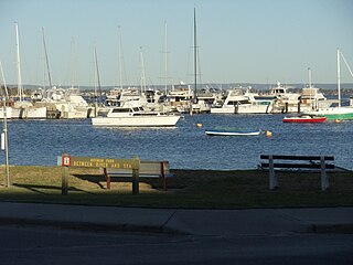
Mosman Park is a western suburb of Perth, Western Australia on the north bank of the Swan River in the local government area of the Town of Mosman Park. It was historically known as Buckland Hill (1889–1909), then Cottesloe Beach (1909–1930) and again Buckland Hill (1930–1937). From 1937 it was named Mosman Park, derived from Mosman in Sydney, the birthplace of Richard Yeldon, a member of the Buckland Hill Road Board. Mosman Park is now considered an affluent suburb, but prior to the 1970s was one of Perth's major industrial centres.

