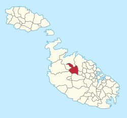
Mosta

Last updated

Mosta
Il-Mosta
Musta
Mosta Dome 4 (6946839125).jpg
View of Mosta
Flag of Mosta.svg
Mosta Coat of Arms.jpg
Motto: 
Spes Alit Ruricolam
Mosta in Malta.svg
Coordinates: 35°54′35″N14°25′34″E / 35.90972°N 14.42611°E / 35.90972; 14.42611
Country Flag of Malta.svg  Malta
Region Northern Region
District Northern District
Borders Attard, Lija, Mġarr, Naxxar, Rabat, St. Paul's Bay
Government
  TypeMayor and cabinet within a directly-elected council
  Body Mosta Local Council
   Mayor Christopher Grech (PL)
Area
  Total6.8 km2 (2.6 sq mi)
Population
 (2021)
  Total23,482
  Density3,500/km2 (8,900/sq mi)
Demonyms Mosti (m), Mostija (f), Mostin (pl)
Time zone UTC+1 (CET)
  Summer (DST) UTC+2 (CEST)
Postal code
MST
Dialing code 356
ISO 3166 code MT-32
Zones Beżbiżija, Blata l-Għolja, Folju, il-Ħanqa, Mosta Technopark, Mount Saint Joseph, San Ġużepp tat-Tarġa, San Pawl Eremita, San Pawl tal-Qlejgħa, San Silvestru, Santa Margerita, (Sgħajtar), L-Isperanza, Ta' Bistra, Ta' Maċedonja, Ta' Mlit, Ta' Redusa, Ta' Srajgu, Ta' Xkora, Tal-Awrora, Taċ-Ċawla, Tad-Daqqaq, Tad-Dib, Tal-Ħanżira, Tal-Qares, Tal-Wata, Tal-Wej, Tas-Sriedek, Tat-Torba, Taż-Żokrija, Tarġa Gap, Wied Ġjananu, Wied il-Għasel.
Patron saint Assumption of Mary
Day of festa 15 August
Website Official website

Mosta (Maltese : Il-Mosta) is a small but densely populated city in the Northern Region of Malta. The most prominent building in Mosta is the Rotunda, a large basilica built by its parishioners' volunteer labour. It features the world's 3rd largest unsupported dome, and displays a replica of a German bombshell that famously crashed through the dome but did not detonate upon impact.

Contents

Mosta celebrates the parish feast of the Assumption every 15 August. Mosta's feast day celebration is popular amongst both locals and tourists. The city is annually decorated by local parishioners and townspeople, seeking to demonstrate their affection for the city and its patron saint, weeks ahead of the public procession.

General

History

Mosta has been inhabited since pre-history. Dolmens in the limits of Mosta and cart ruts are primary evidence of this. Each dolmen has two rectangular standing stones and one other similar stone positioned horizontally above the other two. [1]

In the Middle Ages, Mosta was a small hamlet amongst a number of other hamlets, each sparsely populated. These tiny villages were Raħal Calleja, Raħal Ħobla, Raħal Pessa or Pise, Raħal Sir, Raħal Kircipulli, Raħal Brabar and Raħal Dimech. In the 16th century, these hamlets decreased in importance and Mosta took its place as the principal village. The Apostolic Visit of Mgr Pietro Dusina in 1575 indicated that even the church dedicated to the Assumption that stood in Mosta was so important in the area that it was erroneously called ‘parochial church’. In 1575, there were 580 persons living in Mosta. [2]

Mosta is, in contemporary times, witnessing the construction of many new houses. New built-up zones with residential houses are found on the outskirts of older Mosta. These new zones are known as: Santa Margerita, Tal-Blata l-Għolja, Iż-Żokrija, Is-Sgħajtar and Ta’ Mlit. This means that the population of Mosta is increasing. Mosta has also become a bustling commercial centre. All these developments have made Mosta a big town by local standards and it is today amongst the largest in the Maltese Islands. [3]

Transportation

As Mosta is at the centre of Malta; buses pass through Mosta on the way to Buġibba, Burmarrad, St. Paul's Bay, Qawra, Xemxija, Mġarr, Ċirkewwa and Mellieħa.

Legends

The town has several legends such as The Bride of Mosta (L-Għarusa tal-Mosta). [4]

Social Groups

Mosta has its own scouts and girl guides, two band clubs (Nicolo' Isouard and Santa Marija), and two fireworks factories (Santa Marija and 15 ta' Awwissu). A lot of traffic passes through Constitution Street, one of Mosta's main streets, connecting the south to the north.

Places of interest

Sanctuary Basilica of the Assumption of Our Lady (also known as the Rotunda of Mosta or the Mosta Dome)

Mosta boasts the third largest unsupported dome in the world. The church, also commonly known as the Rotunda of Mosta or the Mosta Dome, is dedicated to the Assumption. [5] The Feast of the Assumption is held on 15 August and it is a public holiday in Malta.

From its inception as a parish in 1608, Mosta has had three different churches built on the same site, [6] with the current one being designed by Giorgio Grognet de Vassé, a French resident of Mosta. The Mostin at that time, totalling not more than 1500, built the church. [7]

Grognet’s design was based on that of the Pantheon of Rome. Due to debates and doubts regarding the design, the first stone was laid on 30 May 1833. The rotunda has a diameter of 55.20 metres on the outside and 39.60 metres on the inside. The main façade faces south and has six columns in the Ionic style. On each side, a steeple rises from the façade. Following the front elevation, the church has an analogous style at the back, but without steeples. The dome was built on the principle of the catenary profile, meaning that each stone was laid over the one underneath it.

The church took 27 years to complete and became a major attraction. [8] On 9 April 1942, the church was nearly destroyed during World War II. An Axis bomb hit the dome of the church whilst people were inside, but it failed to explode. The detonator was removed and a replica bomb is now displayed as a memorial. [9]

Mosta Dome Mosta Dome 2009-3.JPG
Mosta Dome

Lion monument in Rotunda Square

A prominent feature of Rotunda Square is a statue of a lion on a pedestal, which was removed in 2023 and placed in the public garden behind the church. Once, this was part of a fountain which originally was in Sliema. The fountain has since been removed. The statue is made of bronze-coloured cast iron. It was made in the Val d’Osne Foundry in Paris. Embossed on the pedestal there are the coat-of-arms of Mosta and those of independent Malta. [10]

Ta' Bistra Catacombs

The Ta' Bistra Catacombs are the largest set of catacombs found to date outside Rabat, and are located in Triq il-Missjunarji Maltin in Mosta. These catacombs were first recorded in the 1800s but were only investigated in 1933 by Captain Charles Zammit, before part of the site was covered over by a new road leading down to Burmarrad. Further studies in 2004, 2013, and 2014, have brought the site back to life with new discoveries. This site has been part of three EU-funded projects and is now managed by Heritage Malta. [11]

Speranza Chapel (Chapel of Our Lady of Hope)

An attraction in Mosta is the Speranza Chapel in the Speranza Valley. The chapel was built between 1760 and 1761. A legend tied to the Chapel recounts that, during a Turkish invasion, a young girl and her sisters taking care of their family's sheep were at risk to be taken by the invaders. Whilst the sisters escaped, the young girl could not run fast enough because she limped slightly. It is said that she hid in a cave found under the chapel's left side. Meanwhile, she prayed to Mary, promising that if she were saved, she would build a chapel dedicated to Our Lady. When the Turkish invaders chasing her arrived, they didn't look for her in the cave because they thought the girl could not be hiding there as there was an intact web at the entrance, which would have been damaged had she entered the cave.[ citation needed ]

Marquis Mallia Tabone Farmhouse

The Marquis Mallia Tabone Farmhouse is a folklore attraction run by the Talent Mosti philanthropy in collaboration with the adjacent school's council. The farmhouse overlooks the valley of Wied il-Għasel. It houses exhibitions varying from paintings, photography, artisan work, hobbies and a permanent folklore museum. [12] [13]

Wied Filep Dolmens

Two dolmens, dating back to the Bronze Age, can be seen in a field between Vjal Ragusa and Dawret il-Wied.

Cumbo Tower

The Cumbo Tower is a fortified residence in Mosta. [14] In the grounds there is a small Christian family tomb from the Roman era. [15]

Cumbo Tower Cumbo Tower.jpeg
Cumbo Tower

Other sites of interest

Tal-Għammariet Hypogeum

This is a site that has most likely been destroyed, and has been recorded by Emmanuel Magri as being in the hamlet of Ħal Dimech, now part of Mosta, and not far from the Ta' Bistra Catacombs. [16]

Fort Mosta Catacomb

Within the grounds of Fort Mosta, there is a small catacomb. [17] Originally, this was a Punic shaft tomb but it was enlarged into a Roman period catacomb complete with an agape table. [18] This site is within the confines of Fort Mosta which is used by the Armed Forces of Malta.

Wied il-Għasel Catacomb

Another small catacomb is found in Wied il-Għasel, consisting of a series of seven tombs dug in the rock in a semi-circular form found in the side of a natural cave beneath Fort Mosta. [19]

Alleged Roman Temple site

In a 2008 publication, then Mosta Mayor Dr Paul Chetcuti Caruana stated: "As many know, and no one knows, in the neighbourhood of Ta’ Bistra there is at least one Roman temple which has been buried by the speculators." [20]

Zones in Mosta

Twin cities

Mosta has three sister cities:

Related Research Articles

<span class="mw-page-title-main">Local councils of Malta</span> Subdivision of Malta

Since June 30, 1993, Malta has been subdivided into 68 localities, governed by local councils, Maltese: kunsilli lokali, meaning municipalities or borough, and the considered by the Maltese as the equivalent to a basic village or towns, where appropriate. These form the most basic form of local government and there are no intermediate levels between it and the national level. The levels of the 6 districts and of the 5 regions serve statistical purposes.

<span class="mw-page-title-main">Attard</span> Local council in Central Region, Malta

Attard is a town in the Central Region of Malta. Together with Balzan and Lija it forms part of "the Three Villages" and has been inhabited since the Classical Period. It has a population of 12,268 as of 2021. Attard's traditional Latin motto is Florigera rosis halo due to its many flower gardens and citrus orchards. Attard is abundant with public gardens. The inhabitants of Attard are known as saraċini.

<span class="mw-page-title-main">Mġarr</span> Local council in Northern Region, Malta

Mġarr, formerly known as Mgiarro, is a village in the Northern Region of Malta. Mġarr is a typical rural village situated in an isolated region, west of Mosta. It is surrounded with rich farmland and vineyards. Many of its 4,840 inhabitants are farmers or are engaged in some sort of agricultural activity. Maltese pop singers Christabelle Borg and Gaia Cauchi both hail from this town.

<span class="mw-page-title-main">Birkirkara</span> Local council in Central Region, Malta

Birkirkara is a city in the central region of Malta. It is the second most populous on the island, with 24,356 inhabitants as of 2020. The town consists of five autonomous parishes: Saint Helen, Saint Joseph the Worker, Our Lady of Mount Carmel, Saint Mary and San Gorg Preca. The city's motto is In hoc signo vinces, and its coat of arms is a plain red cross, surmounted by a crown.

<span class="mw-page-title-main">Balzan</span> Local council in Central Region, Malta

Balzan is a municipality in the Central Region of Malta, one of the so-called three villages, together with Attard and Lija. The village originally consisted of a group of small dwellings and farms but eventually grew, becoming a parish in the 17th century. As of 2021, the town registered a population of 4,774 inhabitants.

<span class="mw-page-title-main">Siġġiewi</span> City and Local council in Southern Region, Malta

Siġġiewi, also called by its title Città Ferdinand, is a city and a local council in the Southern Region of Malta. It is the third largest council in Malta by surface area, after Rabat and Mellieħa. It is situated on a plateau, a few kilometers away from Mdina, the ancient capital city of Malta, and 10 kilometres away from Valletta, the contemporary capital. It is the home of 8,721 inhabitants as of January 2019. Until several decades ago, almost all of the population was employed in the fields which surround the city. In 1993, the city adopted the motto Labore et Virtute.

<span class="mw-page-title-main">Rabat, Malta</span> Local council in Northern Region, Malta

Rabat is a town in the Northern Region of Malta, with a population of 11,497 as of March 2014. It adjoins the ancient capital city of Mdina, and a north-western area formed part of the Roman city of Melite until its medieval retrenchment. The Apostolic Nunciature of the Holy See to the Republic of Malta is seated in this village. The Local Council of Rabat is also the administrator of Baħrija. Parts of the films Munich and Black Eagle were shot in Rabat. In December 1999, Mtarfa was split from Rabat to form a separate Local Council by Act XXI, an amendment to the Local Council Act of 1993.

<span class="mw-page-title-main">Rotunda of Mosta</span> Church in Mosta, Malta

The Sanctuary Basilica of the Assumption of Our Lady, commonly known as the Rotunda of Mosta or the Mosta Dome, is a Roman Catholic parish church and basilica in Mosta, Malta, dedicated to the Assumption of Mary. It was built between 1833 and the 1860s to neoclassical designs of Giorgio Grognet de Vassé, on the site of an earlier Renaissance church which had been built in around 1614 to designs of Tommaso Dingli.

<span class="mw-page-title-main">Żurrieq</span> Local council in Southern Region, Malta

Żurrieq is a town in the Southern Region of Malta. It is one of the oldest towns in the country, and it has a population of 11,823 inhabitants as of March 2014. Żurrieq is one of the 10 parishes to be documented in 1436 and it is dedicated to Saint Catherine. The island of Filfla is administratively a part of the town. The town stretches from Nigret to Ħal Far. In old times the town was had a border with Żejtun. The village of Qrendi used to be part of the parish of Żurrieq until 1618 when it was made into its own parish.

<span class="mw-page-title-main">Gudja</span> Local council in Southern Region, Malta

Gudja is a village in the Southern Region of Malta, with a population of 3,148 as of March 2017. The village is located on high grounds, south of Valletta. It is administered by the Gudja Local Council. A number of schools, clubs, public gardens and recreations places are found around the village.

<span class="mw-page-title-main">Qrendi</span> Local council in Southern Region, Malta

Qrendi is a village in the Southern Region of Malta, with a population of 2752 people as of March 2014. It is located close to Mqabba, Żurrieq and Siggiewi. Within its boundaries are two well-known Neolithic temples called Mnajdra and Ħaġar Qim. In this village two feasts are held annually. The feast of Our Lady of Lourdes is celebrated either on the last Sunday of June or on the first Sunday of July, with 15 August the titular feast of the Ascension of Our Lady. This feast is popularly known as the feast of Santa Maria.

<span class="mw-page-title-main">Kerċem</span> Local council in Gozo Region, Malta

Ta' Kerċem is an administrative unit of Malta, on the island of Gozo, with a population of 1,938 people as of March 2014.

<span class="mw-page-title-main">Bidnija</span> Village in Malta Island, Malta

Bidnija is a rural hamlet between Mosta, St. Paul's Bay and Mġarr. It is located in the northern region of Malta and is home to roughly 308 people as of 2008, the second least populated habitable zone on the Maltese islands after Mdina. It is located between two main valleys then extends into other small valleys surrounding the area. It is largely a rural village surrounded by fields mainly belong to the inhabitants, although over the years other Maltese and foreigners have settled in the area generally for its countryside views.

<span class="mw-page-title-main">Roads in Malta</span> Overview of the various roads in Malta

In Malta most of the main roads are in the outskirts of the localities to connect one urban area with another urban area. The most important roads are those that connect the south of the island with the northern part, like Tal-Barrani Road, Aldo Moro Street in Marsa and Birkirkara Bypass.

<span class="mw-page-title-main">Catacombs of Malta</span>

There are hundreds of catacombs in Malta, principally found in Mdina, the former capital of the island. The catacombs are very small, but are in good preservation.

<span class="mw-page-title-main">Fort Mosta</span>

Fort Mosta is a polygonal fort in Mosta, Malta. It was built between 1878 and the 1880s by the British as part of the Victoria Lines. It is still in use today by the Armed Forces of Malta as an ammunition depot.

<span class="mw-page-title-main">Chadwick Lakes</span> Dams in Malta

Chadwick are a number of dams, pouring into each other, on the island of Malta. The area is locally known as Wied il-Qlejgħa. Their location extends from Qliegħa Valley in the limits of Mtarfa and Rabat, and extends to Għasel Valley in the peripheries of Mosta. It consists of a complex system of well-planned small dams, draining into Speranza Valley, then at Salina Bay, and then into the sea.

<span class="mw-page-title-main">Cumbo Tower</span>

The Cumbo Tower is a villa in the town of Mosta which served as a stronghold during its time. The tower is a two-storey building adorned with a niche on the main façade and surrounded by extensive gardens.

<span class="mw-page-title-main">Chapel of St Paul the Hermit, Wied il-Għasel</span> Church in Mosta, Malta

The Chapel of St. Paul the Hermit is a small church located in a cave in Wied il-Għasel, in Mosta, Malta.

References

  1. Morana, Martin (September 2011). Bejn kliem u storja: glossarju enċiklopediku dwar tradizzjonijiet - toponimi - termini storiċi Maltin (in Maltese). Malta: Best Print. pp. 57–58. ISBN   978-99957-0-137-6. OCLC   908059040. Archived from the original on 5 October 2016.
  2. Zammit, Gabrielle. "Report on the State of Conservation of Ta Bistra Catacombs".{{cite journal}}: Cite journal requires |journal= (help)
  3. Zammit, Gabrielle. "Report on the State of Conservation of Ta Bistra Catacombs".{{cite journal}}: Cite journal requires |journal= (help)
  4. "The Mosta Archives".
  5. Borg, Victor (2002). Rough Guide to Malta and Gozo. Rough Guides. pp. 151–2. ISBN   9781858286808.
  6. Zammit, Gabrielle. "Report on the State of Conservation of Ta Bistra Catacombs".{{cite journal}}: Cite journal requires |journal= (help)
  7. "200-year-old History in an old musty archive". The Malta Independent . 11 March 2012. Archived from the original on 4 March 2016.
  8. MacGill, Thomas (1839). A hand book, or guide, for strangers visiting Malta. Malta: Luigi Tonna. pp. 124–126.
  9. Castillo, Dennis (2006). The Maltese Cross: a strategic history of Malta. Greenwood Publishing Group. p. 184. ISBN   9780313323294.
  10. Zammit, Gabrielle. "Report on the State of Conservation of Ta Bistra Catacombs".{{cite journal}}: Cite journal requires |journal= (help)
  11. "Ta' Bistra Catacombs – Heritage Malta".
  12. "Paġna Ewlenija". www.talentmosti.com. Retrieved 19 April 2018.
  13. Ltd, Allied Newspapers (30 June 2013). "Mosta philanthropic society is 30 years young". timesofmalta.com. Retrieved 19 April 2018.
  14. "Cumbo Tower". The Times of Malta. 19 April 2012. Retrieved 19 April 2016.
  15. Zammit, Gabrielle. "Report on the State of Conservation of Ta Bistra Catacombs".{{cite journal}}: Cite journal requires |journal= (help)
  16. Zammit, Gabrielle. "Report on the State of Conservation of Ta Bistra Catacombs".{{cite journal}}: Cite journal requires |journal= (help)
  17. Zammit, Gabrielle. "Report on the State of Conservation of Ta Bistra Catacombs".{{cite journal}}: Cite journal requires |journal= (help)
  18. "Places of Interest". localgovernment.gov.mt (in Maltese). Retrieved 21 March 2021.
  19. Zammit, Gabrielle. "Report on the State of Conservation of Ta Bistra Catacombs".{{cite journal}}: Cite journal requires |journal= (help)
  20. Zammit, Gabrielle. "Report on the State of Conservation of Ta Bistra Catacombs".{{cite journal}}: Cite journal requires |journal= (help)
  21. Millbrae Sister Cities – Mosta Archived 3 March 2016 at the Wayback Machine millbraesistercities.org
  22. (Italian) Comune di Ragusa: Comunicati Stampa ragusa.gov.it