Araria is a city and a municipality that is the headquarters of Araria district in the state of Bihar, India. Araria is situated in the northern part of Bihar.

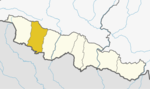
Baglung District, a part of Gandaki Province, is one of the seventy-seven districts of Nepal. The district, with Baglung as its district headquarters, covers an area of 1,784 km2 (689 sq mi) and has a population (2011) of 268,613.

Bajhang District (Nepali: बझाङ जिल्ला Listen , a part of Sudurpashchim Province, is one of the seventy-seven districts of Nepal. The district, with Chainpur, that is part of Jaya Prithvi Municipality, as its district headquarters, covers an area of 3,422 km2 and has a population of 195,159. The headquarter Chainpur is situated at the bank of Seti River and Bauli Khola. Bitthad Bazar is bordered with Baitadi District which is the place of Bitthad Kalika and Kedar. This place was famous for fresh milk and yogurt.

Bara District lies in Province No. 2. It is one of the seventy-seven districts of Nepal. The district, with Kalaiya as its district headquarters, covers an area of 1,190 km2 (460 sq mi) and has a population (2011) of 687,708. Bakaiya, Jamuniya, Pasaha, Dudhaura and Bangari are the main rivers of Bara. The main languages spoken in Bara are Bhojpuri, Bajjika, Tharu and Nepali.

Dang District is a district of Lumbini Province located in the Inner Terai of midwestern Nepal. Deukhuri valley of the district is the capital of the province and is the second largest valley of Asia surrounded by Sivalik Hills and Mahabharata Range. The district headquarter Ghorahi is the seventh largest city and the largest sub-metropolitan city of Nepal. Tulsipur sub-metropolitan city, the second largest city of Dang, is a major transportation hub with an extensive road and air networks. The district covers an area of 2,955 km² and has a population of 548,141.

Rupandehi District, a part of Lumbini Province, is one of the seventy-seven districts of Nepal and covers an area of 1,360 km2 (530 sq mi). The district headquarter is Bhairahawa. As per the national census 2011, the population of Rupandehi was 880,196.

Hetauda is a sub-metropolitan city in the Makwanpur District of Bagmati Province in central Nepal. It is the administrative headquarters of the Makwanpur District and the capital of Bagmati Province as declared by majority Provincial Assembly Members on 12 January 2020. It is one of the largest cities of Nepal. At the time of the 2015 Nepal census, it had a population of 153,875 people.

Damak, a city in eastern Nepal is one of the oldest municipalities in Jhapa District in Province No. 1 of Nepal. It is situated between the Ratuwa River in the east and the Maawa River in the west. It has Sivalik Hills in its north and ends with the intersection of Ratuwa River and Maawa River in the south. Mahendra Highway crosses this municipality nearly bisecting it. It is the largest city in Jhapa District as well as in Mechi zone with a population of 75,743 in 2011 A.D

Sabaila, sometimes spelled Sabela, is a municipality in Dhanusa District in Province No. 2 of south-eastern Nepal. At the time of the 1991 Nepal census, it had a population of 6,860 persons living in 1,246 individual households. Sabaila is one of the strongest municipalities in the Dhanusha district.
Lele is a village development committee in Lalitpur District in the Bagmati Zone of central Nepal. At the time of the 1991 Nepal census it had a population of 6928 living in 1245 individual households, but the population has increased greatly since then.
Amlekhganj (Nepali:अमलेखगंज) is a town and Village Development Committee in Bara District in the Narayani Zone of south-eastern Nepal. At the time of the 2011 Nepal census it had a population of 6,709 people living in 1370 individual households. There were 3,413 males and 3,296 females at the time of census. At one time it was famed as the starting point of the Nepal Government Railway (NGR) which connected it with Raxaul in India.
Basatpur is a town and was Village Development Committee in Bara District in the Narayani Zone of south-eastern Nepal. According to new geographical updates in Nepal, Basatpur now falls under Kalaiya Sub-Metropolitan City and has been defined as Kalaiya-20 where 20 is a ward number in Kalaiya. It is now Basatpur in Bara District, Kalaiya Sub-Metropolitan City, Province Number 2, NEPAL. It's no longer Village Development Committee. The capital of the district is Kalaiya which is around 10 km north of Basatpur, Matiarwa lies west of Basatpur which is another town in the Kalaiya Sub-Metropolitan City. Adapur lies to the south of Basatpur which is a small town next to Basatpur in India. Basatpur is one of the biggest town and populated town in Kalaiya, Bara. To the south of Basatpur, it has open border of India which is just 1-2 km far from the town. It has plain areas and very fertile lands to grow crops. It is a popular town in the neighboring areas which is famous for its markets, ponds, temples, and culture. The majority of person living in the town are Hinduism and then Muslims. At the time of the 1991 Nepal census it had a population of 4,435 persons residing in 740 individual households.
South Jhitakaiya is a town and Village Development Committee, near by Dewapur- Chowk/Pokhara/Mandir/School/Police Station and Pashah River, Bara District in the Narayani Zone of south-eastern Nepal. At the time of the 1991 Nepal census it had a population of 7,235.

Gadhimai is a former independent municipality in Bara District in of south-eastern Nepal that was merged into Jeetpur Simara Sub-Metropolitan City on 10 March 2017. It was itself established on 18 May 2014 by merging Pipara Simara, Jitpur Bhawanipur, Chhata Pipra, Phattepur, Dumbarwana Village Development Committees.
Lumle is a sub-urban and Village Development Committee in Kaski District in the Gandaki Zone of northern-central Nepal
- East side of this VDC is Paudhur Village,
- Sallyan village on south.
Balara (Maithili/Nepali: बलरा) is a municipality in Sarlahi District, a part of Province No. 2 in Nepal. It was formed in 2016 occupying current 12 sections (wards) from previous 9 former VDCs. It occupies an area of 48.55 km2 with a total population of 45,194.
Asanpur is a village development committee in Siraha District in the Sagarmatha Zone of south-eastern Nepal. At the time of the 2011 Nepal census it had a population of 12926 people living in 2510 individual households.
Bhardaha is a village development committee in Saptari District in the Sagarmatha Zone of south-eastern Nepal. At the time of the 2011 Nepal census it had a population of 7,124 people living in 1,245 individual households.
Banganga is a municipality in Kapilvastu District in the Lumbini Zone of southern Nepal. Banganga Municipality has total of 233.6 km2. According to the 2011 census, total population of the municipality is 75, 242 with population density of 322 person per km2 and density without forest is 804 persons per km2.

Letang, "लेटाङ " is a Municipality in Morang District in the Province No. 1 of south-eastern Nepal. It was formed by merging the existing Village Development Committees of Letang, Jante, Warrangi and Bhogateni.