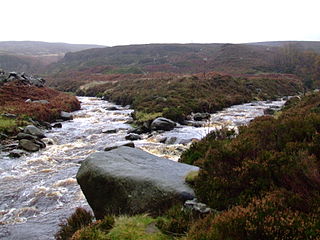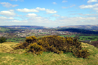
Longdendale is a valley in the Peak District of England, north of Glossop and southwest of Holmfirth. The name means "long wooded valley" and the valley is mostly in the counties of Derbyshire and Greater Manchester.

The River Etherow is a river in northern England, and a tributary of the River Goyt. Although now passing through South Yorkshire, Derbyshire and Greater Manchester, it historically formed the ancient county boundary between Cheshire and Derbyshire. The upper valley is known as Longdendale. The river has a watershed of approximately 30 square miles (78 km2), and the area an annual rainfall of 52.5 inches (1,330 mm).

Mottram in Longdendale is an unparished village within the Metropolitan Borough of Tameside, in Greater Manchester, England. The 2011 Census for the ward of Longdendale which includes Mottram and the surrounding area was 9,950.

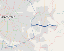
The M67 is a 5-mile (8.0 km) urban motorway in Greater Manchester, England, which heads east from the M60 motorway passing through Denton and Hyde before ending near Mottram. It was originally conceived as the first part of a trans-Pennine motorway between Manchester and Sheffield connecting the A57(M) motorway to the M1 motorway; however, the motorway never progressed this far.

Hollingworth is a village in the Metropolitan Borough of Tameside, in Greater Manchester, England. It is about 12 miles (19 km) east of Manchester on the Derbyshire border near Glossop. Historically part of Cheshire, it gave its name to a family who owned much of the surrounding area from before the time of the Norman conquest.

Hadfield is a village in the High Peak of Derbyshire, England. The population of the town's wards in the 2011 Census was 6,305. It lies on the south side of the River Etherow, the border between Derbyshire and Greater Manchester, at the western edge of the Peak District close to Glossop.

Woodhead is a small and scattered settlement at the head of the Longdendale valley in Derbyshire, England. It lies on the trans-Pennine A628 road connecting Greater Manchester and South Yorkshire, 6 miles (10 km) north of Glossop, 19 miles (31 km) east of Manchester and 18 miles (29 km) west of Barnsley. It is close to the River Etherow and the Trans Pennine Trail. Like nearby Tintwistle and Crowden, the hamlet lay within the historic (pre-1974) county boundaries of Cheshire.

The Woodhead line was a railway line linking Sheffield, Penistone and Manchester in the north of England. A key feature of the route is the passage under the high moorlands of the northern Peak District through the Woodhead Tunnels. The line was electrified in 1953 and closed between Hadfield and Penistone in 1981.

ValehouseReservoir is a man-made lake in Longdendale in north Derbyshire. It was built between 1865 and 1869 as part of the Longdendale chain, which was built to supply water from the River Etherow to the urban areas of Greater Manchester while maintaining a constant flow into the river. The upper reservoirs supply the drinking water, while Vale House and Bottoms are compensation reservoirs which guarantee the flow of water to water-powered mills downstream. Valehouse, with a crest elevation of 503 m, is too low to supply water under gravity to the Mottram tunnel, so could not be used as an impounding reservoir. Today 45 megalitres of compensation water are released each day into the River Etherow.

Arnfield Reservoir is a man-made lake in Longdendale in north Derbyshire. It was constructed in 1854 as part of the Longdendale chain to supply water from the River Etherow to the urban areas of Greater Manchester. Unlike the other reservoirs in the chain, Arnfield and Hollingworth Reservoir are not in the Etherow valley but lie in the valley of tributary brooks to the north and above. From Arnfield the water is extracted to pass through the Mottram Tunnel to Godley.

The Longdendale Bypass is a long-planned road scheme in England by the Highways Agency. The aim is to alleviate traffic congestion on the A57 road/A628 road/A616 road routes that presently pass through the villages. There is both support and opposition for this long-planned scheme which will pass through the valley of Longdendale and part of the Peak District National Park.

The A628 is a major road in England connecting Greater Manchester and South Yorkshire by crossing the Pennine chain of hills by way of the Woodhead Pass through the Peak District National Park. The road's altitude and its exposure to bad weather create problems in winter and the road is sometimes closed due to snow or high winds.

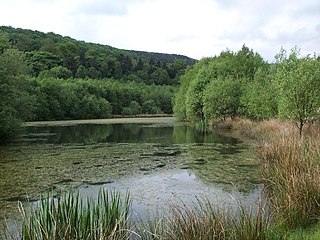
Swallows Wood is a nature reserve near Hollingworth, Tameside, straddling the border between Greater Manchester and north Derbyshire. The 60-acre (0.24 km2) reserve, which contains semi-natural woodlands, meadows, ponds and marsh areas, is owned by United Utilities who are responsible for its management. The site was formerly occupied by the Hollingworth and Waste Lodge reservoirs; these were demolished in 1987, and the nature reserve was installed in their place. Arnfield Reservoir, the lowest of the Longdendale Chain reservoirs, is nearby.

St Michael and All Angels Church stands on Warhill overlooking the village of Mottram in Longdendale, Greater Manchester, England. The church is recorded in the National Heritage List for England as a designated Grade II* listed building. It is an active Anglican parish church in the diocese of Chester, the archdeaconry of Macclesfield and the deanery of Mottram.

Padfield is a small village near Hadfield in High Peak, Derbyshire, England. The village is on the west side of the Peak District National Park, and the nearest town is Glossop, where many local amenities and services are based. It is in a conservation area. The population as of the 2011 census was 2,796.

Mellor Hall is a country hall in Mellor, Greater Manchester, England, 0.4 miles (0.64 km) north of The Devonshire Arms off Longhurst Lane.

The Godley Reservoir is a reservoir in Godley, Hyde, Greater Manchester. It was completed in 1851, as a critical part of the Longdendale Chain project that brings fresh water to Manchester.
The Mottram Tunnel is a tunnel carrying drinking water by gravity from Arnfield Reservoir, Tintwistle, Derbyshire in the valley of the River Etherow, to Godley, Greater Manchester in the valley of the River Tame. It was essential to the construction of the Longdendale Chain of reservoirs constructed by John Frederick Bateman. The tunnel was built between August 1848 and October 1850, and the Godley service reservoir was built to receive and filter the water. That was finished in 1851.
Longdendale is a valley, part of which is in Tameside, Greater Manchester, England. In the valley are the villages of Broadbottom, Hattersley, Hollingworth and Mottram in Longdendale. These villages and the surrounding countryside contain 56 listed buildings that are recorded in the National Heritage List for England. Of these, three are listed at Grade II*, the middle grade, and the others are at Grade II, the lowest grade. The listed buildings include houses and associated structures, farmhouses, farm buildings, churches and items in churchyards, an ancient cross, a railway viaduct, a school, and two war memorials.


