Mount Gahinga

Last updated
Mount Gahinga
GahingaMuhabura.png
Mts. Gahinga (left) and Muhabura (right)
Highest point
Elevation 3,474 m (11,398 ft)
Prominence 423 m (1,388 ft)
Coordinates 01°23′13″S29°38′48″E / 1.38694°S 29.64667°E / -1.38694; 29.64667 [Notes 1]
Naming
English translationA little pile of stones
Language of name Kinyarwanda
Geography
Rwanda relief location map.jpg
Red triangle with thick white border.svg
Mount Gahanga
Uganda relief map.svg
Red triangle with thick white border.svg
Mount Gahanga
Mount Gahanga (Uganda)
Parent range Virunga Mountains
Geology
Mountain type Stratovolcano
Last eruption unknown [1]
Climbing
Easiest route Hike

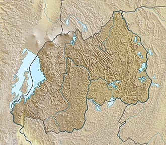
Mount Gahinga is a dormant/extinct volcano in the Virunga Mountains on the Rwanda-Uganda border. Gahinga lies between Muhabura and Sabyinyo, but is the smallest of these three valcanoes. Mount Gahinga, also known in the local Kinyarwanda/Rufumbira dialect as "a small pile of stones", has a swampy caldera on its peak. The caldera is believed to be about 180 m (591 ft) wide. [2] Mgahinga Gorilla National Park got its name from this volcano. Mount Gahinga, whose elevation is 3,473 m (11,394 ft), is part of a chain of eight volcanic mountains of the Mufumbiro ranges. The volcano chain spans across Uganda, Rwanda and the Democratic Republic of Congo.

The vegetation across the mountain can be described as afro-montane with bamboo composing the main vegetation. Like Muhabura and Sabyinyo, the bamboo forests on Mount Gahinga are a habitat of the endangered mountain gorilla. There are several other species of animals and birds that form part of the Mount Gahinga ecosystem. The golden monkeys are notable to these.

Related Research Articles

<span class="mw-page-title-main">Virunga Mountains</span> Chain of volcanoes in East Africa

The Virunga Mountains are a chain of volcanoes in East Africa, in the area where Rwanda, the Democratic Republic of the Congo (DRC), and Uganda meet. The mountain range is a branch of the Albertine Rift Mountains, which border the western branch of the East African Rift. They are located between Lake Edward and Lake Kivu. The name "Virunga" is an English version of the Kinyarwanda word ibirunga, which means "volcanoes".

<span class="mw-page-title-main">Mountain gorilla</span> Subspecies of the eastern gorilla

The mountain gorilla is one of the two subspecies of the eastern gorilla. It is listed as endangered by the IUCN as of 2018.

<span class="mw-page-title-main">Volcanoes National Park</span> National park in Rwanda

Volcanoes National Park is a national park in northwestern Rwanda. It covers 160 km2 (62 sq mi) of rainforest and encompasses five of the eight volcanoes in the Virunga Mountains, namely Karisimbi, Bisoke, Muhabura, Gahinga and Sabyinyo. It borders Virunga National Park in the Democratic Republic of Congo and Mgahinga Gorilla National Park in Uganda. It is home to the mountain gorilla and the golden monkey, and was the base for the primatologist Dian Fossey.

<span class="mw-page-title-main">Bwindi Impenetrable National Park</span> National park in Uganda

The Bwindi Impenetrable National Park is a national park in southwestern Uganda. It is part of the Bwindi Impenetrable Forest and is situated along the Democratic Republic of the Congo border next to the Virunga National Park and on the edge of the Albertine Rift. Composed of 321 km2 (124 sq mi) of both montane and lowland forest, it is accessible only on foot. It is a United Nations Educational, Scientific and Cultural Organization-designated World Heritage Site.

<span class="mw-page-title-main">Kisoro District</span> District in Western Region, Uganda

Kisoro District is a district in the Western Region of Uganda. The town of Kisoro is the site of the district headquarters.

Kisoro is a town in the Western Region of Uganda. It is the chief town of Kisoro District and the site of the district headquarters.

<span class="mw-page-title-main">Kigezi District</span> Former district in Uganda

Kigezi District once covered what are now Kabale District, Kanungu District, Kisoro District and Rukungiri District, in southwest Uganda. Its terraced fields are what gives this part of Uganda its distinctive character. Kigezi was popularly known as the Switzerland of Africa. The coordinates for the region are: Latitude:01 13 20S, 29 53 20E.

<span class="mw-page-title-main">Mount Muhabura</span>

Mount Muhabura, also known as Mount Muhavura, is an inactive volcano in the Virunga Mountains on the Rwanda-Uganda border. At 4,127 metres (13,540 ft), Muhabura is the third highest of the eight major mountains of the mountain range, which is part of the Albertine Rift, the western branch of the East African Rift. Its summit contains a small crater lake. The limited evidence for this volcano suggests that it last erupted some time in the Holocene, but the exact date is not known. The Smithsonian Institution states that a small parasitic crater near Muhabura had been active recently. Muhabura is partly in the Volcanoes National Park, Rwanda and partly in the Mgahinga Gorilla National Park, Uganda.

<span class="mw-page-title-main">Mgahinga Gorilla National Park</span> National Park in Uganda

Mgahinga Gorilla National Park is a national park in southwestern Uganda. It was created in 1991 and covers an area of 33.9 km2 (13.1 sq mi).

<span class="mw-page-title-main">Eastern gorilla</span> Species of ape

The eastern gorilla is a critically endangered species of the genus Gorilla and the largest living primate. At present, the species is subdivided into two subspecies. There are 6,800 eastern lowland gorillas or Grauer's gorillas and 1,000 mountain gorillas. Illegal hunting threatens the species.

<span class="mw-page-title-main">Albertine Rift montane forests</span> Ecoregion in east-central Africa

The Albertine Rift montane forests is a tropical moist broadleaf forest ecoregion in east-central Africa. The ecoregion covers the mountains of the northern Albertine Rift, and is home to distinct Afromontane forests with high biodiversity.

Tourism in Rwanda is the largest source of foreign exchange earnings in Rwanda. It was projected to grow at a rate of 25% every year from 2013-2018. The sector is the biggest contributor to the national export strategy. Total revenue generated from the sector in 2014 alone was USD 305 million.

<span class="mw-page-title-main">Wildlife of Uganda</span> Endemic flora and fauna

The wildlife of Uganda is composed of its flora and fauna. Uganda has a wide variety of different habitats, including mountains, hills, tropical rainforest, woodland, freshwater lakes, swamps and savanna with scattered clumps of trees. The country has a biodiverse flora and fauna reflecting this range of habitats and is known for its primates, including gorillas and chimpanzees. There are ten national parks and thirteen wildlife reserves; some 345 species of mammal and 1020 species of bird have been recorded in the country.

<span class="mw-page-title-main">Mount Sabyinyo</span>

Mount Sabyinyo is an extinct volcano in eastern Africa in the Virunga Mountains. Mount Sabyinyo is the oldest volcano of the range. It is north-east of Lake Kivu, one of the African Great Lakes, and west of Lake Bunyonyi in Uganda. The summit of the mountain, at 3,669 metres (12,037 ft), marks the intersection of the borders of the Democratic Republic of the Congo (DRC), Rwanda, and Uganda, and holds religious significance for local tribes. It also is within the adjoining national parks established by these countries: Virunga National Park in the DRC, the Volcanoes National Park in Rwanda, and Mgahinga Gorilla National Park in Uganda.

<span class="mw-page-title-main">Rwenzori batis</span> Species of bird

The Rwenzori batis is an endemic bird native to the Albertine Rift montane forests, where it inhabits altitudes of 1,340–3,300 m (4,400–10,830 ft).

<span class="mw-page-title-main">Golden monkey</span> Subspecies of Old World monkey

The golden monkey is a subspecies of the blue monkey. It is an Old World monkey found in the Virunga volcanic mountains of Central Africa, including four national parks: Mgahinga, in south-west Uganda; Volcanoes, in north-west Rwanda; and Virunga and Kahuzi-Biéga, in the eastern Democratic Republic of Congo. It is restricted to highland forest, especially near bamboo.

<span class="mw-page-title-main">Tourism in Uganda</span>

Tourism in Uganda is focused on Uganda's landscape and wildlife. It is a major driver of employment, investment and foreign exchange, contributing USh 4.9 trillion to Uganda's GDP in the financial year 2012–2013.

<span class="mw-page-title-main">Lake Mutanda</span>

Lake Mutanda is a small freshwater lake in Uganda.

<span class="mw-page-title-main">International Gorilla Conservation Programme</span>

The International Gorilla Conservation Programme was formed in 1991 to ensure that the critically endangered mountain gorillas are conserved in their habitat in the mountain forests of the Virunga Massif in Rwanda, Uganda and the Democratic Republic of the Congo.

<span class="mw-page-title-main">Rwenzori–Virunga montane moorlands</span> Montane ecoregion in central Africa

The Ruwenzori-Virunga montane moorlands is a montane grasslands and shrublands ecoregion of the Rwenzori Mountains and Virunga Mountains in central Africa.

References

  1. "Mahavura". Global Volcanism Program . Smithsonian Institution . Retrieved 2020-01-06.
  2. "Mgahinga Gorilla National Park - Areas of Interest: The Virunga Volcanoes". Uganda Wildlife Authority. Retrieved 2020-01-06.
Notes
  1. See the Synonyms & Subfeatures tab on the GVP page