Mount Lebanon, Louisiana

Last updated

Mount Lebanon, Louisiana
Town
Bienville Parish Louisiana Incorporated and Unincorporated areas Mount Lebanon Highlighted.svg
Location of Mount Lebanon in Bienville Parish, Louisiana.
Louisiana in United States (US48).svg
Location of Louisiana in the United States
Coordinates: 32°30′42″N93°02′29″W / 32.51167°N 93.04139°W / 32.51167; -93.04139
CountryUnited States
StateLouisiana
Parish Bienville
Area
[1]
  Total4.03 sq mi (10.44 km2)
  Land4.03 sq mi (10.44 km2)
  Water0.00 sq mi (0.00 km2)
Elevation
338 ft (103 m)
Population
 (2020)
  Total66
  Density16.38/sq mi (6.32/km2)
Time zone UTC-6 (CST)
  Summer (DST) UTC-5 (CDT)
Area code 318
FIPS code 22-52740

Mount Lebanon is a town in Bienville Parish, Louisiana, United States. The population was 83 at the 2010 census. [2]

Contents

History

Mount Lebanon was probably the first permanent settlement in what is now Bienville Parish. Its pioneers were Baptists from South Carolina who quickly established a church and school. The school became Mount Lebanon University in 1853, but closed during the Civil War to serve as a high school and a Confederate hospital. After the war the school reopened. After years of struggling, it was consolidated in 1906 through the Louisiana Baptist Convention into Louisiana College in Pineville in Rapides Parish in central Louisiana.

The Mount Lebanon Baptist Church was organized in 1837, and the Louisiana Baptist Convention was established there in 1848. One of the Baptist organizers in Mount Lebanon was pastor George Washington Baines, maternal great-grandfather of future U.S. President Lyndon B. Johnson. The church building is still in use. The sanctuary is separated down the middle; men would sit on one side of the divide, women on the other. There is a balcony where the slaves were seated.

There are eight houses in the town that are on the National Register of Historic Places, including a building once used as a stagecoach stop and hotel. That was established by Emily Antoinette Bryan Smith around 1848 and is still owned by her direct descendants.

After the railroad was built through Gibsland, 3 miles (5 km) north, Mount Lebanon began to decline in population and economic opportunity. The post office was decommissioned in the 1950s.

Geography

Mount Lebanon is located in northern Bienville Parish at 32°30′42″N93°2′29″W / 32.51167°N 93.04139°W / 32.51167; -93.04139 (32.511680, -93.041382). [3]

According to the United States Census Bureau, the town has a total area of 4.0 square miles (10.4 km2), all land.

Demographics

Historical population
CensusPop.Note
1970 102
1980 1052.9%
1990 102−2.9%
2000 73−28.4%
2010 8313.7%
2020 66−20.5%
U.S. Decennial Census [4]

As of the census [5] of 2000, there were 73 people, 34 households, and 21 families residing in the town. The population density was 18.1 people per square mile (7.0/km2). There were 44 housing units at an average density of 10.9 per square mile (4.2/km2). The racial makeup of the town was 76.71% White and 23.29% African American.

There were 34 households, out of which 23.5% had children under the age of 18 living with them, 44.1% were married couples living together, 14.7% had a female householder with no husband present, and 38.2% were non-families. 35.3% of all households were made up of individuals, and 20.6% had someone living alone who was 65 years of age or older. The average household size was 2.15 and the average family size was 2.76.

In the town, the population was spread out, with 17.8% under the age of 18, 27.4% from 25 to 44, 19.2% from 45 to 64, and 35.6% who were 65 years of age or older. The median age was 48 years. For every 100 females, there were 82.5 males. For every 100 females age 18 and over, there were 93.5 males.

The median income for a household in the town was $46,250, and the median income for a family was $54,375. Males had a median income of $32,500 versus $30,417 for females. The per capita income for the town was $18,219. There were 10.5% of families and 13.8% of the population living below the poverty line, including no under eighteens and 25.0% of those over 64.

Notable people

Related Research Articles

<span class="mw-page-title-main">Webster Parish, Louisiana</span> Parish in Louisiana, United States

Webster Parish is a parish located in the northwestern section of the U.S. state of Louisiana. The seat of the parish is Minden.

<span class="mw-page-title-main">Jackson Parish, Louisiana</span> Parish in Louisiana, United States

Jackson Parish is a parish in the northern part of the U.S. state of Louisiana. As of the 2020 census, the population was 15,031. The parish seat is Jonesboro. The parish was formed in 1845 from parts of Claiborne, Ouachita, and Union Parishes. In the twentieth century, this part of the state had several small industrial mill towns, such as Jonesboro.

<span class="mw-page-title-main">Bienville Parish, Louisiana</span> Parish in Louisiana, United States

Bienville Parish is a parish located in the northwestern portion of the U.S. state of Louisiana. At the 2020 census, the population was 12,981. The parish seat is Arcadia.

<span class="mw-page-title-main">Merryville, Louisiana</span> Town in Louisiana, United States

Merryville is a town in Beauregard Parish, Louisiana, United States. The population was 1,103 at the 2010 census. It is part of the DeRidder Micropolitan Statistical Area.

<span class="mw-page-title-main">Arcadia, Louisiana</span> Town in Louisiana, United States

Arcadia is a town in, and the parish seat of, Bienville Parish in northern Louisiana, United States. The population was 2,919 at the 2010 census. Arcadia has the highest elevation of any incorporated municipality in Louisiana. Arcadia's name commemorates the Ancient Greek region of Arcadia.

<span class="mw-page-title-main">Bienville, Louisiana</span> Village in Louisiana, United States

Bienville is a village in Bienville Parish, Louisiana, United States. The population was 218 at the 2010 census.

<span class="mw-page-title-main">Bryceland, Louisiana</span> Village in Louisiana, United States

Bryceland is a village in Bienville Parish, Louisiana, United States. The population was 108 at the 2010 census.

<span class="mw-page-title-main">Castor, Louisiana</span> Village in Louisiana, United States

Castor is a village in Bienville Parish in north Louisiana, United States. The population was 209 at the 2000 census but increased 23% to 258 in 2010. The median age was 32.2 years. The village was established in 1900. The name "Castor" refers to the genus Castoridae or beaver, a Latin term, contrary to an oral tradition of the word being Native American in origin.

<span class="mw-page-title-main">Jamestown, Louisiana</span> Village in Louisiana, United States

Jamestown is a village in Bienville Parish, Louisiana, United States. The population was 139 at the 2010 census and 130 in 2017.

<span class="mw-page-title-main">Lucky, Louisiana</span> Village in Louisiana, United States

Lucky is a village in Bienville Parish, Louisiana, United States. The population was 272 at the 2010 census.

<span class="mw-page-title-main">Ringgold, Louisiana</span> Town in Louisiana, United States

Ringgold is a town in the U.S. state of Louisiana, in the western half of Bienville Parish. The town of Ringgold is named for United States Army Major Samuel Ringgold. The population of Ringgold was 1,495 at the 2010 census, and 1,370 at the U.S. Census Bureau's 2019 estimates, down from 1,601 in 2018. The 2020 U.S. census estimates program recorded a population of 1,336, though the census established a population of 1,379. It is the second largest incorporated municipality in Bienville Parish by population.

<span class="mw-page-title-main">Saline, Louisiana</span> Village in Louisiana, United States

Saline is a village in southeastern Bienville Parish, Louisiana, United States. The population was 277 at the 2010 census. Saline is pronounced "Suh-LEEN".

<span class="mw-page-title-main">Greenwood, Louisiana</span> Suburban town in Caddo, Louisiana, United States

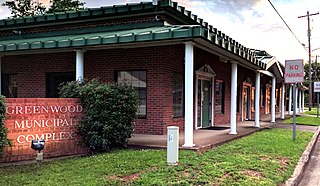
Greenwood is a suburban town in southern Caddo Parish, which is located in the northwest corner of the U.S. state of Louisiana. With a population of 3,166 at the 2020 United States census, it is the third most populous incorporated municipality in Caddo Parish after Shreveport and Blanchard. Part of the Shreveport-Bossier City metropolitan statistical area, it is located 15 miles west of downtown Shreveport.

<span class="mw-page-title-main">Rodessa, Louisiana</span> Village in Louisiana, United States

Rodessa is a village in Caddo Parish, Louisiana, United States. The population was 270 at the 2010 census. It is part of the Shreveport–Bossier City Metropolitan Statistical Area.

<span class="mw-page-title-main">Ferriday, Louisiana</span> Sole incorporated city in Louisiana, United States

Ferriday is a town in Concordia Parish, which borders the Mississippi River and is located on the central eastern border of Louisiana, United States. With a population of 3,511 at the 2010 census, it is an African-American majority town.

<span class="mw-page-title-main">Keachi, Louisiana</span> Town in Louisiana, United States

Keachi is a town in DeSoto Parish, Louisiana, United States. The population was 295 at the 2010 census. It is part of the Shreveport–Bossier City Metropolitan Statistical Area.

<span class="mw-page-title-main">Montgomery, Louisiana</span> Town in Louisiana, United States

Montgomery is a town in the far northwestern portion of Grant Parish, which is located in north-central Louisiana, United States. The population of Montgomery was 726 at the 2010 census. The town has a poverty rate of 37 percent and a median household income of just under $22,000. The median age is just under forty; the population in 2010 was 78 percent white.

<span class="mw-page-title-main">Robeline, Louisiana</span> Village

Robeline is a village in western Natchitoches Parish, Louisiana, United States. The population was 183 at the 2000 census. It is part of the Natchitoches Micropolitan Statistical Area.

<span class="mw-page-title-main">Gramercy, Louisiana</span> Town in Louisiana, United States

Gramercy is a town in the U.S. state of Louisiana, in St. James Parish. It is part of the New Orleans Metropolitan Area. The population was 3,613 at the time of the 2010 U.S. census and 3,188 according to the 2020 population estimates program.

<span class="mw-page-title-main">Dixie Inn, Louisiana</span> Village in Louisiana, United States

Dixie Inn is a village in Webster Parish, Louisiana, United States. The population was 352 at the 2000 census. It is located off Interstate 20 at the old Shreveport Road, some twenty-six miles east of Shreveport. Minden, the seat of Webster Parish, is located some three miles to the east. Dixie Inn is part of the Minden Micropolitan Statistical Area.

References

  1. "2020 U.S. Gazetteer Files". United States Census Bureau. Retrieved March 20, 2022.
  2. "Geographic Identifiers: 2010 Demographic Profile Data (G001): Mount Lebanon town, Louisiana". U.S. Census Bureau, American Factfinder. Archived from the original on February 12, 2020. Retrieved December 2, 2013.
  3. "US Gazetteer files: 2010, 2000, and 1990". United States Census Bureau. February 12, 2011. Retrieved April 23, 2011.
  4. "Census of Population and Housing". Census.gov. Retrieved June 4, 2015.
  5. "U.S. Census website". United States Census Bureau . Retrieved January 31, 2008.
  6. Minor, David. "Joseph Wilson Baines". Handbook of Texas Online. Texas State Historical Association. Retrieved December 24, 2013.
  7. "Cottingham, Claybrook C." A Dictionary of Louisiana Biography (lahistory.org). Archived from the original on February 25, 2012. Retrieved December 19, 2010.