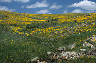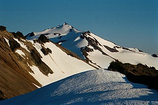
Gifford Pinchot National Forest is a National Forest located in southern Washington, USA, managed by the United States Forest Service. With an area of 1.32 million acres (5300 km2), it extends 116 km along the western slopes of Cascade Range from Mount Rainier National Park to the Columbia River. The forest straddles the crest of the South Cascades of Washington State, spread out over broad, old growth forests, high mountain meadows, several glaciers, and numerous volcanic peaks. The forest's highest point is at 12,276 ft. at the top of Mount Adams, the second tallest volcano in the state after Rainier. It includes the 110,000-acre (450 km2) Mount St. Helens National Volcanic Monument, established by Congress in 1982

Mount Jefferson is a mountain located on the Continental Divide between Fremont County of northeastern Idaho and Beaverhead County of southwestern Montana. Mount Jefferson is the highest point of the Centennial Mountains, whose crest runs along the Continental Divide and can be climbed using a class 2 route (scramble) from the access road to neighboring Sawtell Peak.

Mount Stimson is the second highest peak in Glacier National Park, located in Montana, United States. It is part of the Lewis Range, which spans much of the park. It is located in the remote southwestern portion of the park, approximately 5 miles (8.0 km) west of the Continental Divide and 12 miles (19 km) southeast of Lake McDonald. It is drained by Pinchot Creek and Nyack Creek, both of which flow into the Middle Fork of the Flathead River. The mountain is named for Henry L. Stimson (1867–1950), former U.S. Secretary of State and twice Secretary of War, who hiked and assisted George Bird Grinnell survey the area in and around Glacier National Park in the 1890s, and supported efforts to establish the national park.

Lake Jed Johnson, named for Jed Johnson (1888–1963), is third largest of thirteen small reservoirs in the Wichita Mountains National Wildlife Refuge, located in southwestern Oklahoma. Lawton, Oklahoma, southeast of the lake and the fourth largest city in the state, is the nearest major population center. Smaller communities of Cache, Medicine Park and Meers lie north of the lake.
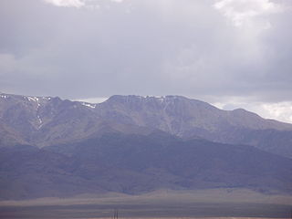
Mount Jefferson is the highest mountain in both the Toquima Range and Nye County in Nevada, United States. It is the sixth highest mountain in the state. As the high point of a range which is well separated from other ranges by low basins, Mount Jefferson has a high topographic prominence of 5,861 feet (1,786 m). This makes it the most prominent peak in Nye County and the third most prominent peak in Nevada. For similar reasons, it is also the highest mountain for over 90 miles in all directions. It is located about 50 miles (80 km) northeast of the county seat of Tonopah within the Alta Toquima Wilderness of the Humboldt-Toiyabe National Forest, near the smaller towns of Carvers and Round Mountain. Three distinct summits are located on a broad area of subalpine tundra: North Summit rises to 11,820 feet (3,603 m), Middle Summit to 11,692 feet (3,564 m), and South Summit to 11,949 feet (3,642 m). During the Pleistocene, alpine glaciers eroded several cirques east of the summit plateau.

The Charon's Garden Wilderness Area is part of the Wichita Mountains Wildlife Refuge in southwestern Oklahoma and is managed by the US Fish & Wildlife Service. It is located to the west of Medicine Park, Oklahoma and north of Lawton, Oklahoma. The wilderness area, dominated by rugged granite mountains, oak forests, and mixed grass prairies, covers 5,723 acres (23.16 km2) in the western portion of the Refuge. It is not unusual to run into deer, buffalo, elk, longhorn, and prairie dogs. Day use and limited backcountry camping is allowed with a permit from the Refuge. The area is popular with rock climbers, with formations such as Echo Dome and Crab Eyes being popular destinations.

Mount Chamberlin is the third highest peak in the Brooks Range, Alaska, USA. Located in what are known as the Franklin Mountains of the Brooks Range, Mount Chamberlin is 30 miles (48 km) west-northwest of Mount Isto, the tallest peak in the Brooks Range. Mount Chamberlin is within the Arctic National Wildlife Refuge and was named for Thomas Chrowder Chamberlin (1843-1928), geologist of the Peary Auxiliary Expedition of 1894. Previously believed to be the highest peak in the Brooks Range, in 2014 new measurement technology established that Mount Chamberlin is the third highest peak in the range.
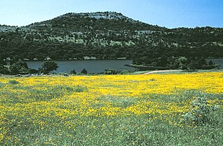
Mount Scott is a prominent mountain just to the northwest of Lawton, Oklahoma rising to a height of 2,464 feet (751 m). It is located in the Wichita Mountains near Fort Sill Military Reservation and lies in the Wichita Mountains National Wildlife Refuge (WMWR). The US Fish and Wildlife Service is responsible for the maintenance of the area. Visitors can reach the summit by car or bicycle via a three-mile paved road. Hiking is allowed, although there are no formal trails and the paved road is open to pedestrians and bicycles from 6am to 9:30 am only. Mount Scott is also popular for its numerous rock climbing areas. The peak was named in honor of General Winfield Scott.

Mount Baldy is a mountain in eastern Arizona in the United States. It is the highest point in the White Mountains and Apache County. It is the fifth-highest point in the state, and the highest outside the San Francisco Peaks in the Flagstaff area. With a summit elevation of 11,409 feet (3,477 m), the peak of Mount Baldy rises above the tree line and is left largely bare of vegetation, lending the mountain its current name.

The Geography of Oklahoma encompasses terrain and ecosystems ranging from arid plains to subtropical forests and mountains. Oklahoma contains 10 distinct ecological regions, more per square mile than in any other state by a wide margin. It is situated in the Great Plains and U.S. Interior Highlands region near the geographical center of the 48 contiguous states. Usually considered part of the South Central United States, Oklahoma is bounded on the east by Arkansas and Missouri, on the north by Kansas, on the northwest by Colorado, on the far west by New Mexico, and on the south and near-west by Texas.

Lake Lawtonka is a lake in Comanche County in the state of Oklahoma in the United States.

Mount Isto is the highest peak in the Brooks Range, Alaska, USA. Located in the eastern Brooks Range, in what are known as the Romanzof Mountains, Mount Isto is 5 miles (8.0 km) south of Mount Hubley, the second tallest peak in the Brooks Range. Mount Isto is within the Arctic National Wildlife Refuge and was named in 1966 for Reynold E. (Pete) Isto, a civil engineer for the U.S. Geological Survey. In 2014, new measurement technology established that Mount Isto is the highest peak in the Brooks Range. Previously, Mount Chamberlin was believed to be the tallest, but it is now ranked third.
Elmer Thomas Lake is a lake in Comanche County in the state of Oklahoma in the United States. It is located on the boundary between the Wichita Mountain Wildlife Refuge and Fort Sill military base. The lake is named for an Oklahoma lawyer and politician, Elmer Thomas (1876-1965), who lived in Lawton and represented Oklahoma's 6th Congressional District in the U. S. House of Representatives from 1922 until 1926, then was elected as U.S. Senator, where he served until 1950.
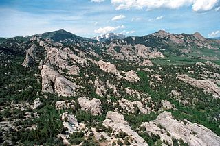
Cache Peak, at 10,339 feet (3,151 m) above sea level, is the highest peak in the Albion Mountains of Cassia County in Southern Idaho. Cache Peak is located in the central part of the range southeast of Oakley and north of Almo in the Albion Division of the Minidoka Ranger District of Sawtooth National Forest.

Mount Hubley is the second highest peak in the Brooks Range, Alaska, USA. Located in the eastern Brooks Range, in what are known as the Romanzof Mountains, Mount Hubley is 5 miles (8.0 km) north of Mount Isto, the tallest peak in the Brooks Range and its parent peak. Mount Hubley is within the Arctic National Wildlife Refuge and was named in 1958 for Dr. Richard Carleton Hubley, a coordinator for the International Geophysical Year who died in 1957 while doing research on the adjacent McCall Glacier. In 2014 new measurement technology established that Mount Hubley is the second highest peak in the Brooks Range after Mount Isto. Previously, Mount Chamberlin was believed to be the tallest, but it is now ranked third.
