The Shackleton Range is a mountain range in Antarctica that rises to 1,875 metres (6,152 ft) and extends in an east–west direction for about 100 miles (160 km) between the Slessor and Recovery Glaciers.
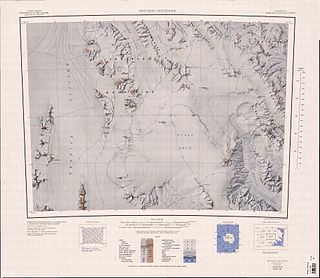
The Ohio Range is a mountain range in the Transantarctic Mountains of Antarctica. It is about 48 km (30 mi) long and 16 km (10 mi) wide, extending WSW-ENE from Eldridge Peak to Mirsky Ledge. The range forms the northeast end of the Horlick Mountains and consists primarily of a large snow-topped plateau with steep northern cliffs and several flat-topped ridges and mountains. The highest point is the summit of Mount Schopf.
The Churchill Mountains are a mountain range group of the Transantarctic Mountains System, located in the Ross Dependency region of Antarctica. They border on the western side of the Ross Ice Shelf, between Byrd Glacier and Nimrod Glacier.

The Usarp Mountains are a major mountain range in North Victoria Land, Antarctica. They are west of the Rennick Glacier and trend north to south for about 190 kilometres (118 mi). The mountains are bounded to the north by Pryor Glacier and the Wilson Hills.
The Scott Mountains are a large number of isolated peaks lying south of Amundsen Bay in Enderby Land of East Antarctica, Antarctica. Discovered on 13 January 1930 by the British Australian New Zealand Antarctic Research Expedition (BANZARE) under Sir Douglas Mawson. He named the feature Scott Range after Captain Robert Falcon Scott, Royal Navy. The term mountains is considered more appropriate because of the isolation of its individual features.

The Herbert Mountains are a conspicuous group of rock summits on the east side of Gordon Glacier in the Shackleton Range of Antarctica. They were first mapped in 1957 by the Commonwealth Trans-Antarctic Expedition and named for Sir Edwin S. Herbert, Chairman of the Finance Committee and a Member of the Committee of Management of the expedition, 1955–58.
Surveyors Range is a 30 miles (48 km) long mountain range in the Churchill Mountains of Antarctica.

The Independence Hills are a line of rugged hills and peaks, 10 miles (16 km) long, with mainly bare rock eastern slopes. They lie 3 miles (5 km) southeast of the Marble Hills and form the southern segment of the west wall of Horseshoe Valley, in the Heritage Range of Antarctica. The Independence Hills were mapped by the United States Geological Survey from ground surveys and U.S. Navy air photos, 1961–66. The name was applied by the Advisory Committee on Antarctic Names in association with the name "Heritage Range".
The Porthos Range is the second range south in the Prince Charles Mountains of Antarctica, extending for about 30 miles in an east-to-west direction between Scylla Glacier and Charybdis Glacier. First visited in December 1956 by the Australian National Antarctic Research Expeditions (ANARE) southern party under W.G. Bewsher (1956-57) and named after Porthos, a character in Alexandre Dumas, père's novel The Three Musketeers, the most popular book read on the southern journey.
Mount Wisting is a rock peak, the northwesternmost summit of the massif at the head of Amundsen Glacier in the Queen Maud Mountains. In November 1911, a number of mountain peaks in this general vicinity were observed and positioned by the South Pole Party under Roald Amundsen. Amundsen named one of them for Oscar Wisting, a member of the party. The peak described was mapped by United States Geological Survey (USGS) from surveys and U.S. Navy aerial photography, 1960–64. For the sake of historical continuity and to commemorate the Norwegian exploration in this area, the Advisory Committee on Antarctic Names (US-ACAN) has selected this feature to be designated Mount Wisting. Other peaks in the massif have been named for members of Amundsen's South Pole Party.
Mount Weston is the highest peak of Haskard Highlands, in the west part of the Shackleton Range. It was first mapped in 1957 by the Commonwealth Trans-Antarctic Expedition and named after Flight Sgt. Peter D. Weston, RAF, an aircraft mechanic with the RAF contingent of the Commonwealth Trans-Antarctic Expedition in 1956–58.
The Freyberg Mountains are a group of mountains in Victoria Land, Antarctica, bounded by Rennick Glacier, Bowers Mountains, Black Glacier, and Evans Neve. Named for New Zealand's most famous General, Lord Bernard Freyberg, by the Northern Party of New Zealand Geological Survey Antarctic Expedition (NZGSAE), 1963-64. This mountain group includes the Alamein Range. These topographical features all lie situated on the Pennell Coast, a portion of Antarctica lying between Cape Williams and Cape Adare.
Pioneers Escarpment is a mostly snow-covered north-facing escarpment in Antarctica, interrupted by occasional bluffs and spurs, between Slessor Glacier on the north and Shotton Snowfield on the south, in the Shackleton Range.
The Haskard Highlands are a range of peaks and ridges between Blaiklock Glacier and Stratton Glacier in the northwest of the Shackleton Range, Antarctica, rising to 1,210 metres (3,970 ft) at Mount Weston and including features between Mount Provender and Pointer Nunatak. The highlands were first mapped in 1957 by the Commonwealth Trans-Antarctic Expedition, and photographed from the air by the U.S. Navy in 1967. They were surveyed by the British Antarctic Survey between 1968 and 1971, and named by the UK Antarctic Place-Names Committee in 1971 after Sir Cosmo Haskard, Governor of the Falkland Islands 1964–70.
Ramsay Wedge is a narrow rock spur, 2 nautical miles (3.7 km) long, with talus slopes rising to about 1,200 m, located 2 nautical miles (3.7 km) southwest of Mount Absalom in the southwest portion of the Herbert Mountains, Shackleton Range. Photographed from the air by the U.S. Navy, 1967, and surveyed by British Antarctic Survey (BAS), 1968–71. In association with the names of glacial geologists grouped in this area, named by the United Kingdom Antarctic Place-Names Committee (UK-APC) after Sir Andrew C. Ramsay (1814–91), Scottish geologist who first recognized the glacial origin of rock basins in 1862; Director-General, Geological Survey of Great Britain, 1871–81.

The Kent Plateau is an ice-covered plateau in the northern extreme of the Churchill Mountains of Antarctica.
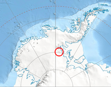
Read Mountains is a group of rocky summits, the highest being Holmes Summit at 1,875 metres (6,152 ft), lying east of Glen Glacier in the south-central part of the Shackleton Range.
Redpath Peaks is a cluster of low, snow-covered peaks lying 3 nautical miles (6 km) southeast of Mount Shattuck and the Independence Hills, at the south extremity of the Heritage Range, Ellsworth Mountains. They were named by the Advisory Committee on Antarctic Names (US-ACAN) for Bruce B. Redpath, a United States Antarctic Research Program (USARP) geophysicist on the South Pole—Queen Maud Land Traverse I of 1964–65.