Mourilyan, Queensland

Last updated

Mourilyan
Queensland
Mourilyan mill destruction.jpg
The Mourilyan sugar mill after Cyclone Larry
Australia Queensland location map.svg
Red pog.svg
Mourilyan
Coordinates 17°34′S146°03′E / 17.567°S 146.050°E / -17.567; 146.050 Coordinates: 17°34′S146°03′E / 17.567°S 146.050°E / -17.567; 146.050
Population571 (2016 census) [1]
Postcode(s) 4858
Location
LGA(s) Cassowary Coast Region
State electorate(s) Hill
Federal Division(s) Kennedy
Localities around Mourilyan:
Comoon Loop South Innisfail Coquette Point
Stockton Mourilyan Etty Bay
Boogan Martyville
New Harbourline
Mourilyan Harbour

Mourilyan is a town and locality in the Cassowary Coast Region, Queensland, Australia. [2] [3] It was established around the Mourilyan sugar mill which provided much of the employment in the area until it was destroyed by Cyclone Larry on 20 March 2006. In the 2016 census, Mourilyan had a population of 571 people. [1]

Contents

Geography

The town is located 8 kilometres (5.0 mi) south of Innisfail on the Bruce Highway.

History

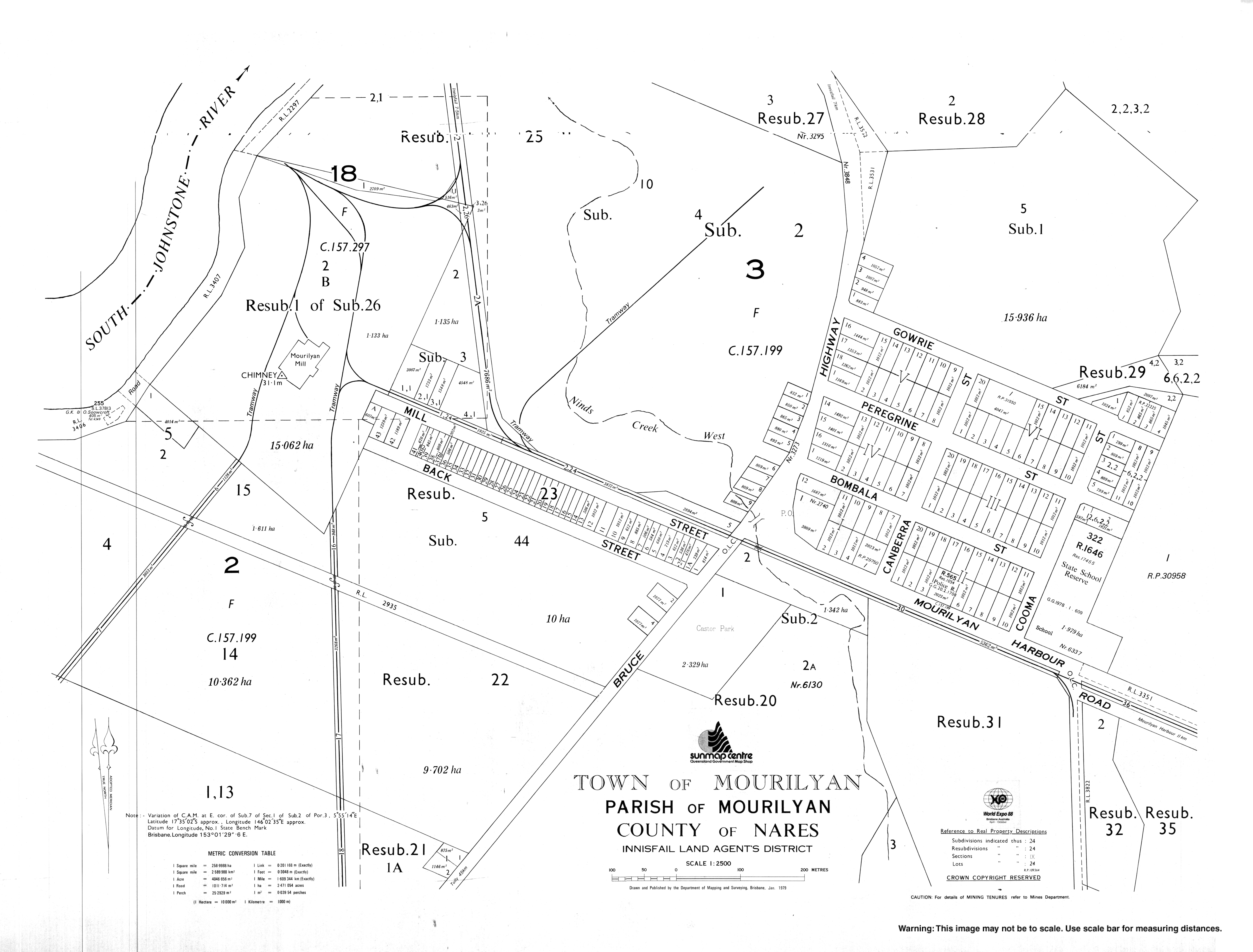
Construction of the Mourilyan sugar mill began in 1882, rendering it among the oldest in Australia. Excavation of the site was undertaken mainly by Kanakas, with assistance from Chinese and Anglo-Saxon labourers. After its completion in 1884, the mill had a processing capacity of 14 tonnes of sugar per 12-hour shift. [4]

In 1913, the Colonial Sugar Refining Company (now CSR) began purchasing sugar refined at the mill. Mourilyan remained a small settlement, growing only very slowly since.

Mourilyan Post Office opened by September 1910 (a receiving office had been open from 1884 when the mill opened). [5]

Mourilyan is prone to tropical cyclones; in 1918, a cyclone caused serious damage to the mill and surrounding community, having a drastic effect on sugar production in that year.[ citation needed ]

The Mourilyan parish of the Roman Catholic Vicariate Apostolic of Cooktown (now the Roman Catholic Diocese of Cairns) was established in 1935. It is now merged with the Innisfail and South Johnstone parishes. [6]

In 1986, Cyclone Winifred also caused substantial damage to the area.[ citation needed ]

In March 2006 Cyclone Larry caused substantial damage to many households in the area, and destroyed the town's main source of employment. A major effort by the Australian Defence Force helped restore Mourilyan Primary School to functioning capacity. Insurance payouts have helped to repair residential and commercial properties. [7]

At the 2006 census, Mourilyan had a population of 424 people. [8]

At the 2016 census, Mourilyan had a population of 571 people. [1]

Attractions

Mourilyan's main attraction is the Australian Sugar Industry Museum, [9] which contains several relics from North Queensland's extensive sugar farming history. It also serves as a gateway to Mourilyan Harbour, Etty Bay and Paronella Park.

Education

Mourilyan State School opened on 29 January 1908 and as of July 2017, educates 167 students from Prep to Year 6. [10] [11]

Amenities

Christ the King Catholic Church is at 10 Harbour Road. It is within the Innisfail Parish of the Roman Catholic Diocese of Cairns. [6]

See also

Related Research Articles

Tully, Queensland Town in Queensland, Australia

Tully is a town and locality in the Cassowary Coast Region, Queensland, Australia. It is adjacent to the Bruce Highway, approximately 140 kilometres (87 mi) south of Cairns by road and 210 kilometres (130 mi) north of Townsville. At the 2016 census, the population was 2,390.

Innisfail, Queensland Town in Queensland, Australia

Innisfail is a rural town and locality in the Cassowary Coast Region, Queensland, Australia. The town was originally called Geraldton until 1910. In the 2016 census, the town of Innisfail had a population of 7,236 people, while the locality of Innisfail had a population of 1,145 people.

Dimbulah, Queensland Town in Queensland, Australia

Dimbulah is a town and locality in Far North Queensland, Australia, 114 kilometres (71 mi) from Cairns by road, on the Atherton Tableland. It is within the local government area of Shire of Mareeba. At the 2016 census, Dimbulah had a population of 1,050.

Mission Beach, Queensland Town in Queensland, Australia

Mission Beach is a small coastal town and locality in the Cassowary Coast Region, Queensland, Australia. In the 2016 census Mission Beach and surrounding villages had a total population of 3,597 people.

Edmonton, Queensland Suburb of Cairns, Queensland, Australia

Edmonton is a town and suburb in the Cairns Region, Queensland, Australia. In the 2016 census, Edmonton had a population of 10,753 people.

Babinda Town in Queensland, Australia

Babinda is a small town and locality in the Cairns Region, Queensland, Australia. It is located 60 kilometres (37 mi) south of Cairns.

Cyclone Larry

Severe Tropical Cyclone Larry was a tropical cyclone that made landfall in Australia during the 2005–06 Southern Hemisphere tropical cyclone season. Larry originated as a low pressure system over the eastern Coral Sea on 16 March 2006, and was monitored by the Australian Bureau of Meteorology in Brisbane, Australia. The low-pressure area organized into a tropical cyclone two days later and quickly strengthened into a Category 4 storm on the Australian tropical cyclone scale. Larry made landfall in Far North Queensland close to Innisfail, on 20 March 2006, as a Category 5 tropical cyclone on the Australian scale, with wind gusts reaching 240 kilometres per hour (150 mph), before dissipating over land several days later.

Malanda, Queensland Town in Queensland, Australia

Malanda is a rural town and locality in the Tablelands Region, Queensland, Australia. In the 2016 census, Malanda had a population of 1,985 people. The economy is based upon agriculture and tourism.

Millaa Millaa, Queensland Town in Queensland, Australia

Millaa Millaa is a rural town and locality in the Tablelands Region, Queensland, Australia. In the 2016 census, Millaa Millaa had a population of 514 people.

Mossman, Queensland Town in Queensland, Australia

Mossman is a town and a locality in Far North Queensland, Australia, on the Mossman River. It is within the local government area of Shire of Douglas. In the 2016 census, Mossman had a population of 1,937 people.

Roman Catholic Diocese of Cairns

The Roman Catholic Diocese of Cairns is a diocese of the Catholic Church located in the state of Queensland, Australia. It is a suffragan diocese of the Archdiocese of Brisbane. The diocese was erected as a vicariate apostolic in 1877 and was elevated to a diocese in 1941. Its territorial remit is Far North Queensland.

Innisfail Court House Historic court house in Queensland, Australia

Innisfail Court House is a heritage-listed court house at 10 Edith Street, Innisfail, Cassowary Coast Region, Queensland, Australia. It is the town’s third court house. It was designed in the inter-war classical style by the Department of Public Works (Queensland) and built in 1939 by day labour. The current court house is a two-storeyed brick building with a corrugated-iron roof. It was added to the Queensland Heritage Register on 13 January 1995.

El Arish, Queensland Town in Queensland, Australia

El Arish is a small town and locality in the Cassowary Coast Region of Queensland, Australia.

East Innisfail, Queensland Suburb of Cassowary Coast Region, Queensland, Australia

East Innisfail is a suburban locality in the Cassowary Coast Region, Queensland, Australia. In the 2016 census, East Innisfail had a population of 1,855 people.

Michael Martin Clancy

Father Michael Martin Clancy OSA (1868–1931) was an Irish-Australian Roman Catholic priest. He was the first resident Parish Priest in Geraldton, a town and parish in North Queensland, Australia. He was an inspirational parish priest who developed the Parish, established Catholic education in the Johnstone River district and built Innisfail's present Mother of Good Counsel Church. He played an important part in the development in the town and the district. Father Clancy was enthusiastically involved in the life of the town, local committees and governing bodies. He was instrumental in the changing of Geraldton's name to Innisfail in 1910. He also advocated for forging a link to the Atherton Tableland and the use of Mourilyan Harbour by shipping. Mount Father Clancy Garreth McGonnell near the Beatrice River was named in his honour.

South Johnstone, Queensland Town in Queensland, Australia

South Johnstone is a rural town and locality in the Cassowary Coast Region, Queensland, Australia. In the 2016 census, South Johnstone had a population of 413 people.

Silkwood, Queensland Town in Queensland, Australia

Silkwood is a rural town and locality in the Cassowary Coast Region, Queensland, Australia. In the 2016 census the locality of Silkwood had a population of 391 people.

Mourilyan Harbour Suburb of Cassowary Coast Region, Queensland, Australia

Mourilyan Harbour is a coastal locality and harbour within the Cassowary Coast Region, Queensland, Australia. In the 2016 census, Mourilyan Harbour had a population of 156 people.

St Saviours Anglican Church, South Johnstone

St Saviour's Anglican Church is a heritage-listed former church building at 26 Hynes Street, South Johnstone, Cassowary Coast Region, Queensland, Australia. It was built from 1938 to 1939 by Mose Romano. It was added to the Queensland Heritage Register on 24 September 2004.

Daradgee, Queensland Town in Queensland, Australia

Daradgee is a rural town and locality in the Cassowary Coast Region, Queensland, Australia. In the 2016 census, Daradgee had a population of 74 people.

References

  1. 1 2 3 Australian Bureau of Statistics (27 June 2017). "Mourilyan (SSC)". 2016 Census QuickStats. Retrieved 20 October 2018. OOjs UI icon edit-ltr-progressive.svg
  2. "Mourilyan - town (entry 23226)". Queensland Place Names. Queensland Government . Retrieved 12 March 2017.
  3. "Mourilyan - locality (entry 45735)". Queensland Place Names. Queensland Government . Retrieved 12 March 2017.
  4. "ABC Rural News" . Retrieved 26 May 2007.
  5. Premier Postal History. "Post Office List". Premier Postal Auctions. Retrieved 10 May 2014.
  6. 1 2 "Innisfail Parish". Roman Catholic Diocese of Cairns . Archived from the original on 18 November 2020. Retrieved 18 November 2020.
  7. "Cyclone Larry: The Aftermath" . Retrieved 26 May 2007.
  8. Australian Bureau of Statistics (25 October 2007). "Mourilyan (L) (Urban Centre/Locality)". 2006 Census QuickStats. Retrieved 25 October 2008.
  9. "The Australian Sugar Industry Museum". Archived from the original on 18 June 2007. Retrieved 26 May 2007.
  10. "Opening and closing dates of Queensland Schools". Queensland Government . Retrieved 18 April 2019.
  11. "School Details" . Retrieved 9 April 2018.