Related Research Articles
Pargana or parganah, also spelt pergunnah during the time of the Sultanate period, Mughal times and British Raj, is a former administrative unit of the Indian subcontinent and each parganas may or may not be subdivided into pirs. Those revenue units are used primarily, but not exclusively, by the Muslim kingdoms. After independence the Parganas became equivalent to Block/ Tahsil and Pirs became Grampanchayat.
Ryot was a general economic term used throughout India for peasant cultivators but with variations in different provinces. While zamindars were landlords, raiyats were tenants and cultivators, and served as hired labour.

Jhalakathi Sadar is an upazila of Jhalokati District in the Division of Barisal, Bangladesh.

Akhaura is an upazila of Brahmanbaria District, a district under Chattogram, Bangladesh. Akhaura Upazila has an area of 99.28 km2. The main river that run through this upazila is the Titas River. Akhaura played an important historical role during both World War II and Liberation War of Bangladesh.

Hathazari is an upazila of Chattogram District in Chattogram Division, Bangladesh.

Patiya is an upazila of Chattogram District in Chattogram Division, Bangladesh.
Chauddagram is an upazila of Cumilla District in the Division of Chittagong, Bangladesh. It also a Municipality under Cumilla District.Chauddagram Municipality is a part of Chauddagram Upazila. A municipality in Comilla district of Bangladesh.

Muradnagar is an upazila of the Comilla District in Chittagong Division, Bangladesh.
Ajmiriganj (Bengali: আজমিরিগঞ্জ, is an upazila of Habiganj District in the Division of Sylhet, Bangladesh.
Baniachong, is an upazila of Habiganj District in Sylhet Division, Bangladesh.
Balaganj is an upazila of Sylhet District in Sylhet Division, Bangladesh.
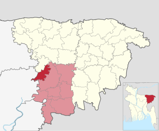
Kanaighat is an upazila of Sylhet Division of Bangladesh. It is the second-largest upazila (sub-district) of Sylhet District after Gowainghat Upazila. It is named after the town of Kanaighat, which is also the only municipality in the Upazila.
Islampur is the most sparsely populated upazila of the Jamalpur District, located in the Mymensingh Division of Bangladesh.

Munshiganj Sadar is an upazila of Munshiganj District in the Division of Dhaka, Bangladesh.

Mollahat is an upazila of Bagerhat District in the Division of Khulna, Bangladesh.
Gangni is an upazila of Meherpur District in the Division of Khulna, Bangladesh.

The East Bengal State Acquisition and Tenancy Act of 1950 was a law passed by the newly formed democratic Government of East Bengal in the Dominion of Pakistan. The bill was drafted on 31 March 1948 during the early years of Pakistan and passed on 16 May 1951. Before passage of the legislature, landed revenue laws of Bengal consisted of the Permanent Settlement Regulations of 1793 and the Bengal Tenancy Act of 1885.
Mohadevpur is an Upazila of Naogaon in the Division of Rajshahi, Bangladesh.

Union councils of Khulna District are the smallest rural administrative and local government units in Khulna District of Bangladesh. There are 9 upazilas in Khulna district with 67 Union councils. The list are below:
Union councils of Bagerhat District are the smallest rural administrative and local government units in Satkhira District of Bangladesh. The district consists of 2 municipalities, 9 upazilas, 79 union porishods and 1047 villages.
References
- ↑ Final Report of survey settlement operations in santhal pargana. Third programme zamindari estates. Author McPherson. p. 53
- ↑ Islam, Sirajul (2012). "Mouza". In Islam, Sirajul; Jamal, Ahmed A. (eds.). Banglapedia: National Encyclopedia of Bangladesh (Second ed.). Asiatic Society of Bangladesh.
- 1 2 3 4 5 Khan, Tariq Shafiq (2009). Pakistan 2008 Mouza Statistics (PDF). Government of Pakistan: Statistics Division – Agricultural Census Organization. Retrieved 4 May 2021.