Mulhuddart is an outer suburb situated 12 km north-west of Dublin, Ireland. The River Tolka passes near the village.

Doora is a village and civil parish in County Clare, Ireland, just to the east of the town of Ennis.
Lambeg is a small village and civil parish in County Antrim, Northern Ireland. Located between Belfast and Lisburn, it was once a small rural village, but is now within the Greater Belfast conurbation. Lambeg is also an electoral ward of Lisburn Council. In the 2001 Census it had a population of 60 people. The civil parish of Lambeg covers areas of County Down as well as County Antrim.

Rolestown, is a small village six miles (10 km) north-west of Swords along the R125 in Fingal, County Dublin, Ireland. It lies about halfway between Swords and Ashbourne, County Meath. It is located around two parallel roads intersected by a road that crosses the Broadmeadow River by an old cut stone bridge. Rolestown is also a parish in the Fingal North deanery of the Roman Catholic Archdiocese of Dublin.

Twynholm is a village in Scotland. It is located 2+1⁄4 miles (3.6 km) north-northwest of Kirkcudbright and 4+1⁄2 miles (7.2 km) east of Gatehouse of Fleet on the main A75 trunk road. It is in the historic county of Kirkcudbrightshire, Dumfries and Galloway.

Naul, is a village, townland, and civil parish at the northern edge of the traditional County Dublin in Ireland. The Delvin River to the north of the village marks the county boundary with County Meath. Naul civil parish is in the historic barony of Balrothery West.
Ballylaneen is a small village and townland in County Waterford, Ireland, approximately halfway between the villages of Kilmacthomas and Bunmahon on a hill by the River Mahon.
Kilteel is the name of a village, townland and civil parish located in the barony of South Salt, County Kildare, Ireland. The townland of Kilteel Upper contains the remains of a church with a decorated Romanesque chancel arch, the ruins of a 13th-century preceptory of the Knights Hospitaller and a well-preserved 15th-century tower house. The historic settlement is located on the southwest corner of the English Pale and served an important function as a border fortress during the medieval period.

Brickens, officially Brickeens, is a village and townland on the N60 road between Ballyhaunis and Claremorris in southeast County Mayo in Ireland. The River Robe flows through the village which is 65 metres above sea level, and old ordnance survey maps show the townland with an area of 368 acres and 23 perches – equivalent to nearly 150 hectares.

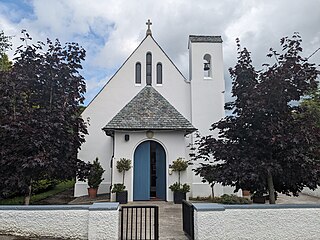
Moycarkey, Littleton, Two-Mile-Borris is an ecclesiastical parish in the Cashel deanery of the Roman Catholic Archdiocese of Cashel and Emly. There are three churches in the parish:

Moycarkey is an electoral division in County Tipperary in Ireland. It was originally an electoral division in the Thurles Poor Law Union in North Tipperary but is still used for various administrative purposes.
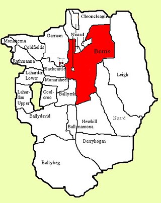
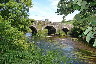
Borris is a townland comprising a little over 1,327 acres in the civil parish of Twomileborris in County Tipperary, Ireland. At the time of the 1891 census, it had a population of 212; in 1891 this had fallen to 175 but had risen again to 190 at the time of the 1911 census.
Coolkerry is a civil parish in the barony of Clarmallagh in County Laois. It is separated into two disjoint areas by an arm of Aghaboe civil parish.
Coolkerry is a townland in Coolkerry civil parish in County Laois.

Moyarta is a civil parish in County Clare, Ireland. It lies on the Loop Head peninsula between the Atlantic Ocean and the Shannon Estuary. The parish contains the villages of Carrigaholt and Doonaha.

Doonbeg (Killard) (Irish: Cill Ard) is a civil parish on the Atlantic coast of County Clare in Ireland. It is also an ecclesiastical parish in the Roman Catholic Diocese of Killaloe. The largest population centre in the parish is the village of Doonbeg.

Kilballyowen is the name of both a civil parish and a townland within that parish in County Clare, Ireland. The name is also occasionally used for the slightly larger Catholic parish of Cross.
Kilfintinan is a civil parish in County Clare, Ireland. It is part of the Catholic parish of Cratloe.

Lickbla, is a historic monument, civil parish, religious parish, and townland, in County Westmeath, Ireland. It is located about 23.05 kilometres (14 mi) north of Mullingar. St. Bladma is listed in the Martyrology of Oengus as a saint: "Bladma, i.e. from Blad son of Conmac Cas Clothach, grandson of Tachall son of Cermait, son of the Dagda, a quo nominatur. Or Blad son of Breogan, a quo Sliab Bladma" whose feastday is 7 April and 20 November.
Moycullen is a Gaeltacht civil parish in the ancient barony of the same name. It is located in the western shore of Lough Corrib in County Galway, Ireland and is around 4 miles (6.4 km) north-west of the city of Galway on the road to Oughterard. The parish contains 27,294 statute acres. According to Lewis's survey of 1837, "The land is of very indifferent quality; and there is a large quantity of reclaimable waste and bog.". The parish gets its name from the church, now in ruins, that is situated around 1 mile (1.6 km) to the east of the village, in the townland of Moycullen itself.