Municipal Borough of Sale

Last updated

Sale
Sale town hall.jpg
Sale Town Hall
Municipal Borough of Sale, Cheshire (1970).svg
Sale within Cheshire in 1970
Area
  1891 [1] 2,006 acres (8.12 km2)
  1931 [2] 3,629 acres (14.69 km2)
  1961 [2] 3,629 acres (14.69 km2)
Population
  1891 [1] 9,644
  1931 [2] 28,071
  1971 [2] 55,749
History
  Created1867
  Abolished1974
  Succeeded by Metropolitan Borough of Trafford
Status Local board of health 1867–1894

Urban district 1894–1935

Municipal borough 1935–1974
Government
   HQ Sale Town Hall
   Motto Salus et Felicitas (Health and happiness)
Sale coat of arms2.jpg

Sale was, from 1867 to 1974, a district in Cheshire, England. The district had in turn the status of local government district, urban district and municipal borough. Its area now forms part of the Metropolitan Borough of Trafford, Greater Manchester.

Contents

Local Board and Urban District

On 15 November 1866 the ratepayers of the township of Sale adopted the Local Government Act 1858, and a Local Board was formed to govern the town in January 1867. [3] From 1889 it was a part of the administrative county of Cheshire. The Local Government Act 1894 reconstituted the Local Board's area as Sale Urban District. An urban district council of 15 members replaced the local board. [1] The neighbouring town of Ashton upon Mersey became an urban district in 1895. [4] In 1930 a county review order merged Ashton upon Mersey Urban District into Sale UD. [4] [5]

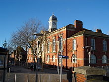
In December 1933 a petition was submitted to the Privy Council praying for a charter of incorporation to raise the urban district to the status of a municipal borough. [6] At the time, Sale was the urban district with the largest population and highest rateable value in the county. The petition was successful, and the charter was presented by Sir William Bromley-Davenport the Lord Lieutenant of Cheshire on 21 September 1935. [7] The first elections to the borough council were held on 1 November. [4]

Political control

The borough council consisted of a mayor, eight aldermen and twenty-four councillors. One-third of the councillors were elected annually, and half of the aldermen were chosen by the council every three years.

The council initially consisted of a number of groupings, with none in a majority. Except for members of the Conservative and Labour parties, Independent, "Owner-Occupier" and "Trader" candidates were elected. In 1946 the Conservatives gained an overall majority, which they held until 1962. Opposition was provided by Labour and Liberal councillors. [8] From 1962 to 1965 the council was under no overall control, with the Liberals forming the largest party. [9] Conservatives regained control in 1965 and held it until 1972. The latter year saw the last election before the borough's abolition, and the final council was hung, with sixteen Conservatives balanced by ten Labour and six Liberal members. [10] [11]

PartyPeriod
Independent 1935-1937
No overall control 1937
Conservative 1937-1938
No overall control 1938-1946
Conservative 1946-1962
No overall control 1962-1964
Liberal 1964
No overall control 1964-1965
Conservative 1965-1974

Coat of arms

Sale Urban District Council was granted armorial bearings by the College of Arms by letters patent dated 23 September 1920. The blazon was as follows:

Azure, on a pile argent between two garbs Or, three lozenges sable, and for a Crest on a wreath of the colours, upon the battlements of a tower argent a moorcock sable combed and wattled gules beaked and legged Or. [12]

The gold "garbs" or wheatsheaves on a blue field were county emblems, appearing in the arms of Cheshire County Council and the Earldom of Chester. The three black lozenges on white were from the arms of the Massey family of Sale. The crest above the shield was a black "moorcock" representing Sale Moor.

The Latin motto adopted was Salus et felicitas or "health and happiness": the first word was a pun on the name of the town. [13]

The arms continued in use by the borough council on incorporation in 1935. An additional grant of heraldic supporters was made on 15 August 1945 to commemorate the tenth anniversary of borough status: [12] [13]

On the dexter side a unicorn argent, armed and unguled Or, maned and tufted azure, and on the sinister side a badger proper, each gorged with a wreath of salllow twigs also proper.

The unicorn represented Ashton-upon-Mersey, and was derived from the arms of the Carrington family. The badger or "brock" stood for the Brooklands area. Both supporters wore collars made of sallow twigs, another reference to the town's name. [13]

Abolition

The municipal borough was abolished in 1974 as a result of the Local Government Act 1972, which abolished all municipal boroughs. Sale became a part of the Metropolitan Borough of Trafford, in Greater Manchester. [4] [14]

Local elections

Related Research Articles

<span class="mw-page-title-main">Trafford</span> Borough in Greater Manchester, England

Trafford is a metropolitan borough of Greater Manchester, England, with an estimated population of 236,301 in 2022. It covers 106 square kilometres (41 sq mi) and includes the area of Old Trafford and the towns of Altrincham, Stretford, Urmston, Partington and Sale. The borough was formed in 1974 as a merger of six former districts and part of a seventh. The River Mersey flows through the borough, separating North Trafford from South Trafford, and the historic counties of Lancashire and Cheshire. Trafford is the seventh-most populous district in Greater Manchester.

<span class="mw-page-title-main">Sale, Greater Manchester</span> Town in Greater Manchester, England

Sale is a town in Trafford, Greater Manchester, England, in the historic county of Cheshire on the south bank of the River Mersey, 2 miles (3.2 km) south of Stretford, 3 miles (4.8 km) northeast of Altrincham, and 5 miles (8.0 km) southwest of Manchester. In 2021, it had a population of 54,515.

<span class="mw-page-title-main">Metropolitan Borough of Hackney</span>

The Metropolitan Borough of Hackney was a metropolitan borough of the County of London from 1900 to 1965. Its area became part of the London Borough of Hackney.

<span class="mw-page-title-main">Municipal Borough of Bromley</span>

Bromley was a local government district in northwest Kent from 1867 to 1965 around the town of Bromley. The area was suburban to London, and formed part of the Metropolitan Police District and from 1933 was included in the area of the London Passenger Transport Board.

<span class="mw-page-title-main">County Borough of East Ham</span>

East Ham was a local government district in the far south west of Essex from 1878 to 1965. It extended from Wanstead Flats in the north to the River Thames in the south and from Green Street in the west to Barking Creek in the east. It was part of the London postal district and Metropolitan Police District.

<span class="mw-page-title-main">Municipal Borough of Finchley</span>

Finchley, which is now in north London, was a local government district in Middlesex, England, from 1878 to 1965. Finchley Local Board first met in 1878. It became Finchley Urban District Council in 1895 and the Municipal Borough of Finchley in 1933. In 1965 Middlesex was abolished and Finchley became part of the London Borough of Barnet.

<span class="mw-page-title-main">Municipal Borough of Bexley</span> Abolished 1965

Bexley was a local government district in north west Kent from 1880 to 1965 covering the parish of Bexley, which included both Bexley village and Bexleyheath.

<span class="mw-page-title-main">Municipal Borough of Acton</span>

Acton was a local government district in Middlesex, England from 1865 to 1965.

<span class="mw-page-title-main">Municipal Borough of Ealing</span>

Ealing was a local government district from 1863 to 1965 around the town of Ealing which formed part of the built up area of London until 1965, where it became part of Greater London.

<span class="mw-page-title-main">Municipal Borough of Beddington and Wallington</span>

Beddington and Wallington was, from 1915 to 1965, a local government district in north east Surrey, England. It formed part of the London suburbs, lying within the Metropolitan Police District and the London Passenger Transport Area. In 1965 it was abolished on the creation of Greater London.

<span class="mw-page-title-main">Ashton upon Mersey</span> Human settlement in England

Ashton upon Mersey is an area of the Metropolitan Borough of Trafford, Greater Manchester, England, with a population of 9,693 at the 2011 census. It lies on the south bank of the River Mersey, 5 miles (8.0 km) south of Manchester city centre.

Altrincham was a county constituency of the House of Commons of the Parliament of the United Kingdom from 1885 to 1945. It elected one Member of Parliament (MP) by the first past the post system of election.

<span class="mw-page-title-main">County Borough of Oldham</span> Local government district in northwest England

Oldham was, from 1849 to 1974, a local government district in the northwest of England coterminous with the town of Oldham.

<span class="mw-page-title-main">County Borough of Stockport</span> Former municipal borough in present-day town of Stockport

Stockport County Borough was a county-level local authority between 1889 and 1974.

<span class="mw-page-title-main">Municipal Borough of Stretford</span>

Stretford was, from 1868 to 1974, a local government district coterminate with the town of Stretford, Lancashire, England.

<span class="mw-page-title-main">County Borough of Rochdale</span> United Kingdom legislation

Rochdale was, from 1856 to 1974, a local government district coterminate with the town of Rochdale in the northwest of England.

<span class="mw-page-title-main">Halton Borough Council</span>

Halton Borough Council is the local authority for the Borough of Halton, incorporating the towns of Runcorn and Widnes and the parishes of Daresbury, Hale, Moore and Preston Brook. It is a constituent council of Liverpool City Region Combined Authority.

<span class="mw-page-title-main">Municipal Borough of Middleton</span>

The Municipal Borough of Middleton was, from 1886 to 1974, a municipal borough in the administrative county of Lancashire, England, coterminous with the town of Middleton.

<span class="mw-page-title-main">Municipal Borough of Heywood</span>

The Municipal Borough of Heywood was, from 1881 to 1974, a local government district in the administrative county of Lancashire, England, with borough status and coterminate with the town of Heywood.

<span class="mw-page-title-main">Municipal Borough of Altrincham</span> Altrincham Urban District

Altrincham was, from 1886 to 1974, a local government district in Cheshire, England. It held the status of local board, urban district and municipal borough before it was abolished by the Local Government Act 1972 and became a part of Trafford.

References

  1. 1 2 3 "Sale", Kelly's Directory of Cheshire (6th ed.), 1902, pp. 497–504, retrieved 10 September 2012
  2. 1 2 3 4 "Sale UD/MB", Vision of Britain, University of Portsmouth , retrieved 17 August 2008
  3. "No. 23204", The London Gazette , 1 January 1867, p. 24
  4. 1 2 3 4 Youngs 1991, pp. 6, 33, 644–646
  5. Swain 1987, p. 119
  6. "No. 34007", The London Gazette , 22 December 1933, p. 8311
  7. Charters for Two New Boroughs: Celebrations at Sale and Radcliffe, The Times, 12 September 1935, p. 15
  8. Polling in the Boroughs, The Times, November 2, 1946, p.2
  9. Election Results in the Boroughs, The Times, May 11, 1962, p.10
  10. Borough Election Results in England and Wales, The Times, May 14, 1965, p.8
  11. Widespread Labour gains in borough elections, The Times, May 5, 1972
  12. 1 2 Geoffrey Briggs, Civic and Corporate Heraldry: A Dictionary of Impersonal Arms of England, Wales and N. Ireland, London, 1971
  13. 1 2 3 C Wilfrid Scott-Giles, Civic Heraldry of England and Wales, 2nd edition, London, 1953
  14. Swain 1987, p. 134

Bibliography

  • Swain, Norman (1987), A History of Sale from earliest times to the present day, Sigma Press, ISBN   1-85058-086-3
  • Youngs, Frederic A. (1991), Guide to the Local Administrative Units of England, Vol. II: Northern England, Royal Historical Society, ISBN   0-86193-127-0

53°25′26″N2°19′19″W / 53.424°N 2.322°W / 53.424; -2.322