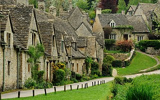
Gloucestershire is a ceremonial county in South West England. It is bordered by Herefordshire to the north-west, Worcestershire to the north, Warwickshire to the north-east, Oxfordshire to the east, Wiltshire to the south, Bristol and Somerset to the south-west, and the Welsh county of Monmouthshire to the west. The city of Gloucester is the largest settlement and the county town.

The River Severn, at 220 miles (354 km) long, is the longest river in Great Britain. It is also the river with the most voluminous flow of water by far in all of England and Wales, with an average flow rate of 107 m3/s (3,800 cu ft/s) at Apperley, Gloucestershire. It rises in the Cambrian Mountains in mid Wales, at an altitude of 2,001 feet (610 m), on the Plynlimon massif, which lies close to the Ceredigion/Powys border near Llanidloes. The river then flows through Shropshire, Worcestershire and Gloucestershire. The county towns of Shrewsbury, Gloucester and Worcester lie on its course.

The Severn bore is a tidal bore seen on the tidal reaches of the River Severn in south western England. It is formed when the rising tide moves into the funnel-shaped Bristol Channel and Severn Estuary and the surging water forces its way upstream in a series of waves, as far as Gloucester and beyond. The bore behaves differently in different stretches of the river; in the lower, wider parts it is more noticeable in the deep channels as a slight roller, while the water creeps across the sand and mudflats. In the narrower, upper reaches, the river occupies the whole area between its banks and the bore advances in a series of waves that move upstream. Near Gloucester, the advancing water overcomes two weirs, and sometimes one in Tewkesbury, before finally petering out.
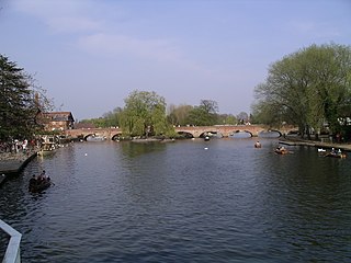
The River Avon in central England flows generally southwestwards and is a major left-bank and easternmost tributary of the River Severn. It is also known as the Warwickshire Avon or Shakespeare's Avon, to distinguish it from several other rivers of the same name in the United Kingdom.

Tewkesbury is a market town and civil parish in the north of Gloucestershire, England. The town grew following the construction of Tewkesbury Abbey in the twelfth century and played a significant role in the Wars of the Roses. It stands at the confluence of the River Severn and the River Avon, and thus became an important trading point, which continued as railways and, later, the M5 and M50 motorway connections were established. The town gives its name to the Borough of Tewkesbury, a local government district of Gloucestershire. The town lies on the border with Worcestershire, marked largely by the Carrant Brook.

Severn Trent plc is a water company based in Coventry, England. It supplies 4.6 million households and business across the Midlands and Wales.

Coombe Hill Canal lies in the Vale of Gloucester, south west England, north of Leigh and runs west 2.75 miles (4.43 km) from Coombe Hill Basin to the River Severn near Wainlode Hill. It opened in 1796 and closed 80 years later in 1876, after the only lock was damaged by flooding. The Gloucestershire Wildlife Trust purchased the Coombe Hill Canal nature reserve in 1985 and the area is managed by the trust. Adjacent to the Coombe Hill Canal is a large area of wet meadowland situated midway between Gloucester and Tewkesbury to the west of the A38, which was purchased by the trust in 1999. There is a north and a south meadow. This land and the Canal itself often flood in winter, which attracts hundreds of wildfowl.

The Severn Way is a waymarked long-distance footpath in the United Kingdom, which follows the course of the River Severn through Mid Wales and western England.
The Severn Valley is a rural area of the West Midlands region of England, through which the River Severn runs and the Severn Valley Railway steam heritage line operates, starting at its northernmost point in Bridgnorth, Shropshire and running south for 16 miles (26 km) to Ribbesford, a few miles south of Bewdley, Worcestershire in the Wyre Forest.
The Gloucestershire Fire and Rescue Service is the statutory emergency fire and rescue service for the non-metropolitan county of Gloucestershire, England. The service is run by Gloucestershire County Council. The service does not cover the unitary authority of South Gloucestershire which is covered by Avon Fire and Rescue Service.

Mythe Bridge carries the A438 road across the River Severn at Tewkesbury. It is a cast-iron arch bridge spanning 170 feet (52 m) and 24 feet (7.3 m) wide, designed by Thomas Telford and completed in April 1826. It is a Grade II* listed structure.

A series of large floods occurred in parts of the United Kingdom during the summer of 2007. The worst of the flooding occurred across Scotland on 14 June; East Yorkshire and the Midlands on 15 June; Yorkshire, the Midlands, Gloucestershire, Herefordshire and Worcestershire on 25 June; and Gloucestershire, Herefordshire, Worcestershire, Oxfordshire, Berkshire and South Wales on 28 July 2007.
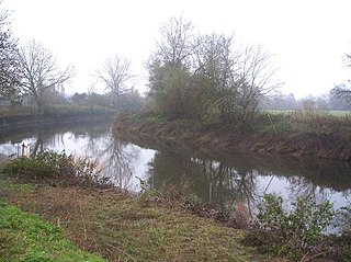
Walham is a village in Longford parish, north of Gloucester, England. It lies on the banks of the River Severn and north of the A40 road.

Dowdeswell Reservoir and former water treatment works lie below the parish of Dowdeswell in Gloucestershire. They were originally built by Cheltenham Corporation to supply the town of Cheltenham with drinking water and subsequently became part of the Severn Trent network.

The Tewkesbury and Malvern Railway was a branch of the Midland Railway which ran from Ashchurch via Tewkesbury to Great Malvern in the United Kingdom. It was opened on 16 May 1864. At grouping in 1923 it became part of the London Midland and Scottish Railway.

The Mythe Chapel is located at Tewkesbury on the Mythe. The Mythe Chapel was the only place of worship on the Mythe after the Dissolution. The chapel was built in 1870 with funds from the Marquis de Lys who had lived in Tewkesbury since 1863. An old group of stables originally occupied the site and were partly incorporated into the new building to which windows, niches and buttresses were added.

Mythe Railway Nature Reserve is a 2.8-hectare (6.9-acre) nature reserve in Gloucestershire. The site is listed in the ‘Tewkesbury Borough Local Plan to 2011’, adopted March 2006, Appendix 3 'Nature Conservation',' as a Key Wildlife Site (KWS).

The Battle of Ripple Field, fought on 13 April 1643, was an engagement in the First English Civil War. In the battle, a Royalist cavalry force led by Prince Maurice routed Parliamentarian cavalry and infantry forces led by Sir William Waller.

Llandinam Bridge is a single-arch cast-iron Grade II*-listed bridge located in Llandinam, Powys, Wales. Constructed in 1846, it was the first cast-iron bridge in the county of Montgomeryshire, and was designed by Thomas Penson to replace an earlier timber bridge.
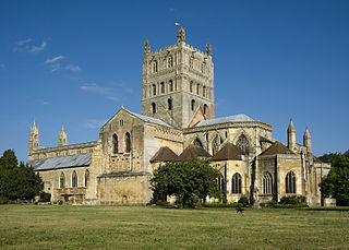
The Borough of Tewkesbury is a local government district with borough status in Gloucestershire, England. The borough is named after its largest town, Tewkesbury, which is where the council is based. The district also includes the town of Winchcombe and numerous villages including Bishops Cleeve, Ashchurch, Churchdown, Innsworth and Brockworth as well as other hamlets and surrounding rural areas. Parts of the district lie within the Cotswolds Area of Outstanding Natural Beauty.


