Related Research Articles
The Global Positioning System (GPS), originally Navstar GPS, is a satellite-based radio navigation system owned by the United States government and operated by the United States Space Force. It is one of the global navigation satellite systems (GNSS) that provide geolocation and time information to a GPS receiver anywhere on or near the Earth where there is an unobstructed line of sight to four or more GPS satellites. It does not require the user to transmit any data, and operates independently of any telephone or Internet reception, though these technologies can enhance the usefulness of the GPS positioning information. It provides critical positioning capabilities to military, civil, and commercial users around the world. Although the United States government created, controls and maintains the GPS system, it is freely accessible to anyone with a GPS receiver.
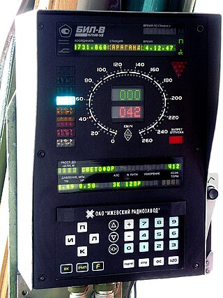
GLONASS is a Russian satellite navigation system operating as part of a radionavigation-satellite service. It provides an alternative to Global Positioning System (GPS) and is the second navigational system in operation with global coverage and of comparable precision.

An emergency position-indicating radiobeacon (EPIRB) is a type of emergency locator beacon for commercial and recreational boats, a portable, battery-powered radio transmitter used in emergencies to locate boaters in distress and in need of immediate rescue. In the event of an emergency, such as a ship sinking or medical emergency onboard, the transmitter is activated and begins transmitting a continuous 406 MHz distress radio signal, which is used by search-and-rescue teams to quickly locate the emergency and render aid. The signal is detected by satellites operated by an international consortium of rescue services, COSPAS-SARSAT, which can detect emergency beacons anywhere on Earth transmitting on the distress frequency of 406 MHz. The satellites calculate the position or utilize the GPS coordinates of the beacon and quickly passes the information to the appropriate local first responder organization, which performs the search and rescue. As Search and Rescue approach the search areas, they use Direction Finding (DF) equipment to locate the beacon using the 121.5 MHz homing signal, or in newer EPIRBs, the AIS location signal. The basic purpose of this system is to help rescuers find survivors within the so-called "golden day" during which the majority of survivors can usually be saved. The feature distinguishing a modern EPIRB, often called GPIRB, from other types of emergency beacon is that it contains a GPS receiver and broadcasts its position, usually accurate within 100 m (330 ft), to facilitate location. Previous emergency beacons without a GPS can only be localized to within 2 km (1.2 mi) by the COSPAS satellites and relied heavily upon the 121.5 MHz homing signal to pin-point the beacons location as they arrived on scene.
Automatic vehicle location is a means for automatically determining and transmitting the geographic location of a vehicle. This vehicle location data, from one or more vehicles, may then be collected by a vehicle tracking system to manage an overview of vehicle travel. As of 2017, GPS technology has reached the point of having the transmitting device be smaller than the size of a human thumb, able to run 6 months or more between battery charges, easy to communicate with smartphones — all for less than $20 USD.

Telematics is an interdisciplinary field encompassing telecommunications, vehicular technologies, electrical engineering, and computer science. Telematics can involve any of the following:

A satellite navigation or satnav system is a system that uses satellites to provide autonomous geopositioning. A satellite navigation system with global coverage is termed global navigation satellite system (GNSS). As of 2024, four global systems are operational: the United States's Global Positioning System (GPS), Russia's Global Navigation Satellite System (GLONASS), China's BeiDou Navigation Satellite System (BDS), and the European Union's Galileo.

The automatic identification system (AIS) is an automatic tracking system that uses transceivers on ships and is used by vessel traffic services (VTS). When satellites are used to receive AIS signatures, the term Satellite-AIS (S-AIS) is used. AIS information supplements marine radar, which continues to be the primary method of collision avoidance for water transport. Although technically and operationally distinct, the ADS-B system is analogous to AIS and performs a similar function for aircraft.
A GPS tracking unit, geotracking unit, satellite tracking unit, or simply tracker is a navigation device normally on a vehicle, asset, person or animal that uses satellite navigation to determine its movement and determine its WGS84 UTM geographic position (geotracking) to determine its location. Satellite tracking devices may send special satellite signals that are processed by a receiver.
A navigation system is a computing system that aids in navigation. Navigation systems may be entirely on board the vehicle or vessel that the system is controlling or located elsewhere, making use of radio or other signal transmission to control the vehicle or vessel. In some cases, a combination of these methods is used.
Augmentation of a global navigation satellite system (GNSS) is a method of improving the navigation system's attributes, such as precision, reliability, and availability, through the integration of external information into the calculation process. There are many such systems in place, and they are generally named or described based on how the GNSS sensor receives the external information. Some systems transmit additional information about sources of error, others provide direct measurements of how much the signal was off in the past, while a third group provides additional vehicle information to be integrated in the calculation process.

The Indian Regional Navigation Satellite System (IRNSS), with an operational name of NavIC, is an autonomous regional satellite navigation system that provides accurate real-time positioning and timing services. It covers India and a region extending 1,500 km (930 mi) around it, with plans for further extension up to 3,000 km (1,900 mi). An extended service area lies between the primary service area and a rectangle area enclosed by the 30th parallel south to the 50th parallel north and the 30th meridian east to the 130th meridian east, 1,500–6,000 km (930–3,730 mi) beyond borders where some of the NavIC satellites are visible but the position is not always computable with assured accuracy. The system currently consists of a constellation of eight satellites, with two additional satellites on ground as stand-by.

A satellite navigation device, satnav device or satellite navigation receiver is a user equipment that uses one or more of several global navigation satellite systems (GNSS) to calculate the device's geographical position and provide navigational advice. Depending on the software used, the satnav device may display the position on a map, as geographic coordinates, or may offer routing directions.

GLONASS-K is the latest satellite design intended as a part of the Russian GLONASS radio-based satellite navigation system. Developed by ISS Reshetnev and first launched on 26 February 2011, it is a substantial improvement of the previous GLONASS-M second-generation satellites, having a longer lifespan and better accuracy.
NVS may refer to:

GLONASS-M, also known as Uragan-M are the second generation of Uragan satellite design used as part of the Russian GLONASS radio-based satellite navigation system. Developed by ISS Reshetnev, it had its debut launch in 2003, and is in the process of being phased out. Its production finished in 2015 and its last launch was in November 2022. It is an evolution of the previous Uragan second-generation satellites, improving accuracy, increasing power, extending the design life and adding the FDMA L2OF open signal. The last eight Glonass-M spacecraft in production included the new CDMA L3OC open signal.
A vehicle tracking system combines the use of automatic vehicle location in individual vehicles with software that collects these fleet data for a comprehensive picture of vehicle locations. Modern vehicle tracking systems commonly use GPS or GLONASS technology for locating the vehicle, but other types of automatic vehicle location technology can also be used. Vehicle information can be viewed on electronic maps via the Internet or specialized software. Urban public transit authorities are an increasingly common user of vehicle tracking systems, particularly in large cities.
KLUB is the name of the modern Russian train control systems. The abbreviation "КЛУБ" stands for "Комплексное локомотивное устройство безопасности", Integrated Train Protection System.

The satellite navigation system GLONASS was conceived in the late 1960s, and formal requirements were completed in 1970. The government of the Soviet Union made a decision to develop the system in 1976. Design work was carried out by specialists led by Vladimir Cheremisin at NPO PM in Krasnoyarsk-26. The first launch took place in 1982. Until its dissolution in 1991, the Soviet Union launched 43 GLONASS-related satellites. Work on the system was continued by the Russian Federation which brought it its full operational capability in 1995. In the following years, the system fell into disrepair due to the economic crisis in the country and diminished space funding. Starting from 2000, the government under President Vladimir Putin made the restoration of GLONASS a top priority; its funding was doubled and after a lull of several years, launches were restarted again. In 2003, a new satellite design, GLONASS-M, was introduced. By early 2011, GLONASS had 22 operational satellites, two short of the required constellation of 24 to provide global coverage. The latest and significantly improved satellite type, GLONASS-K, was launched in February 2011.

GLONASS-K2 is the next-generation satellite design intended to support the Russian GLONASS radio-based satellite navigation system. Developed by ISS Reshetnev, the first satellite was successfully launched on 7 August 2023 from the Plesetsk Cosmodrome with an expected production period of ten years. It is an evolution of the previous GLONASS-K third-generation satellites, adding CDMA signals, improving accuracy and increasing power. It is 70% heavier and has 170% more power.
Emergency response systems are means for emergency response teams to locate and move resources to emergency sites.
References
- ↑ Scientific and technical magazine T-Comm Archived 2013-05-25 at the Wayback Machine , Scientific and technical magazine T-Comm Telecommunications and transport, 2012.
- ↑ Equipment for ERA GLONASS project, intersectional magazine of navigation technologies «Vestnik GLONASS», 2 august 2013.
- ↑ "Equipment for ERA GLONASS project, RNSinfo, Russian Navigation Systems, 3 august 2013г". Archived from the original on 10 June 2015. Retrieved 23 October 2013.
- ↑ GOST P ISO 9000-2008, National standards, Federal Agency for Technical Regulation and Metrology.
| | This Russian corporation or company article is a stub. You can help Wikipedia by expanding it. |