Virginia Falls Water Aerodrome is located on the South Nahanni River approximately 1,300 ft (396 m) upstream from Virginia Falls, Northwest Territories, Canada. It is open from early May until mid-October.
Nahanni Butte Airport is a public aerodrome located near Nahanni Butte, Northwest Territories, Canada, east of the Nahanni National Park Reserve.
Bird River Airport is a registered aerodrome located 2 nautical miles northeast of Lac du Bonnet, Manitoba, Canada. Bird River Water Aerodrome is located at the mouth of the Bird River on Lac du Bonnet. The aerodrome is located on the south east side of Highway 315.

North-Wright Airways is an airline based in Norman Wells, Northwest Territories, Canada. It operates commuter services to several communities in the Northwest Territories, and charter services. Its main base is Norman Wells Airport and they operate the Norman Wells Water Aerodrome.

Nahanni Butte is a "Designated Authority" in the Dehcho Region of the Northwest Territories, Canada. The community is located at the confluence of the Liard and South Nahanni Rivers in the southwestern part of the NWT.

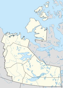
The South Nahanni River is a major tributary of the Liard River, located roughly 500 km (310 mi) west of Yellowknife in the Northwest Territories of Canada. It is the centerpiece of Nahanni National Park Reserve. It flows from the Mackenzie Mountains in the west, through the Selwyn Mountains, growing as it heads east over the majestic Virginia Falls, and finally empties into the Liard River. The Nahanni has a unique geological history. It was formed when the area was a broad flat plain, forming a winding course typical of flatland rivers. As the mountains lifted, the river cut four deep canyons into the rock, maintaining its eccentric course.