The City Circle is a mostly-underground railway line located in the Sydney central business district and Haymarket, in New South Wales, Australia, that forms the core of Sydney's passenger rail network. The lines are owned by the Transport Asset Holding Entity, a State government agency, and operated under Transport for NSW's Sydney Trains brand. Despite its name, the City Circle is of a horseshoe shape, with trains operating in a U-shaped pattern. The constituent stations of the Circle are (clockwise): Central, Town Hall, Wynyard, Circular Quay, St James, Museum and back to Central.

Temora is a town in the north-east of the Riverina area of New South Wales, 418 kilometres (260 mi) south-west of the state capital, Sydney. At the 2016 census the population of Temora was 4,693.
Weemelah is a small village in Moree Plains Shire, New South Wales, Australia. It is 3 km north off the Carnarvon Highway and 27 km east of Mungindi. At the 2006 census, Weemelah had a population of 139.

The Main Southern Railway is a major railway in New South Wales, Australia. It runs from Sydney to Albury, near the Victorian border. The line passes through the Southern Highlands, Southern Tablelands, South West Slopes and Riverina regions.
The Main Western Railway is a major railway in New South Wales, Australia. It runs through the Blue Mountains, Central West, North West Slopes and the Far West regions. It is 825 kilometres (513 mi) with 484 kilometres (301 mi) operational & 341 kilometres (212 mi) under construction & repairs.

Rankins Springs is a village in the Riverina region of New South Wales, Australia in Carrathool Shire and on the Mid-Western Highway. At the 2011 census, Rankins Springs had a population of 299 residents living in 145 private dwellings. The settlement is strung out along the Mid-Western Highway and adjacent railway line. The main agricultural activities of the district around Rankins Springs are the growing of crops such as wheat and oats, and beef-cattle and wool-production.

Ungarie is a town in New South Wales, Australia which is the second major town of the Bland Shire, located in the Central West region of New South Wales. It is located 513 kilometres (319 mi) west of Sydney and 615 kilometres (382 mi) north of Melbourne, between the towns of West Wyalong and Lake Cargelligo and is situated 262 metres (860 ft) above sea level. The town's name is derived from an Indigenous Australian word meaning "thigh".

The Lake Cargelligo railway line is a railway line in Central Western New South Wales, Australia. The first sod was turned commencing construction on 8 June 1913 with the line opening on 13 November 1917. The line branches from the Main South line at Cootamundra and travels in a north-westerly direction to the small town of Lake Cargelligo. The line is used primarily for grain haulage, although passenger service was provided until 1983.
The Rankins Springs railway line is a closed railway line in southwestern New South Wales, Australia. The line branched from the Lake Cargelligo line at the town of Barmedman, heading in a westerly direction to the town of Rankins Springs. It opened in 1923, and was constructed primarily to open up the agricultural areas in the vicinity. Passenger services were operated by CPH railmotors until the widespread withdrawal of country branchline trains in 1974. The line carried approximately 80,000 tonnes of grain per year, before being 'mothballed' in 2004.

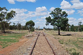
The Burcher railway line is a partly closed railway line in New South Wales, Australia, branching from the Cootamundra to Lake Cargelligo line at Wyalong Central.

Barmedman is a rural village in the Bland Shire in the New South Wales state of Australia, located approximately half-way between West Wyalong and Temora. Barmedman began as a service centre for gold-mining operations in the area. Nowadays the local district has an agricultural economic base, including wheat and canola cropping and sheep grazing. It is the home of two large wheat silos with a combined capacity of over a million bushels. At the 2011 census, Barmedman had a population of 212. The township's name is derived from an Aboriginal word meaning 'long water'.

The Boorowa railway line is a closed railway line in New South Wales, Australia. The line ran for 29 km (18 mi) north to the town of Boorowa from the Main South railway line at Galong.
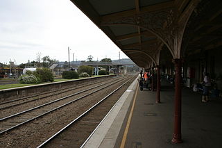
Cootamundra railway station is located on the Main South line in New South Wales, Australia. It serves the town of Cootamundra. The property was added to the New South Wales State Heritage Register on 2 April 1999.

The Temora railway station is a heritage-listed former railway station and now youth hub and mixed-use building located on the Lake Cargelligo railway line in Temora in the Temora Shire local government area of New South Wales, Australia. The station was built from 1893 to 1915 and served the Riverina town of Temora between 1 September 1893 until its closure for passenger services in the late 1970s. The station is also known as the Temora Railway Station group. The property was added to the New South Wales State Heritage Register on 2 April 1999.

Naradhan is a village and locality in the Central West region of New South Wales Australia. The locality is 452 kilometres (281 mi) from Sydney, the state capital. Naradhan is within the Bland Shire local government area. The village was proclaimed in 1930, and features a shop, primary school, public hall, and the now disused railway station. The town was named after Naradhan a grazing run that was in turn probably named for the Wiradjuri term "ngarradan" meaning "bat".

The North Shore & Western Line is a commuter rail line operated by Sydney Trains in Sydney, New South Wales, Australia. It serves the North Shore, parts of the Inner West and Western Suburbs.

Kikoira is a town in the Central West region of New South Wales, Australia. The town is in the Bland Shire local government area 548 kilometres (341 mi) west of the state capital, Sydney.
Yiddah is a locality in New South Wales, Australia. The locality is 474 kilometres (295 mi) west of the state capital, Sydney about midway between the towns of West Wyalong and Barmedman. Yiddah is in the Bland Shire local government area and Bland county cadastral area.
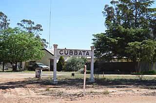
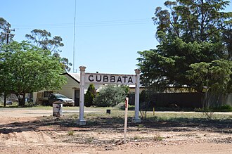
Gubbata is a locality in the Central West region of New South Wales. The locality is in the Bland Shire local government area 432 kilometres (268 mi) west of the state capital, Sydney.
Youngareen is a civil parish in Gipps County, in the Riverina region of New South Wales.