Naselle River

Last updated
Naselle River
Naselle River seen from US 101.JPG
Naselle River as seen from US 101, looking south, a few miles northwest of Naselle
USA Washington relief location map.jpg
Red pog.svg
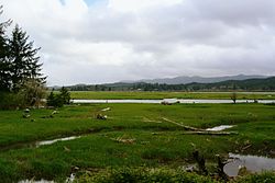
Location of the mouth of the Naselle River in Washington
Location
Country United States
State Washington
County Pacific, Wahkiakum
Physical characteristics
Source 
  location Willapa Hills
  coordinates 46°28′8″N123°33′14″W / 46.46889°N 123.55389°W / 46.46889; -123.55389 [1]
Mouth Chelto Harbor
  location
Willapa Bay
  coordinates
46°27′54″N123°56′24″W / 46.46500°N 123.94000°W / 46.46500; -123.94000 [1]
Discharge 
  location river mile 17.4 near Naselle, WA [2]
  average425 cu ft/s (12.0 m3/s) [2]
  minimum18 cu ft/s (0.51 m3/s)
  maximum10,400 cu ft/s (290 m3/s)

The Naselle River is a river in the U.S. state of Washington.

Contents

Course

The Naselle River originates in the Willapa Hills and flows generally west, passing the community of Naselle before emptying into the southern part of Willapa Bay.

Tributaries of the Naselle include, from source to mouth, Alder Creek, North Fork Naselle River, Cedar Creek, Brock Creek, Salmon Creek, Lane Creek, O'Conner Creek, South Naselle River, Johnson Creek, Dell Creek, Petes Creek, Holm Creek, Smith Creek, and Ellsworth Creek. The community of Naselle is located near the confluence of the Naselle and South Naselle Rivers. The broad tidal mouth of the Naselle River is known as Chelto Harbor. [3] The Naselle River was used in a book called our Only May Amelia by Jennifer L. Holm.

History

The river's name has been spelled Nasel and Nasal. An early settler along the river called it the Kenebec. According to Edmond S. Meany the name comes from the Nisal Indians, a Chinookan tribe formerly residing on the river. [4]

The book Our Only May Amelia by Jennifer L. Holm is about a Finnish family who settled along the Nasel River.

See also

Related Research Articles

<span class="mw-page-title-main">Naselle, Washington</span> Place in Washington, United States

Naselle is a census-designated place (CDP) in Pacific County, Washington, United States located about 23 miles (37 km) from the mouth of the Columbia River. The population was 421 at the 2020 census. The valley's Naselle River flows west into nearby Willapa Bay and then into the Pacific Ocean. Close about the town lie the evergreen-covered Willapa Hills. The river's name has been spelled Nasel and Nasal. An early settler along the river called it the Kenebec. The name comes from the Nisal Indians, a Chinookan tribe formerly residing on the river.

<span class="mw-page-title-main">Willapa Bay</span> Estuary in the U.S. state of Washington

Willapa Bay is a bay located on the southwest Pacific coast of Washington state in the United States. The Long Beach Peninsula separates Willapa Bay from the greater expanse of the Pacific Ocean. With over 120 square miles (310 km2) of surface area Willapa Bay is the second-largest riverine estuary on the Pacific coast of the continental United States. Early settlers called the bay Shoalwater Bay and this name is found on old maps and charts of the region.

Grays River is a tributary of the Columbia River, approximately 30 miles (48 km) long, in southwestern Washington in the United States. One of the last tributaries of the Columbia on the Washington side, it drains an area of low hills north of the mouth of the river.

<span class="mw-page-title-main">Willapa River</span> River in Washington, United States

The Willapa River is a river on the Pacific coast of southwestern Washington in the United States, approximately 20 miles (32 km) long. It drains an area of low hills and a coastal plain into Willapa Bay, a large estuary north of the mouth of the Columbia River.

<span class="mw-page-title-main">Moses Lake</span> Natural lake, reservoir in Grant County, Washington

Moses Lake is a lake and reservoir along the course of Crab Creek, in the U.S. state of Washington.

<span class="mw-page-title-main">Jennifer L. Holm</span> American author of childrens books (born 1968)

Jennifer L. Holm is an American children's writer, and recipient of three Newbery Honors and the Eisner Award.

<span class="mw-page-title-main">Methow River</span> River in Washington, United States

The Methow River is a tributary of the Columbia River in northern Washington in the United States. The river's 1,890-square-mile (4,900 km2) watershed drains the eastern North Cascades, with a population of about 5,000 people. The Methow's watershed is characterized by relatively pristine habitats, as much of the river basin is located in national forests and wildernesses. Many tributaries drain the large Pasayten Wilderness. An earlier economy based on agriculture is giving way to one based on recreation and tourism.

<span class="mw-page-title-main">Willapa Hills</span> Geologic, physiographic, and geographic region in southwest Washington, United States

The Willapa Hills is a geologic, physiographic, and geographic region in southwest Washington. When described as a physiographical province, the Willapa Hills are bounded by the Pacific Ocean to the west, the Columbia River to the south, the Olympic Mountains to the north, and the Cascade Range to the east. Some definitions place the Puget Lowland physiographic province east of the Willapa Hills. Included within the province are the Black Hills, the Doty Hills, and a number of broad river valleys, some of which open up into broad estuaries on the Pacific such as Grays Harbor and Willapa Bay. Other definitions do not include the Black Hills. The USGS GNIS defines the Willapa Hills as bounded by the Columbia River to the south and the Chehalis River to the north, without giving specific east and west bounds. The Willapa Hills are one of the Pacific Coast Ranges, which continue north as the Olympic Mountains and south, across the Columbia River, as the Oregon Coast Range.

Doty, Washington is an unincorporated community located 1.3-miles directly west of Dryad and 5 miles east of Pe Ell on Washington State Route 6. As of 2023, approximately 250 people reside in or around Doty, which boasts a general store, post office, fire department, and two churches. Logging and farming are the industries that most of the residents rely on for income.

Lake River is a tributary, about 11 miles (18 km) long, of the Columbia River in the U.S. state of Washington. It flows north from Vancouver Lake in Vancouver to meet the larger river near Ridgefield and the northern tip of Bachelor Island. The Wilkes Expedition of 1841 referred to Lake River as Calipaya Inlet.

Menlo is a small unincorporated community in the Willapa Valley of Pacific County, Washington, United States. The community is home to a general store and post office, the Pacific County Fairgrounds and a secondary/high school — Willapa Valley High School.

<span class="mw-page-title-main">Hooper, Washington</span> Unincorporated community in Washington, United States

Hooper is an unincorporated community in Whitman County, Washington, United States.

<span class="mw-page-title-main">Tilton River</span> River in Washington, United States

The Tilton River is a tributary of the Cowlitz River, in the U.S. state of Washington. Named for territorial surveyor James Tilton, it flows for about 29 miles (47 km), entirely within Lewis County.

The Palix River is a stream in the U.S. state of Washington. Its tributaries include three forks, North, Middle, and South Fork Palix River, as well as the Canon River. The river's length, including the Canon River, its longest tributary, is approximately 14 miles (23 km).

The Dewatto River is a stream in the U.S. state of Washington. It originates in western Kitsap Peninsula and flows south, emptying into Hood Canal. The name "Dewatto" comes from the Twana placename [duʔwátaxʷ], which implies the presence of spirits causing mental derangement near the stream's mouth.

<span class="mw-page-title-main">Neepaulakating Creek</span> Tributary of Papakating Creek

Neepaulakating Creek is a 2.4-mile long (3.8 km) tributary of Papakating Creek in Wantage Township in Sussex County, New Jersey in the United States. It is one of three streams feeding the Papakating Creek, a major contributor to the Wallkill River. Although the stream was dammed in the 1950s to create Lake Neepaulin as the focal point of a private residential development, the stream did not receive a name until 2002. Residents chose a name that combined elements of the names "Neepaulin" and "Papakating", and submitted a proposal to the United States Board of Geographic Names. The name was approved in 2004.

<span class="mw-page-title-main">Lucerne, Washington</span> Unincorporated community in Washington, United States

Lucerne is an unincorporated community in Chelan County, Washington, United States. Lucerne is assigned the ZIP code 98816.

Johns River is a short tidal river flowing into the south end of Grays Harbor in the U.S. state of Washington.

The Cedar River is a short stream flowing into the north end of Willapa Bay in the U.S. state of Washington.

References

  1. 1 2 U.S. Geological Survey Geographic Names Information System: Naselle River
  2. 1 2 "Water Resources Data-Washington Water Year 2005; Naselle and Willapa River Basins; 12010000 Naselle River near Naselle, WA" (PDF). United States Geological Survey. Retrieved 2009-05-19.
  3. Course info mainly from USGS topographic maps accessed via the "GNIS in Google Map" feature of the USGS Geographic Names Information System website.
  4. Meany, Edmond S. (1921). "Origin of Washington Geographic Names". The Pacific Northwest Quarterly. X–XI. Washington University State Historical Society: 278. Retrieved 2009-06-11.