Related Research Articles

A digital elevation model (DEM) is a 3D computer graphics representation of elevation data to represent terrain, commonly of a planet, moon, or asteroid. A "global DEM" refers to a discrete global grid. DEMs are used often in geographic information systems, and are the most common basis for digitally produced relief maps.

Precision agriculture (PA), satellite farming or site specific crop management (SSCM) is a farming management concept based on observing, measuring and responding to inter and intra-field variability in crops. The goal of precision agriculture research is to define a decision support system (DSS) for whole farm management with the goal of optimizing returns on inputs while preserving resources.

The Landsat program is the longest-running enterprise for acquisition of satellite imagery of Earth. It is a joint NASA / USGS program. On 23 July 1972, the Earth Resources Technology Satellite was launched. This was eventually renamed to Landsat 1 in 1975. The most recent, Landsat 8, was launched on 11 February 2013.

Photogrammetry is the science and technology of obtaining reliable information about physical objects and the environment through the process of recording, measuring and interpreting photographic images and patterns of electromagnetic radiant imagery and other phenomena.

The Farm Security Administration (FSA) was a New Deal agency created in 1937 to combat rural poverty during the Great Depression in the United States. It succeeded the Resettlement Administration (1935–1937).

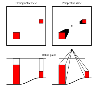
An orthophoto, orthophotograph or orthoimage is an aerial photograph or satellite imagery geometrically corrected ("orthorectified") such that the scale is uniform: the photo or image follows a given map projection. Unlike an uncorrected aerial photograph, an orthophoto can be used to measure true distances, because it is an accurate representation of the Earth's surface, having been adjusted for topographic relief, lens distortion, and camera tilt.

DigitalGlobe is an American commercial vendor of space imagery and geospatial content, and operator of civilian remote sensing spacecraft. The company went public on the New York Stock Exchange on 14 May 2009, selling 14.7 million shares at $19.00 each to raise $279 million in capital. On 5 October 2017, Maxar Technologies completed its acquisition of DigitalGlobe.

Spot Image, a public limited company created in 1982 by the French Space Agency, Centre National d'Etudes Spatiales (CNES), the IGN, and Space Manufacturers is a subsidiary of Airbus Defence and Space (99%). The company is the commercial operator for the SPOT Earth observation satellites.

NASA WorldWind is an open-source virtual globe. It was first developed by NASA in 2003 for use on personal computers and then further developed in concert with the open source community since 2004. As of 2017, a web-based version of WorldWind is available online. An Android version is also available.

Aerial survey is a method of collecting geomatics or other imagery by using airplanes, helicopters, UAVs, balloons or other aerial methods. Typical types of data collected include aerial photography, Lidar, remote sensing and also geophysical data (such as aeromagnetic surveys and gravity. It can also refer to the chart or map made by analysing a region from the air. Aerial survey should be distinguished from satellite imagery technologies because of its better resolution, quality and atmospheric conditions. Today, aerial survey is sometimes recognized as a synonym for aerophotogrammetry, part of photogrammetry where the camera is placed in the air. Measurements on aerial images are provided by photogrammetric technologies and methods.

Satellite images are images of Earth collected by imaging satellites operated by governments and businesses around the world. Satellite imaging companies sell images by licensing them to governments and businesses such as Apple Maps and Google Maps. It should not be confused for astronomy images collected by space telescope.
GlobeXplorer was an online spatial data company that compiled and distributed aerial photos, satellite imagery, and map data from their online spatial archives. GlobeXplorer has been credited as the first company to establish a business around compiling and distributing online aerial and satellite imagery. In 2007, the company was acquired by DigitalGlobe.

Bing Maps is a web mapping service provided as a part of Microsoft's Bing suite of search engines and powered by the Bing Maps for Enterprise framework.

GeoEye Inc. was an American commercial satellite imagery company based in Herndon, Virginia. GeoEye was merged into the DigitalGlobe corporation January 29, 2013.

RemoteView is the family name of a group of software programs designed by Textron Systems Geospatial Solutions to aid in analyzing satellite or aerial images of the Earth's surface for the purpose of collecting and disseminating geospatial intelligence. The National Geospatial-Intelligence Agency (NGA) was a user of RemoteView software.
IMAGINE Photogrammetry is a software application for performing photogrammetric operations on imagery and extracting information from imagery. IMAGINE Photogrammetry is significant because it is a leading commercial photogrammetry application that is used by numerous national mapping agencies, regional mapping authorities, various DOTs, as well as commercial mapping firms. Aside from commercial and government applications, IMAGINE Photogrammetry is widely used in academic research. Research areas include landslide monitoring, cultural heritage studies, and more.
NAIP may refer to:

Nearmap Limited is an Australian aerial imagery technology and location data company that provides frequently-updated, high-resolution aerial imagery of 88% of Australia's population, 68% of the United States population, and 72% of the New Zealand population.

Windows Maps, and its predecessor Maps, are web mapping client software for the Bing Maps service. The Maps app is included with Windows 8 and Windows 8.1, while Windows Maps is included with Windows 10 and is available for Xbox One.
PrecisionHawk is a commercial drone and data company. Founded in 2010, PrecisionHawk is headquartered in Raleigh, North Carolina with another global office in Toronto, Canada and satellite offices around the world. PrecisionHawk is a manufacturer of drones (Lancaster) and has more recently focused heavily on developing software for aerial data analysis (DataMapper) and drone safety systems (LATAS). PrecisionHawk is a member of the U.S. Federal Aviation Administration Pathfinder Initiative and the NASA UTM Program. An angel investor in the company, Bob Young, founder of Red Hat, became CEO in August 2015. In August 2016, PrecisionHawk became the first U.S. company to receive an FAA exemption to commercially fly drones beyond the operator's visual line of sight.
References
- 1 2 3 4
 This article incorporates public domain material from the United States Department of Agriculture document: the Farm Service Agency . "National Agriculture Imagery Program (NAIP)" . Retrieved 2018-01-03.
 - ↑ "NAIP Coverage 2002 - 2016" (PDF). Farm Services Agency, US Department of Agriculture. Retrieved 3 January 2018.
- 1 2 Grant, Simone (2018-07-13). "National Agriculture Imagery Program: FY2019 Plan Update". GeoPlatform, Federal Geographic Data Committee. Retrieved 12 October 2018.
- ↑ Mootz, John (2017-11-14). "2019 NAIP" (PDF). Farm Services Agency, US Department of Agriculture. Retrieved 3 January 2018.