Related Research Articles

Accessibility is the design of products, devices, services, vehicles, or environments so as to be usable by people with disabilities. The concept of accessible design and practice of accessible development ensures both "direct access" and "indirect access" meaning compatibility with a person's assistive technology.
Computer accessibility refers to the accessibility of a computer system to all people, regardless of disability type or severity of impairment. The term accessibility is most often used in reference to specialized hardware or software, or a combination of both, designed to enable the use of a computer by a person with a disability or impairment. Computer accessibility often has direct positive effects on people with disabilities.

A public toilet, restroom, public bathroom or washroom is a room or small building with toilets and sinks for use by the general public. The facilities are available to customers, travelers, employees of a business, school pupils and prisoners and are commonly separated into male and female toilets, although some are unisex, especially for small or single-occupancy public toilets.

Google Maps is a web mapping platform and consumer application offered by Google. It offers satellite imagery, aerial photography, street maps, 360° interactive panoramic views of streets, real-time traffic conditions, and route planning for traveling by foot, car, bike, air and public transportation. As of 2020, Google Maps was being used by over one billion people every month around the world.

iOS is a mobile operating system developed by Apple Inc. exclusively for its hardware. It is the operating system that powers many of the company's mobile devices, including the iPhone; the term also includes the system software for iPads as well as on the iPod Touch devices. It is the world's second-most widely installed mobile operating system, after Android. It is the basis for three other operating systems made by Apple: iPadOS, tvOS, and watchOS. It is proprietary software, although some parts of it are open source under the Apple Public Source License and other licenses.
Broadband.gov was a website run by the Federal Communications Commission of the United States that reports Internet access around the country. The FCC used the website to document the National Broadband Plan and its implementation, and inform the public about room for improvement by both Internet service providers and users.

iCloud is a cloud service developed by Apple Inc. Launched on October 12, 2011, iCloud enables users to store and sync data across devices, including Apple Mail, Apple Calendar, Apple Photos, Apple Notes, contacts, settings, backups, and files, to collaborate with other users, and track assets through Find My. It is built into iOS, iPadOS, watchOS, tvOS and macOS and may additionally be accessed through a limited web interface and Windows application.

iMessage is an instant messaging service developed by Apple Inc. and launched in 2011. iMessage functions exclusively on Apple platforms: macOS, iOS, iPadOS, and watchOS.
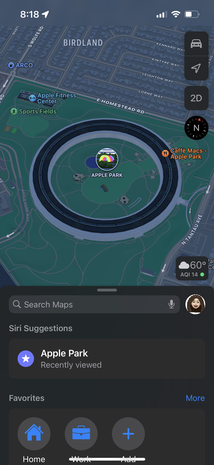
Apple Maps is a web mapping service developed by Apple Inc. The default map system of iOS, iPadOS, macOS, and watchOS, it provides directions and estimated times of arrival for driving, walking, cycling, and public transportation navigation. A "Flyover" mode shows certain densely populated urban centers and other places of interest in a 3D landscape composed of models of buildings and structures.
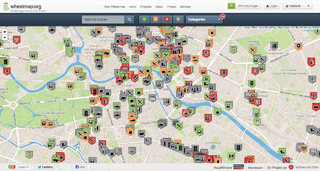
Wheelmap.org is an online, worldwide map for finding and marking wheelchair accessible places, developed by the German nonprofit organisation Sozialhelden e.V. Anyone can find and add public places to the map and rate them according to a simple traffic light system. The map, which is based on OpenStreetMap, was created in 2010 by a team around social entrepreneur Raul Krauthausen to help people who use wheelchairs or wheeled walkers to plan their days more easily. Parents pushing a baby carriage can also benefit from the Wheelmap information. Currently almost 600,000 public places worldwide can be found on the map. About 300 new places are added on a daily basis. Wheelmap is available on the website and as an app for iOS, Android and Windows Phone.
Accessibility apps are mobile apps that increase the accessibility of a device for individuals with disabilities. Accessibility apps are applications that increase the accessibility of a device or technology for individuals with disabilities. Applications, also known as, application software, are programs that are designed for end users to be able to perform specific tasks. There are many different types of apps, some examples include, word processors, web browsers, media players, console games, photo editors, accounting applications and flight simulators. Accessibility in general refers to making the design of products and environment more accommodating to those with disabilities. Accessibility apps can also include making a current version of software or hardware more accessible by adding features. Accessibility apps main aim is to remove any barriers to technological goods and services, making the app available to any group of society to use. A basic example is that a person who experiences vision impairments is able to access technology through enabling voice recognition and text-to-speech software. Accessibility apps are closely related to assistive technology.

Aged care in Australia, is the provision of services to meet the unique needs of older people in Australia. It includes both residential aged care as well as services provided in the home such as personal care, domestic assistance, home nursing, nutrition and meal preparation, respite services, continence management, mobility & dexterity assistance, transport, social support and the provision of equipment and aids.

My Health Record (MHR) is the national digital health record platform for Australia, and is managed by the Australian Digital Health Agency. It was originally established as the Personally Controlled Electronic Health Record (PCEHR), a shared electronic health summary set up by the Australian government with implementation overseen by the National Electronic Health Transition Authority (NEHTA). The purpose of the MHR is to provide a secure electronic summary of people's medical history which will eventually include information such as current medications, adverse drug reactions, allergies and immunisation history in an easily accessible format. This MHR is stored in a network of connected systems with the ability to improve the sharing of information amongst health care providers to improve patient outcomes no matter where in Australia a patient presents for treatment. PCEHR was an opt-in system with a unique individual healthcare identifier (IHI) being assigned to participants and the option of masking and limiting information available for viewing controlled by the patient or a nominated representative; MHR uses an opt-out system.

iOS 14 is the fourteenth major release of the iOS mobile operating system developed by Apple Inc. for their iPhone and iPod Touch lines. Announced at the company's Worldwide Developers Conference on June 22, 2020 as the successor to iOS 13, it was released to the public on September 16, 2020. It was succeeded by iOS 15 on September 20, 2021.

The (Google/Apple) Exposure Notification (GAEN) system, originally known as the Privacy-Preserving Contact Tracing Project, is a framework and protocol specification developed by Apple Inc. and Google to facilitate digital contact tracing during the COVID-19 pandemic. When used by health authorities, it augments more traditional contact tracing techniques by automatically logging close approaches among notification system users using Android or iOS smartphones. Exposure Notification is a decentralized reporting protocol built on a combination of Bluetooth Low Energy technology and privacy-preserving cryptography. It is an opt-in feature within COVID-19 apps developed and published by authorized health authorities. Unveiled on April 10, 2020, it was made available on iOS on May 20, 2020 as part of the iOS 13.5 update and on December 14, 2020 as part of the iOS 12.5 update for older iPhones. On Android, it was added to devices via a Google Play Services update, supporting all versions since Android Marshmallow.

COVIDSafe was a digital contact tracing app released by the Australian Government on 26 April 2020 to help combat the ongoing COVID-19 pandemic. The app was intended to augment traditional contact tracing by automatically tracking encounters between users and later allowing a state or territory health authority to warn a user they have come within 1.5 metres with an infected person for 15 minutes or more. To achieve this, it used the BlueTrace and Herald protocol, originally developed by the Singaporean Government and VMWare respectively, to passively collect an anonymised registry of near contacts. The efficacy of the app was questioned over its lifetime, ultimately identifying just 2 confirmed cases by the time it was decommissioned on 16 August 2022.
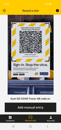
NZ COVID Tracer is a mobile software application that enables a person to record places they have visited, in order to facilitate tracing who may have been in contact with a person infected with the COVID-19 virus. The app allows users to scan official QR codes at the premises of businesses and other organisations they visit, to create a digital diary. It was launched by New Zealand's Ministry of Health on 20 May 2020, during the ongoing COVID-19 pandemic. It can be downloaded from the App Store and Google Play.

Pre-installed iOS apps, referred to in the App Store as 'Built-In Apps', are a suite of mobile applications developed by Apple Inc. which are bundled with iOS and installed by default or through a system update. Many of the default apps found on iOS have counterparts on Apple's other operating systems macOS, iPadOS, watchOS, and tvOS, which are often modified versions of or similar to the iOS application. As each app is integrated into the operating system itself, they often feature greater support for system features than third-party alternatives and are quick to adapt new features of iOS.

iOS 15 is the fifteenth major release of the iOS mobile operating system developed by Apple for its iPhone and iPod Touch lines of products. It was announced at the company's Worldwide Developers Conference on June 7, 2021, as the successor to iOS 14, and released to the public on September 20, 2021.

iOS 16 is the latest major release of Apple's iOS mobile operating system for the iPhone. It is the successor of iOS 15, and was announced at the company's Worldwide Developers Conference (WWDC) on June 6, 2022 alongside iPadOS 16, and released on September 12, 2022.
References
- ↑ "Minister puts public toilets on the map". Media release and speech archive. Australian Government: Department of Health and Aged Care. 2001. Archived from the original on 26 November 2012. Retrieved 29 August 2008.
- ↑ "About the National Toilet Map". The National Toilet Map. Australian Government: Department of Health and Ageing. 2006. Archived from the original on 12 February 2006. Retrieved 14 April 2006.
- ↑ "MLAK Frequently Asked Questions" (PDF). The Wheelie's Handbook of Australia. Archived from the original (PDF) on 29 September 2007. Retrieved 14 April 2006.
- ↑ "Symbols". The National Toilet Map. Australian Government: Department of Health and Ageing. 2006. Archived from the original on 19 August 2006. Retrieved 15 April 2006.