National Register of Historic Places listings in East Hampton (town), New York

Last updated

Map all coordinates using: OpenStreetMap

This list is intended to provide a comprehensive listing of entries in the National Register of Historic Places in the Town of East Hampton, New York. The locations of National Register properties for which the latitude and longitude coordinates are included below, may be seen in an online map. [1]

Contents

Listings

[2] Name on the RegisterImageDate listed [3] Location City or townDescription
1 Amagansett U.S. Life-Saving and Coast Guard Station
Amagansett U.S. Life-Saving and Coast Guard Station US Coast Guard station, Amagansett, New York - 20070609 crop.jpg
Amagansett U.S. Life-Saving and Coast Guard Station
July 27, 2018
(#100002743)
160 Atlantic Ave.
40°58′13″N72°07′31″W / 40.9704°N 72.1253°W / 40.9704; -72.1253 (Amagansett U.S. Life-Saving and Coast Guard Station)
Amagansett One of 20 such stations built by 1902 using the Quonochontaug Type; station's agents played a key role in 1942 interception of German saboteurs.
2 AN/FPS-35 Radar Tower and Antenna
AN/FPS-35 Radar Tower and Antenna Montauk1.jpg
AN/FPS-35 Radar Tower and Antenna
June 4, 2002
(#02000615)
Montauk Point State Parkway
41°03′45″N71°52′28″W / 41.0625°N 71.874444°W / 41.0625; -71.874444 (AN/FPS-35 Radar Tower and Antenna)
Montauk Only surviving long-range radar station of 12 built by Sperry Corporation in the 1960s
3 Caleb Bragg Estate
Caleb Bragg Estate Caleb-bragg-estate.jpg
Caleb Bragg Estate
November 2, 1987
(#87001895)
Star Island Road
41°04′19″N71°56′02″W / 41.0719°N 71.9339°W / 41.0719; -71.9339 (Caleb Bragg Estate)
Montauk
4 Briar Patch Road Historic District
Briar Patch Road Historic District Briar-patch1.jpg
Briar Patch Road Historic District
July 21, 1988
(#88001029)
End of Briar Patch Road along Georgica Pond
40°56′33″N72°13′41″W / 40.9425°N 72.228056°W / 40.9425; -72.228056 (Briar Patch Road Historic District)
East Hampton
5 Buell's Lane Historic District
Buell's Lane Historic District Buell-lane.jpg
Buell's Lane Historic District
July 21, 1988
(#88001027)
47-114 Buell's Lane
40°57′33″N72°11′56″W / 40.959167°N 72.198889°W / 40.959167; -72.198889 (Buell's Lane Historic District)
East Hampton
6 Cedar Island Lighthouse
Cedar Island Lighthouse Cedar-light1.jpg
Cedar Island Lighthouse
April 18, 2003
(#03000248)
Cedar Point Road
41°02′26″N72°15′39″W / 41.040556°N 72.260833°W / 41.040556; -72.260833 (Cedar Island Lighthouse)
Northwest Harbor
7 Elaine de Kooning House and Studio
Elaine de Kooning House and Studio Elaine DeKooning Historic marker.jpg
Elaine de Kooning House and Studio
January 26, 2022
(#100007372)
55 Alewive Brook Rd.
41°01′15″N72°13′02″W / 41.0208°N 72.2172°W / 41.0208; -72.2172 (Elaine de Kooning House and Studio)
East Hampton The home and studio of abstract expressionist artist Elaine de Kooning, a hub of artistic innovation during a critical phase of her career.
8 East Hampton Railroad Station
East Hampton Railroad Station East Hampton LIRR Station-1.jpg
East Hampton Railroad Station
June 2, 2000
(#00000581)
Railroad Avenue, between Race and Newtown Lanes
40°58′00″N72°11′36″W / 40.966667°N 72.193333°W / 40.966667; -72.193333 (East Hampton Railroad Station)
East Hampton
9 East Hampton Village District
East Hampton Village District Home-sweet-home.jpg
East Hampton Village District
May 2, 1974
(#74001309)
Bounded by Main Street and James and Woods Lanes
40°57′17″N72°11′28″W / 40.954722°N 72.191111°W / 40.954722; -72.191111 (East Hampton Village District)
East Hampton
10 Egypt Lane Historic District
Egypt Lane Historic District Egypt-lane.jpg
Egypt Lane Historic District
July 21, 1988
(#88001031)
111, 117, and 129 Egypt Lane
40°57′30″N72°10′39″W / 40.958333°N 72.1775°W / 40.958333; -72.1775 (Egypt Lane Historic District)
East Hampton
11 Gardiners Island Windmill
Gardiners Island Windmill Gardiners Island Windmill.jpg
Gardiners Island Windmill
December 27, 1978
(#78001912)
On Gardiners Island
41°05′28″N72°06′40″W / 41.091111°N 72.111111°W / 41.091111; -72.111111 (Gardiners Island Windmill)
Gardiners Island
12 Hayground Windmill
Hayground Windmill Hayground-windmill.jpg
Hayground Windmill
December 27, 1978
(#78001913)
At Windmill Lane
40°57′17″N72°09′57″W / 40.954722°N 72.165833°W / 40.954722; -72.165833 (Hayground Windmill)
East Hampton
13 H.M.S. CULLODEN Shipwreck Site
H.M.S. CULLODEN Shipwreck Site Culloden-cannon.jpg
H.M.S. CULLODEN Shipwreck Site
March 5, 1979
(#79003795)
Culloden Point
41°04′13″N71°57′36″W / 41.070278°N 71.96°W / 41.070278; -71.96 (H.M.S. CULLODEN Shipwreck Site)
Montauk
14 Hook Windmill
Hook Windmill Hook Windmill in East Hampton.jpg
Hook Windmill
December 27, 1978
(#78001914)
North Main Street
40°57′56″N72°11′02″W / 40.965556°N 72.183889°W / 40.965556; -72.183889 (Hook Windmill)
East Hampton
15 Jericho Historic District
Jericho Historic District Jericho-east-hampton.jpg
Jericho Historic District
July 21, 1988
(#88001028)
Montauk Highway
40°57′04″N72°13′00″W / 40.951111°N 72.216667°W / 40.951111; -72.216667 (Jericho Historic District)
East Hampton
16 Jones Road Historic District
Jones Road Historic District Jones-district.jpg
Jones Road Historic District
July 21, 1988
(#88001030)
Along Jones Road from Apaquogue Road to Lily Pond Lane
40°56′31″N72°12′42″W / 40.941944°N 72.211667°W / 40.941944; -72.211667 (Jones Road Historic District)
East Hampton
17 Miss Amelia's Cottage
Miss Amelia's Cottage Amy-cottage.jpg
Miss Amelia's Cottage
February 25, 1994
(#94000070)
N side Main Street, at the jct. of Windmill Lane, Town of East Hampton
40°58′26″N72°08′39″W / 40.973889°N 72.144167°W / 40.973889; -72.144167 (Miss Amelia's Cottage)
Amagansett
18 Montauk Association Historic District
Montauk Association Historic District Montauk-association.jpg
Montauk Association Historic District
October 22, 1976
(#76001282)
E of Montauk off NY 27 on DeForest Road
41°02′38″N71°54′24″W / 41.043889°N 71.906667°W / 41.043889; -71.906667 (Montauk Association Historic District)
Montauk Seven Shingle style houses nestle by the seashore.
19 Montauk Manor
Montauk Manor Montauk-manor.jpg
Montauk Manor
August 23, 1984
(#84002995)
Fairmont Avenue
41°02′54″N71°56′59″W / 41.048333°N 71.949722°W / 41.048333; -71.949722 (Montauk Manor)
Montauk
20 Montauk Point Light
Montauk Point Light Montauk Point Lighthouse.jpg
Montauk Point Light
July 7, 1969
(#69000142)
Montauk Point, 2000 Montauk Hwy.
41°04′15″N71°51′25″W / 41.070833°N 71.856944°W / 41.070833; -71.856944 (Montauk Point Light)
Montauk designated a National Historic Landmark March 2, 2012
21 Montauk Tennis Auditorium
Montauk Tennis Auditorium Eh-montauk-tennis.jpg
Montauk Tennis Auditorium
February 8, 1988
(#88000052)
Flamingon Avenue and Edgemere Street
41°03′01″N71°57′04″W / 41.050278°N 71.951111°W / 41.050278; -71.951111 (Montauk Tennis Auditorium)
Montauk
22 Thomas Moran House
Thomas Moran House Moran-house.jpg
Thomas Moran House
October 15, 1966
(#66000574)
Main Street
40°57′14″N72°11′40″W / 40.953889°N 72.194444°W / 40.953889; -72.194444 (Thomas Moran House)
East Hampton
23 North Main Street Historic District
North Main Street Historic District Eh-north-burial.jpg
North Main Street Historic District
July 21, 1988
(#88001025)
North Main Street
40°57′55″N72°11′03″W / 40.965278°N 72.184167°W / 40.965278; -72.184167 (North Main Street Historic District)
East Hampton
24 Pantigo Road Historic District
Pantigo Road Historic District Pantigo-road.jpg
Pantigo Road Historic District
July 21, 1988
(#88001026)
Along Pantigo Road from Egypt Lane and Accabonac Road to Amy's Lane
40°57′59″N72°10′40″W / 40.966389°N 72.177778°W / 40.966389; -72.177778 (Pantigo Road Historic District)
East Hampton
25 Ambrose Parsons House
Ambrose Parsons House Parsons-house.jpg
Ambrose Parsons House
November 7, 1995
(#95001276)
Springs-Fireplace Road at jct. with Old Stone Highway, Town of East Hampton
41°01′14″N72°09′26″W / 41.020556°N 72.157222°W / 41.020556; -72.157222 (Ambrose Parsons House)
Springs
26 Pleasants House
Pleasants House Pleasant-house.jpg
Pleasants House
February 2, 1984
(#84002999)
NY 27
40°58′32″N72°08′23″W / 40.975556°N 72.139722°W / 40.975556; -72.139722 (Pleasants House)
Amagansett
27 Jackson Pollock House and Studio
Jackson Pollock House and Studio Pollock-house.jpg
Jackson Pollock House and Studio
April 19, 1994
(#94001193)
830 Fireplace Road
41°01′25″N72°09′19″W / 41.023611°N 72.155278°W / 41.023611; -72.155278 (Jackson Pollock House and Studio)
Springs
28 Sag Harbor Hills, Azurest, and Ninevah Beach Subdivisions Historic District
Sag Harbor Hills, Azurest, and Ninevah Beach Subdivisions Historic District Ninevah beach 001.jpg
Sag Harbor Hills, Azurest, and Ninevah Beach Subdivisions Historic District
July 10, 2019
(#100004217)
Roughly Richards Dr., Hemstead St., Lincoln St., Harding Terr., & Terry Dr.
40°59′48″N72°16′36″W / 40.9968°N 72.2768°W / 40.9968; -72.2768 (Sag Harbor Hills, Azurest, and Ninevah Beach Subdivisions Historic District)
Sag Harbor One of the earliest African American beachfront communities in the U.S., and one of the few to remain so
29 Saint Thomas' Chapel
Saint Thomas' Chapel Stthomas-amag.jpg
Saint Thomas' Chapel
February 14, 1997
(#97000065)
Main Street, jct. with Indian Wells Plain Highway
40°58′23″N72°08′39″W / 40.973056°N 72.144167°W / 40.973056; -72.144167 (Saint Thomas' Chapel)
Amagansett
30 Stephen Sherrill House
Stephen Sherrill House Eh-sherrill.jpg
Stephen Sherrill House
January 4, 1996
(#95001486)
4 Fireplace Road
40°58′22″N72°10′53″W / 40.972778°N 72.181389°W / 40.972778; -72.181389 (Stephen Sherrill House)
East Hampton
31 Thomas Strong House
Thomas Strong House Thomas-strong-house.jpg
Thomas Strong House
January 5, 2005
(#04001451)
100 Wainscott Hollow Road
40°56′12″N72°15′08″W / 40.936667°N 72.252222°W / 40.936667; -72.252222 (Thomas Strong House)
Wainscott
32 Van Scoy-Edwards Cemetery
Van Scoy-Edwards Cemetery VanScoySchoolhouse HM 20230806 115836.jpg
Van Scoy-Edwards Cemetery
January 27, 2023
(#100008577)
Northwest Rd.
41°01′18″N72°13′31″W / 41.0217719835941°N 72.22515856440678°W / 41.0217719835941; -72.22515856440678 (Van Scoy-Edwards Cemetery)
Northwest Harbor In 1827 the Van Scoy family gave permission for the Town of East Hampton to erect a schoolhouse on their land
33 Wainscott Windmill
Wainscott Windmill Wainscott-windmill.jpg
Wainscott Windmill
December 27, 1978
(#78001915)
On Georgica Association grounds
40°56′01″N72°14′16″W / 40.933611°N 72.237778°W / 40.933611; -72.237778 (Wainscott Windmill)
Wainscott

See also

Related Research Articles

<span class="mw-page-title-main">National Register of Historic Places listings in Albany County, New York</span>

National Register of Historic Places listings in Albany County, New York exclusive of the City of Albany: This is intended to be a complete list of properties and districts listed on the National Register of Historic Places in Albany County, New York, besides those in the City of Albany, itself.

<span class="mw-page-title-main">National Register of Historic Places listings in Allegany County, New York</span>

This is intended to be a complete list of properties and districts listed on the National Register of Historic Places in Allegany County, New York. The locations of National Register properties and districts for which the latitude and longitude coordinates are included below, may be seen in a map.

<span class="mw-page-title-main">National Register of Historic Places listings in the Bronx</span>

List of Registered Historic Places in Bronx County, New York :

<span class="mw-page-title-main">National Register of Historic Places listings in Cattaraugus County, New York</span>

This is intended to be a complete list of properties and districts listed on the National Register of Historic Places in Cattaraugus County, New York. The locations of National Register properties and districts for which the latitude and longitude coordinates are included below, may be seen in a map.

<span class="mw-page-title-main">National Register of Historic Places listings in Cayuga County, New York</span>

The following is a list of the National Register of Historic Places listings located in Cayuga County, New York:

<span class="mw-page-title-main">National Register of Historic Places listings in Chenango County, New York</span>

List of the National Register of Historic Places listings in Chenango County, New York

<span class="mw-page-title-main">National Register of Historic Places listings in Clinton County, New York</span>

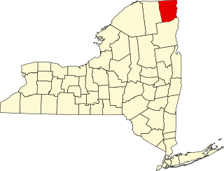
List of the National Register of Historic Places listings in Clinton County, New York

<span class="mw-page-title-main">National Register of Historic Places listings in Montgomery County, New York</span>

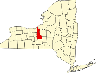
List of the National Register of Historic Places listings in Montgomery County, New York

<span class="mw-page-title-main">National Register of Historic Places listings in Onondaga County, New York</span>

This is a list of the properties and districts listed on the National Register of Historic Places listings in Onondaga County, New York. The locations of National Register properties and districts may be seen in a map by clicking on "Map of all coordinates". There are 170 properties and districts listed on the National Register in the county. Of those, 55 are outside Syracuse, and are listed here, while the rest are covered in National Register of Historic Places listings in Syracuse, New York. One property, the New York State Barge Canal, spans the city and the remainder of the county.

<span class="mw-page-title-main">National Register of Historic Places listings in Schuyler County, New York</span>

List of the National Register of Historic Places listings in Schuyler County, New York

<span class="mw-page-title-main">National Register of Historic Places listings in Yates County, New York</span>

List of the National Register of Historic Places listings in Yates County, New York

<span class="mw-page-title-main">National Register of Historic Places listings in Tioga County, New York</span>

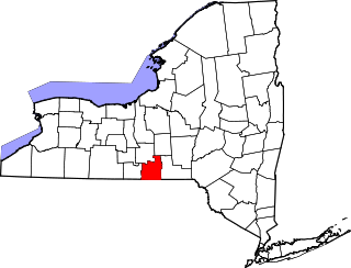
List of the National Register of Historic Places listings in Tioga County, New York

This list is intended to provide a comprehensive listing of entries in the National Register of Historic Places in the Town of Southampton, New York. The locations of National Register properties for which the latitude and longitude coordinates are included below, may be seen in an online map.

This list is intended to provide a comprehensive listing of entries on the National Register of Historic Places in the Town of Huntington, New York. The locations of National Register properties for which the latitude and longitude coordinates are included below, may be seen in an online map.

This is a List of the National Register of Historic Places listings on Shelter, New York

This list is intended to provide a comprehensive listing of entries on the National Register of Historic Places in Town of Southold, New York. The locations of National Register properties for which the latitude and longitude coordinates are included below, may be seen in an online map.

This list is intended to provide a comprehensive listing of entries in the National Register of Historic Places in the Town of Riverhead, New York. The locations of National Register properties for which the latitude and longitude coordinates are included below, may be seen in a Google map.

<span class="mw-page-title-main">National Register of Historic Places listings in Islip (town), New York</span>

This is a List of the National Register of Historic Places listings in the Town of Islip, New York

This is a List of the National Register of Historic Places listings in the Town of Babylon, New York

This is a list of the National Register of Historic Places entries in New Rochelle, New York. See also National Register of Historic Places listings in Westchester County, New York for all others in the county.

References

  1. The latitude and longitude information provided is primarily from the National Register Information System, and has been found to be fairly accurate for about 99% of listings. For 1%, the location info may be way off. We seek to correct the coordinate information wherever it is found to be erroneous. Please leave a note in the Discussion page for this article if you believe any specific location is incorrect.
  2. Numbers represent an alphabetical ordering by significant words. Various colorings, defined here, differentiate National Historic Landmarks and historic districts from other NRHP buildings, structures, sites or objects.
  3. The eight-digit number below each date is the number assigned to each location in the National Register Information System database, which can be viewed by clicking the number.