National Register of Historic Places listings in Lander County, Nevada

Last updated

Map all coordinates using: OpenStreetMap

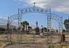
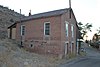
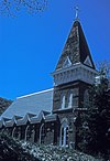
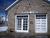
Contents:List of Registered Historic Places in Lander County, Nevada , USA:

Contents

The locations of National Register properties and districts (at least for all showing latitude and longitude coordinates below), may be seen in an online map by clicking on "Map of all coordinates". [1]


    This National Park Service list is complete through NPS recent listings posted August 18, 2023. [2]

Contents: Counties in Nevada / See also: Nevada state-wide list

Current listings

[3] Name on the RegisterImageDate listed [4] Location City or townDescription
1 Austin Cemetery
Austin Cemetery Austin NV cemetery Catholic gate 1.JPG
Austin Cemetery
August 14, 2003
(#03000753)
Northern and southern sides of U.S. Route 50 near its junction with State Route 305
39°30′04″N117°05′04″W / 39.501111°N 117.084444°W / 39.501111; -117.084444 (Austin Cemetery)
Austin
2 Austin City Hall
Austin City Hall Austin City Hall.JPG
Austin City Hall
August 14, 2003
(#03000754)
90 South St.
39°29′33″N117°04′15″W / 39.4925°N 117.070833°W / 39.4925; -117.070833 (Austin City Hall)
Austin
3 Austin Historic District
Austin Historic District AUSTIN HISTORIC DISTRICT.jpg
Austin Historic District
November 23, 1971
(#71000489)
In Pony Canyon at the junction of State Route 8A [ clarification needed ] and U.S. Route 50
39°29′37″N117°04′15″W / 39.493611°N 117.070833°W / 39.493611; -117.070833 (Austin Historic District)
Austin
4 Austin Masonic and Odd Fellows Hall
Austin Masonic and Odd Fellows Hall Odd Fellows Home and Masonic Lodge Austin NV.JPG
Austin Masonic and Odd Fellows Hall
August 14, 2003
(#03000756)
105 Main St.
39°29′34″N117°04′10″W / 39.492778°N 117.069444°W / 39.492778; -117.069444 (Austin Masonic and Odd Fellows Hall)
Austin
5 Austin Methodist Church
Austin Methodist Church Austin Methodist Church.jpg
Austin Methodist Church
August 14, 2003
(#03000751)
135 Court St.
39°29′32″N117°04′06″W / 39.492222°N 117.068333°W / 39.492222; -117.068333 (Austin Methodist Church)
Austin
6 Gridley Store
Gridley Store Gridley Store1.jpg
Gridley Store
August 14, 2003
(#03000752)
247 Water St.
39°29′22″N117°03′47″W / 39.489509°N 117.062927°W / 39.489509; -117.062927 (Gridley Store)
Austin Store operated by Reuel Colt Gridley
7 Lander County Courthouse
Lander County Courthouse Lander County Courthouse.jpg
Lander County Courthouse
August 14, 2003
(#03000750)
122 Main St.
39°29′31″N117°04′11″W / 39.491944°N 117.069722°W / 39.491944; -117.069722 (Lander County Courthouse)
Austin
8 Lander County High School
Lander County High School Lander County High School W side 1.JPG
Lander County High School
July 20, 2000
(#00000821)
130 6th St.
39°29′37″N117°04′08″W / 39.493497°N 117.068780°W / 39.493497; -117.068780 (Lander County High School)
Austin
9 Nevada Central Turntable
Nevada Central Turntable Nevada Central turntable (Austin NV) center 1.JPG
Nevada Central Turntable
August 14, 2003
(#03000759)
Off Austin Roping Arena Rd. on the southern side of U.S. Route 50
39°29′50″N117°05′02″W / 39.497108°N 117.08385°W / 39.497108; -117.08385 (Nevada Central Turntable)
Austin
10 St. Augustine's Catholic Church
St. Augustine's Catholic Church St Augustine's Austin Nevada.jpg
St. Augustine's Catholic Church
August 14, 2003
(#03000758)
113 Virginia St.
39°29′35″N117°04′11″W / 39.493056°N 117.069722°W / 39.493056; -117.069722 (St. Augustine's Catholic Church)
Austin
11 St. George's Episcopal Church
St. George's Episcopal Church Austin NV St. George's Episcopal Church.JPG
St. George's Episcopal Church
August 14, 2003
(#03000755)
156 Main St.
39°29′28″N117°04′07″W / 39.491111°N 117.068611°W / 39.491111; -117.068611 (St. George's Episcopal Church)
Austin
12 Stokes Castle
Stokes Castle Stokes castle.JPG
Stokes Castle
August 14, 2003
(#03000757)
Along U.S. Route 50 west of Austin
39°29′37″N117°04′45″W / 39.493611°N 117.079167°W / 39.493611; -117.079167 (Stokes Castle)
Austin
13 Toquima Cave
Toquima Cave Bwneg416.jpg
Toquima Cave
April 4, 2002
(#02000298)
Humboldt-Toiyabe National Forest
39°11′13″N116°47′12″W / 39.186944°N 116.786667°W / 39.186944; -116.786667 (Toquima Cave)
Austin

See also

Related Research Articles

<span class="mw-page-title-main">National Register of Historic Places listings in Genesee County, New York</span>

List of the National Register of Historic Places listings in Genesee County, New York

<span class="mw-page-title-main">National Register of Historic Places listings in Warren County, New York</span>

List of Registered Historic Places in Warren County, New York

<span class="mw-page-title-main">National Register of Historic Places listings in Nevada County, California</span>

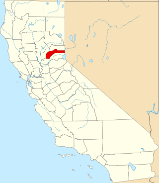
This is a list of the National Register of Historic Places listings in Nevada County, California.

<span class="mw-page-title-main">National Register of Historic Places listings in Warren County, North Carolina</span>

This list includes properties and districts listed on the National Register of Historic Places in Warren County, North Carolina. Click the "Map of all coordinates" link to the right to view a Google map of all properties and districts with latitude and longitude coordinates in the table below.

<span class="mw-page-title-main">National Register of Historic Places listings in Bertie County, North Carolina</span>

This list includes properties and districts listed on the National Register of Historic Places in Bertie County, North Carolina. Click the "Map of all coordinates" link to the right to view an online map of all properties and districts with latitude and longitude coordinates in the table below.

<span class="mw-page-title-main">National Register of Historic Places listings in Nevada County, Arkansas</span>

This is a list of the National Register of Historic Places listings in Nevada County, Arkansas.

List of Registered Historic Places in Churchill County, Nevada, USA:

<span class="mw-page-title-main">National Register of Historic Places listings in Douglas County, Nevada</span>

Contents:List of Registered Historic Places in Douglas County, Nevada, USA:

List of Registered Historic Places in Clark County, Nevada, USA:

Contents:List of Registered Historic Places in Humboldt County, Nevada, USA:

Contents:List of Registered Historic Places in Nye County, Nevada, USA:

<span class="mw-page-title-main">National Register of Historic Places listings in Elko County, Nevada</span>

List of Registered Historic Places in Elko County, Nevada, USA:

Contents:List of Registered Historic Places in Esmeralda County, Nevada, USA:

Contents:List of Registered Historic Places in Eureka County, Nevada, USA

Contents:List of Registered Historic Places in Lincoln County, Nevada, USA:

Contents:List of Registered Historic Places in Lyon County, Nevada, USA:

Contents:List of Registered Historic Places in Mineral County, Nevada, USA:

Contents:List of Registered Historic Places in Pershing County, Nevada, USA:

Contents:List of Registered Historic Places in Storey County, Nevada, USA:

List of Registered Historic Places in White Pine County, Nevada, USA:

References

  1. The latitude and longitude information provided in this table was derived originally from the National Register Information System, which has been found to be fairly accurate for about 99% of listings. Some locations in this table may have been corrected to current GPS standards.
  2. National Park Service, United States Department of the Interior, "National Register of Historic Places: Weekly List Actions", retrieved August 18, 2023.
  3. Numbers represent an alphabetical ordering by significant words. Various colorings, defined here, differentiate National Historic Landmarks and historic districts from other NRHP buildings, structures, sites or objects.
  4. The eight-digit number below each date is the number assigned to each location in the National Register Information System database, which can be viewed by clicking the number.