National Register of Historic Places listings in Union County, South Dakota

Last updated

Location of Union County in South Dakota Map of South Dakota highlighting Union County.svg
Location of Union County in South Dakota

This is a list of the National Register of Historic Places listings in Union County, South Dakota.

Contents

This is intended to be a complete list of the properties and districts on the National Register of Historic Places in Union County, South Dakota, United States. The locations of National Register properties and districts for which the latitude and longitude coordinates are included below, may be seen in a map. [1]

There are 16 properties and districts listed on the National Register in the county.


    This National Park Service list is complete through NPS recent listings posted February 16, 2024. [2]

Current listings

[3] Name on the Register [4] ImageDate listed [5] Location City or townDescription
1 Baker House
Baker House Baker house (Union Co SD) from W 1.JPG
Baker House
August 7, 1979
(#79002409)
48113 SD Highway 48 [6]
42°50′38″N96°35′06″W / 42.843819°N 96.584975°W / 42.843819; -96.584975 (Baker House)
Alcester
2 Governor William J. Bulow House
Governor William J. Bulow House Willam J. Bulow house from N 1.JPG
Governor William J. Bulow House
May 8, 1986
(#86001024)
207 W. Hemlock St.
43°04′53″N96°46′35″W / 43.081343°N 96.776478°W / 43.081343; -96.776478 (Governor William J. Bulow House)
Beresford
3 Chicago and Northwestern Railroad Depot
Chicago and Northwestern Railroad Depot Beresford, SD depot from SE 1.JPG
Chicago and Northwestern Railroad Depot
January 31, 1985
(#85000262)
1 Depot Sq.
43°04′50″N96°46′13″W / 43.080621°N 96.770281°W / 43.080621; -96.770281 (Chicago and Northwestern Railroad Depot)
Beresford
4 Hultgren Farm
Hultgren Farm Hulteboda Farm from SW 2 long.JPG
Hultgren Farm
January 28, 2004
(#03001536)
47953 309th St.
42°54′15″N96°37′00″W / 42.904242°N 96.616618°W / 42.904242; -96.616618 (Hultgren Farm)
Big Springs
5 Hyden House
Hyden House Hyden House (Alcester SD) from NW 1.JPG
Hyden House
July 5, 1996
(#96000742)
405 Hyden House
43°01′18″N96°37′31″W / 43.021734°N 96.625395°W / 43.021734; -96.625395 (Hyden House)
Alcester
6 John August Larson Home
John August Larson Home J. A. Larson house (Beresford SD) from N 1.JPG
John August Larson Home
October 31, 1985
(#85003451)
407 W. Hemlock
43°04′53″N96°46′46″W / 43.081297°N 96.779344°W / 43.081297; -96.779344 (John August Larson Home)
Beresford
7 Junction City Rest Stop Tipi
Junction City Rest Stop Tipi Interstate 29 SD exit 26 rest stop teepee from below 1.JPG
Junction City Rest Stop Tipi
January 20, 2015
(#14001191)
Mi. 26.6 on I-29
42°47′05″N96°47′15″W / 42.784744°N 96.787547°W / 42.784744; -96.787547 (Junction City Rest Stop Tipi)
Junction City Part of the Concrete Interstate Tipis of South Dakota MPS
8 Charles Murtha House and Brick Yard
Charles Murtha House and Brick Yard Charles Murtha house from SW 2.JPG
Charles Murtha House and Brick Yard
February 1, 1982
(#82003945)
707 W. Main St. [7]
42°41′26″N96°41′32″W / 42.690556°N 96.692222°W / 42.690556; -96.692222 (Charles Murtha House and Brick Yard)
Elk Point
9 Nora Store
Nora Store Nora Store. South Dakota..JPG
Nora Store
November 20, 2007
(#07001215)
30705 475th Ave.
42°56′25″N96°42′25″W / 42.940278°N 96.706944°W / 42.940278; -96.706944 (Nora Store)
Alcester
10 J.W. Reedy House December 13, 1984
(#84000605)
309 N. 2nd [8]
43°05′01″N96°46′21″W / 43.083611°N 96.7725°W / 43.083611; -96.7725 (J.W. Reedy House)
Beresford
11 St. Paul Lutheran Church and Cemetery February 20, 2018
(#100002103)
31903 475th Ave.
42°45′53″N96°42′28″W / 42.764652°N 96.707751°W / 42.764652; -96.707751 (St. Paul Lutheran Church and Cemetery)
Richland vicinity
12 St. Peter's Catholic Church
St. Peter's Catholic Church St. Peter's, Jefferson SD, from S 2.JPG
St. Peter's Catholic Church
July 19, 1989
(#89000833)
400 Main St.
42°36′15″N96°33′37″W / 42.604155°N 96.560308°W / 42.604155; -96.560308 (St. Peter's Catholic Church)
Jefferson
13 South Dakota Dept. of Transportation Bridge No. 64-061-199 December 9, 1993
(#93001322)
Local road over Brule Creek
42°47′39″N96°41′08″W / 42.794167°N 96.685556°W / 42.794167; -96.685556 (South Dakota Dept. of Transportation Bridge No. 64-061-199)
Elk Point
14 Star School District 61
Star School District 61 Star School District 61 from S 1.JPG
Star School District 61
February 19, 2008
(#08000056)
47446 305th St.
42°58′06″N96°43′02″W / 42.968306°N 96.717293°W / 42.968306; -96.717293 (Star School District 61)
Alcester
15 Swanson House
Swanson House Swan John Swanson house from SW 1.JPG
Swanson House
May 31, 2006
(#06000461)
30572 483rd Ave.
42°57′22″N96°32′50″W / 42.956031°N 96.547275°W / 42.956031; -96.547275 (Swanson House)
Alcester
16 United Brethren Church
United Brethren Church Pleasant Hill Chapel (Union Co SD) from SSE 3.JPG
United Brethren Church
February 9, 2001
(#01000091)
31141 476th Ave.
42°52′28″N96°41′16″W / 42.874331°N 96.687829°W / 42.874331; -96.687829 (United Brethren Church)
Spink

See also

Related Research Articles

<span class="mw-page-title-main">National Register of Historic Places listings in Akron, Ohio</span>

This is a list of the National Register of Historic Places listings in Akron, Ohio.

<span class="mw-page-title-main">National Register of Historic Places listings in Bon Homme County, South Dakota</span>

This is a list of the National Register of Historic Places listings in Bon Homme County, South Dakota.

<span class="mw-page-title-main">National Register of Historic Places listings in Brookings County, South Dakota</span>

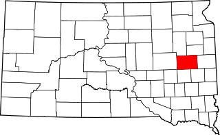
This is a list of the National Register of Historic Places listings in Brookings County, South Dakota.

<span class="mw-page-title-main">National Register of Historic Places listings in Brown County, South Dakota</span>

This is a list of the National Register of Historic Places listings in Brown County, South Dakota.

<span class="mw-page-title-main">National Register of Historic Places listings in Butte County, South Dakota</span>

This is a list of the National Register of Historic Places listings in Butte County, South Dakota.

<span class="mw-page-title-main">National Register of Historic Places listings in Clark County, South Dakota</span>

This is a list of the National Register of Historic Places listings in Clark County, South Dakota.

<span class="mw-page-title-main">National Register of Historic Places listings in Codington County, South Dakota</span>

This is a list of the National Register of Historic Places listings in Codington County, South Dakota.

<span class="mw-page-title-main">National Register of Historic Places listings in Day County, South Dakota</span>

This is a list of the National Register of Historic Places listings in Day County, South Dakota.

<span class="mw-page-title-main">National Register of Historic Places listings in Deuel County, South Dakota</span>

This is a list of the National Register of Historic Places listings in Deuel County, South Dakota.

<span class="mw-page-title-main">National Register of Historic Places listings in Edmunds County, South Dakota</span>

This is a list of the National Register of Historic Places listings in Edmunds County, South Dakota.

<span class="mw-page-title-main">National Register of Historic Places listings in Grant County, South Dakota</span>

This is a list of the National Register of Historic Places listings in Grant County, South Dakota.

<span class="mw-page-title-main">National Register of Historic Places listings in Kingsbury County, South Dakota</span>

This is a list of the National Register of Historic Places listings in Kingsbury County, South Dakota.

<span class="mw-page-title-main">National Register of Historic Places listings in Walworth County, South Dakota</span>

This is a list of the National Register of Historic Places listings in Walworth County, South Dakota.

<span class="mw-page-title-main">National Register of Historic Places listings in Marshall County, South Dakota</span>

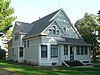
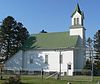
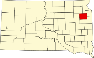
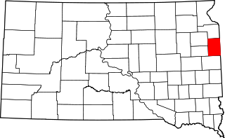
This is a list of the National Register of Historic Places listings in Marshall County, South Dakota.

<span class="mw-page-title-main">National Register of Historic Places listings in Perkins County, South Dakota</span>

This is a list of the National Register of Historic Places listings in Perkins County, South Dakota.

<span class="mw-page-title-main">National Register of Historic Places listings in Roberts County, South Dakota</span>

This is a list of the National Register of Historic Places listings in Roberts County, South Dakota.

<span class="mw-page-title-main">National Register of Historic Places listings in Stanley County, South Dakota</span>

This is a list of the National Register of Historic Places listings in Stanley County, South Dakota.

<span class="mw-page-title-main">National Register of Historic Places listings in Todd County, South Dakota</span>

This is a list of the National Register of Historic Places listings in Todd County, South Dakota.

<span class="mw-page-title-main">National Register of Historic Places listings in Tripp County, South Dakota</span>

This is a list of the National Register of Historic Places listings in Tripp County, South Dakota.

<span class="mw-page-title-main">National Register of Historic Places listings in Turner County, South Dakota</span>

This is a list of the National Register of Historic Places listings in Turner County, South Dakota.

References

  1. The latitude and longitude information provided in this table was derived originally from the National Register Information System, which has been found to be fairly accurate for about 99% of listings. Some locations in this table may have been corrected to current GPS standards.
  2. National Park Service, United States Department of the Interior, "National Register of Historic Places: Weekly List Actions", retrieved February 16, 2024.
  3. Numbers represent an alphabetical ordering by significant words. Various colorings, defined here, differentiate National Historic Landmarks and historic districts from other NRHP buildings, structures, sites or objects.
  4. "National Register Information System". National Register of Historic Places . National Park Service. April 24, 2008.
  5. The eight-digit number below each date is the number assigned to each location in the National Register Information System database, which can be viewed by clicking the number.
  6. "Akron - Front and Side Facade;Akron - 48113 SD Highway 48;Akron - Baker House". Labelled photo at South Dakota Digital Archives. Retrieved 2015-09-30.
  7. "Grand Opening of Union County Historical Society new museum". WNAX Radio. No date. Retrieved 2015-10-15.
  8. The address 309 N. 2nd appears on the NRHP nominating form, retrieved 2015-09-30. It was incorrectly transcribed as 304 N. 2nd in the NRIS database.