
Gentrification is the process of changing the character of a neighborhood through the influx of more affluent residents and businesses. It is a common and controversial topic in urban politics and planning. Gentrification often increases the economic value of a neighborhood, but the resulting demographic displacement may itself become a major social issue. Gentrification often sees a shift in a neighborhood's racial or ethnic composition and average household income as housing and businesses become more expensive and resources that had not been previously accessible are extended and improved.

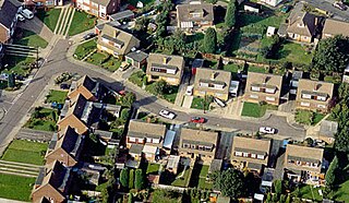
Smart growth is an urban planning and transportation theory that concentrates growth in compact walkable urban centers to avoid sprawl. It also advocates compact, transit-oriented, walkable, bicycle-friendly land use, including neighborhood schools, complete streets, and mixed-use development with a range of housing choices. The term "smart growth" is particularly used in North America. In Europe and particularly the UK, the terms "compact city", "urban densification" or "urban intensification" have often been used to describe similar concepts, which have influenced government planning policies in the UK, the Netherlands and several other European countries.

In urban planning, zoning is a method in which a municipality or other tier of government divides land into "zones", each of which has a set of regulations for new development that differs from other zones. Zones may be defined for a single use, they may combine several compatible activities by use, or in the case of form-based zoning, the differing regulations may govern the density, size and shape of allowed buildings whatever their use. The planning rules for each zone determine whether planning permission for a given development may be granted. Zoning may specify a variety of outright and conditional uses of land. It may indicate the size and dimensions of lots that land may be subdivided into, or the form and scale of buildings. These guidelines are set in order to guide urban growth and development.
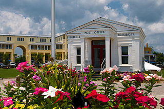
New Urbanism is an urban design movement that promotes environmentally friendly habits by creating walkable neighbourhoods containing a wide range of housing and job types. It arose in the United States in the early 1980s, and has gradually influenced many aspects of real estate development, urban planning, and municipal land-use strategies. New Urbanism attempts to address the ills associated with urban sprawl and post-Second World War suburban development.

A neighbourhood (CwE) or neighborhood (AmE) is a geographically localized community within a larger city, town, suburb or rural area, sometimes consisting of a single street and the buildings lining it. Neighbourhoods are often social communities with considerable face-to-face interaction among members. Researchers have not agreed on an exact definition, but the following may serve as a starting point: "Neighbourhood is generally defined spatially as a specific geographic area and functionally as a set of social networks. Neighbourhoods, then, are the spatial units in which face-to-face social interactions occur—the personal settings and situations where residents seek to realise common values, socialise youth, and maintain effective social control."
A dead end, also known as a cul-de-sac, no through road or no exit road, is a street with only one inlet or outlet.

Land use planning is the process of regulating the use of land by a central authority. Usually, this is done to promote more desirable social and environmental outcomes as well as a more efficient use of resources. More specifically, the goals of modern land use planning often include environmental conservation, restraint of urban sprawl, minimization of transport costs, prevention of land use conflicts, and a reduction in exposure to pollutants. In the pursuit of these goals, planners assume that regulating the use of land will change the patterns of human behavior, and that these changes are beneficial. The first assumption, that regulating land use changes the patterns of human behavior is widely accepted. However, the second assumption - that these changes are beneficial - is contested, and depends on the location and regulations being discussed.
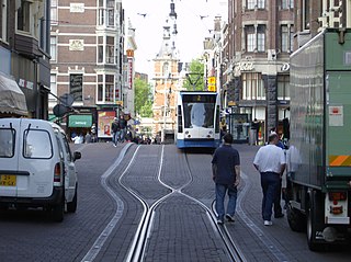
In urban planning, transit-oriented development (TOD) is a type of urban development that maximizes the amount of residential, business and leisure space within walking distance of public transport. It promotes a symbiotic relationship between dense, compact urban form and public transport use. In doing so, TOD aims to increase public transport ridership by reducing the use of private cars and by promoting sustainable urban growth.
A Form-Based Code (FBC) is a means of regulating land development to achieve a specific urban form. Form-Based Codes foster predictable built results and a high-quality public realm by using physical form as the organizing principle, with less focus on land use, through municipal regulations. An FBC is a regulation, not a mere guideline, adopted into city, town, or county law and offers a powerful alternative to conventional zoning regulation.

Environmental planning is the process of facilitating decision making to carry out land development with the consideration given to the natural environment, social, political, economic and governance factors and provides a holistic framework to achieve sustainable outcomes. A major goal of environmental planning is to create sustainable communities, which aim to conserve and protect undeveloped land.

Mixed use is a type of urban development, urban design, urban planning and/or a zoning classification that blends multiple uses, such as residential, commercial, cultural, institutional, or entertainment, into one space, where those functions are to some degree physically and functionally integrated, and that provides pedestrian connections. Mixed-use development may be applied to a single building, a block or neighborhood, or in zoning policy across an entire city or other administrative unit. These projects may be completed by a private developer, (quasi-) governmental agency, or a combination thereof. A mixed-use development may be a new construction, reuse of an existing building or brownfield site, or a combination.
Activity centre is a term used in urban planning and design for a mixed-use urban area where there is a concentration of commercial and other land uses. For example, the central business districts of cities (CBD) are also known as “Central Activities Districts” (CAD) (also known as Downtown in North America or "Central Activities Zone" in the United Kingdom in recognition of the fact that commercial functions are not the only things that occur there. The term activity centre can also be used to designate an area for mixed-use development, whatever its current land use happens to be.
Generally the concept of the neighborhood unit, crystallised from the prevailing social and intellectual attitudes of the early 1900s by Clarence Perry, is an early diagrammatic planning model for residential development in metropolitan areas. It was designed by Perry to act as a framework for urban planners attempting to design functional, self-contained and desirable neighbourhoods in the early 20th century in industrialising cities. It continues to be utilised, as a means of ordering and organising new residential communities in a way which satisfies contemporary "social, administrative and service requirements for satisfactory urban existence".

Round Hill is an inner suburban area of Brighton, part of the coastal city of Brighton and Hove in England. The area contains a mix of privately owned and privately rented terraced housing, much of which has been converted for multiple occupancies, and small-scale commercial development. It was developed mostly in the late 19th century on an area of high land overlooking central Brighton and with good views in all directions, the area became a desirable middle-class suburb—particularly the large terraced houses of Roundhill Crescent and Richmond Road, and the exclusive Park Crescent—and within a few decades the whole of the hill had been built up with smaller terraces and some large villas.
The sustainable urban neighbourhood (SUN) is an urban design model which is part of 21st-century urban reform theory, moving away from the typical suburban development of the UK and US towards more continental city styles. It emerged in the UK in the 1990s, specifically from pioneering work by URBED, an urban regeneration consultancy and research centre in Manchester.
The gentrification of Vancouver, Canada, has been the subject of debate between those who wish to promote gentrification and those who do not.

The Bear Road area is a largely residential area in the east of Brighton, part of the English city of Brighton and Hove. Centred on the steep west–east road of that name, it is characterised by terraced houses of the early 20th century, but Brighton's main cemeteries were established here in the 19th century and there is also some industry.

Prestonville is a largely residential area in the northwest of Brighton, part of the English city of Brighton and Hove. It covers a long, narrow and steeply sloping ridge of land between the Brighton Main Line and Dyke Road, two major transport corridors which run north-northwestwards from the centre of Brighton. Residential development started in the 1860s and spread northwards, further from central Brighton, over the next six decades. The area is characterised by middle-class and upper-middle-class housing in various styles, small-scale commercial development and long eastward views across the city. Two Anglican churches serve Prestonville—one at each end of the area—and there are several listed buildings.

Elm Grove is a mainly residential area of Brighton, part of the English coastal city of Brighton and Hove. The densely populated district lies on a steep hill northeast of the city centre and developed in the second half of the 19th century after the laying out of a major west–east road, also called Elm Grove. Terraced houses, small shops and architecturally impressive public buildings characterise the streetscape: within the area are a major hospital, two churches and a former board school, as well as Brighton's oldest council houses and an interwar council estate.
Environmental, ecological or green gentrification is a process in which cleaning up pollution or providing green amenities increases local property values and attracts wealthier residents to a previously polluted or disenfranchised neighbourhood. Green amenities include green spaces, parks, green roofs, gardens and green and energy efficient building materials. These initiatives can heal many environmental ills from industrialization and beautify urban landscapes. Additionally, greening is imperative for reaching a sustainable future. However, if accompanied by gentrification, these initiatives can have an ambiguous social impact. For example, if the low income households are displaced or forced to pay higher housing costs. First coined by Sieg et al. (2004), environmental gentrification is a relatively new concept, although it can be considered as a new hybrid of the older and wider topics of gentrification and environmental justice. Social implications of greening projects specifically with regards to housing affordability and displacement of vulnerable citizens. Greening in cities can be both healthy and just.
