Buffalo Narrows Airport is located 2 NM east-southeast of Buffalo Narrows, Saskatchewan, Canada.
Cigar Lake Airport is located 1 nautical mile south-west of Waterbury Lake, Saskatchewan, Canada in the Athabasca Basin. It serves the Cigar Lake Mine.
Collins Bay Airport is located on the west side of Wollaston Lake, on Collins Bay, near Collins Creek, Saskatchewan, Canada.
Davin Lake Airport, formerly TC LID: CKW6, was located adjacent to Davin Lake Lodge, a fly-in fishing lodge in northern Saskatchewan, Canada.
Dore Lake Airport is located adjacent to Dore Lake, Saskatchewan, Canada.
Hidden Bay Airport(TC LID: CKL4) is an abandoned aerodrome that was located near Hidden Bay, on Wollaston Lake, in north-eastern Saskatchewan, Canada. It was located off Highway 905, about 264 kilometres north of Southend and about 220 kilometres south of Black Lake.
Key Lake Airport is a regional airport near the Key Lake mine in Saskatchewan, Canada.
Wollaston Lake Airport is located adjacent to Wollaston Lake, Saskatchewan, Canada on the Hatchet Lake Dene Nation.
Sandy Bay Airport is located 1.3 nautical miles north-east of Sandy Bay, Saskatchewan, Canada. The airport and community are on the shores of Wasawakasik Lake, which is along the course of the Churchill River.
Sandy Bay Water Aerodrome is located adjacent to Sandy Bay, Saskatchewan, Canada on the shore of Wasawakasik Lake.

Pronto Airways LP was an airline formed in 2006 that was based in Saskatoon, Saskatchewan, Canada. It operated scheduled and charter passenger services as well as cargo service until the airline ceased operations in 2015. Its main bases were Prince Albert and Saskatoon, with destinations throughout northern Saskatchewan and Nunavut.
Hatchet Lake Airport is located near Hatchet Lake, Saskatchewan, Canada.

Wollaston Lake is a lake in north-eastern part of the Canadian province of Saskatchewan. It is about 550 kilometres (340 mi) north-east of Prince Albert. With a surface area of 2,286 square kilometres (883 sq mi), it is the largest bifurcation lake in the world – that is, a lake that drains naturally in two directions.
Highway 995, also known as Welcome Street, is a provincial highway in the far north region of the Canadian province of Saskatchewan. It is one of the few highways in Saskatchewan that is completely isolated from the other highways. Seasonal access is provided to Highway 905 by way of the Wollaston Lake Barge.
Highway 954 is a provincial highway in the Canadian province of Saskatchewan. It runs from Highway 26 on the north side of Goodsoil to a dead end at Northern Cross Resort on Lac des Îles within Meadow Lake Provincial Park. At the eastern end of the highway is the Goodsoil Airport. It is about 12.9 kilometres (8.0 mi) long.
Highway 905 is a provincial highway in the far north region of the Canadian province of Saskatchewan. It runs from Highway 102 to Stony Rapids. It is about 469 kilometres (291 mi) long and is entirely unpaved. A 185-kilometre (115 mi) section between Points North Landing and Black Lake is a seasonal winter road.
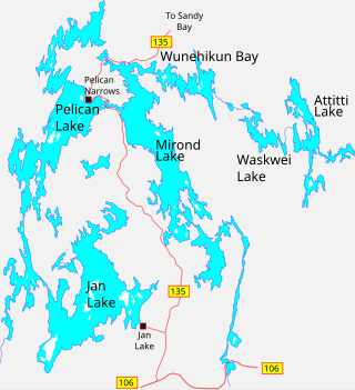
Jan Lake is a community on the south-eastern shore of Jan Lake on Doupe Bay in the north-eastern part of the Canadian province of Saskatchewan. The community has a Canadian Coast Guard wharf, provincial and private campgrounds, pubs, as well as many tourist lodges, which focus on fishing, camping, and private cabins. Access is from Highway 135 and Jan Lake Airport, which is located along Highway 135, near the intersection with Highway 106.
Axe Lake Aerodrome is located near the Axe Lake oil sands discovery in north-west Saskatchewan, Canada. The aerodrome is located near the border with Alberta, just south of Vande Veen Lake. The nearest highway is Highway 955 to the east. A gravel road connects the airport to the highway.

Hatchet Lake Denesuline Nation is a Denesuline First Nation in northern Saskatchewan. The main settlement, Wollaston Lake, is an unincorporated community on Wollaston Lake in the boreal forest of north-eastern Saskatchewan, Canada.

