The Nelson and Fort Sheppard Railway (N&FS) is a historic railway that operated in the West Kootenay region of southern British Columbia. The railway's name derived from a misspelling of Fort Shepherd, a former Hudson's Bay Company fort, on the west bank of the Columbia River immediately north of the border.
The BC government was unsympathetic to any proposal that was merely a feeder for US railroads. Using Canadian businessmen as a front, and promising to connect the railway to the coast, Corbin obtained a provincial charter for the N&FS in 1891.[1] This act made the $750,000 CP investment in the C&K of little value, until further CP expansion began in 1898. In 1893, the N&FS received a federal charter,[2] declaring it to be a work for the greater advantage of Canada.[3] The connection to the coast was never built but the railway reached Nelson in 1893. With an all-rail route to the United States and links to American transcontinental railroads, the N&FS offered better market access than CP.[4]
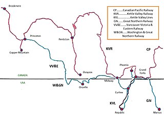
Map showing Nelson and Fort Sheppard Railway
Route
From south to north, the railway joined the SF&N on the east shore of the Columbia River at the US border, and crossed a 500-foot bridge over the Pend-d'Oreille River at Waneta, since repurposed as a highway crossing. The railway ascended the Columbia Valley, the Salmo River valley, and descended to the northeast of Nelson to Troup (also known as Five Mile Point), which became the temporary terminus until 1894.[5][6][4][7]
Nelson train stations
Mountain station was in the current parking area at the south end of Cherry St.[8]
In 1895, a rail loop at Troup, enabled the line to reverse direction, border the west arm of the lake, and terminate by the Cottonwood St. and Maple St. intersection, at what was then Bogustown (now Fairview).[4][8]
In December 1899, the inaugural streetcar (tram) ran southwestward from a terminus at the adjacent Cottonwood St. and First St. intersection to the then Railway St. and Baker St. intersection (now BC Highway 3A)/Baker St.), which served the C&K station at the former foot of Railway.[9] In April 1900, the tramway hill section commenced. This line turned from Kootenay St. northeastward into Houston St, terminating at the Stanley St. intersection,[10] requiring a 0.9-kilometre (0.6mi) walk from the closest point to the N&FS Mountain station.
To create the Nelson–Procter spur in 1900, CP bought the Nelson–Troup right-of-way from N&FS, which received trackage rights on this section.[4]
In January 1901, on the opening of the new CP C&K station (now the visitor centre), two blocks southwest of the former station, the N&FS terminal moved from Bogustown to share this facility, and the tramway was extended along the Baker St. alignment adjacent to this point. That same day, the final part of the hill route changed, turning northeastward on Observatory St. and south eastward on Stanley St. to the previous terminus.[11] The new CP station became the northwestern terminus for this route. However, from May 1901, unless requested by a passenger, or meeting the 11:35 am or 10:10 pm trains, the tramway terminus became Stanley/Baker streets.[12] In 1902, the tramway extension to the station was abandoned, which was likely the time that the two tramway routes were combined into a single through route.[8]
In November 1910, the final part of the hill section reopened as a loop. Uphill was Stanley St, Latimer St, Hendryx St, Carbonate St, Cedar St, and Innes St, with the downhill return unchanged. The amended route offered a short 0.2-kilometre (0.12mi) walk from the closest point to the N&FS Mountain station.[13] When the tramway ceased in June 1949, the replacement bus route appears to have been no closer than Josephine St. to this station.[14]
In 1951, passenger train service ceased, leaving only Auto Interurban (assumedly in association with Greyhound) bus travel via Trail, which followed a completely different route. The former route became freight only.[23]
In 1997, BNSF sold the abandoned Salmo–Troup rails to Canadian Rail Track Materials for removal,[25] and the provincial government acquired the right-of-way for conversion to the Salmo-Troup Rail Trail.
In 1998, International Reload Systems subsidiary, International Rail Road Systems (IRRS), leased the Columbia Gardens–Salmo section, interlining with BNSF to the south, and abandoned north of Parks.[26] IRRS handled concentrates for the Trail smelter and lumber shipments.[25] In 2010, ATCO Wood Products purchased the section, which was renamed the Nelson and Fort Sheppard Railway Corporation in 2012.[26]
In the 1890s, the Nelson and Fort Sheppard Railway was involved in a court case which resulted in a significant ruling on Canadian constitutional law. A train operated by the railway killed two horses. The owner of the horses sued for damages, under a provincial statute. Although the owner of the horses was successful at trial, the British Columbia Supreme Court overturned the decision, ruling that the provincial statute did not apply to the railway, which was under federal jurisdiction. That ruling was upheld by the Judicial Committee of the Privy Council, at that time the highest appellate body in the British Empire: Madden v Nelson and Fort Sheppard Railway Co.[29]
Footnotes
↑ An Act to incorporate the Nelson and Fort Sheppard Railway Company, SBC 1891, c. 58.
Creston is a town in the Kootenay region of southeastern British Columbia, Canada.
The Kaslo and Slocan Railway (K&S) is a historic railway that operated in the West Kootenay region of southeastern British Columbia in western Canada. The K&S connected Kaslo and Sandon. Initially a narrow-gauge railway, the line was later rebuilt to standard gauge.
The Nakusp and Slocan Railway (N&S) is a historic Canadian railway that operated in the West Kootenay region of southeastern British Columbia. The N&S initially connected Nakusp and Three Forks but soon extended to Sandon.
Eholt is in the Boundary Country region of south central British Columbia. This ghost town, on BC Highway 3, is by road about 27 kilometres (17 mi) northwest of Grand Forks and 14 kilometres (9 mi) northeast of Greenwood.
Salmo is a village in the West Kootenay region of southeastern British Columbia. It is mostly on the north side of Erie Creek at the confluence with the Salmo River. The place lies largely east of the junction of BC Highway 3, and BC Highway 6.
Ymir is a village in the Selkirk Mountains in the West Kootenay region of southeastern British Columbia. Ymir is located where the Salmo River meets Quartz Creek, and Ymir Creek. The locality, on BC Highway 6, is by road about 10 kilometres (6 mi) northeast of Salmo and 34 kilometres (21 mi) south of Nelson.
The Great Northern Rail Trail originally known as the Salmo–Troup Rail Trail is a multi-use recreational rail trail located in southeastern British Columbia's West Kootenay region.
Baynes Lake is an unincorporated rural community on the east shore of Lake Koocanusa, just north of the mouth of the Elk River, in the East Kootenay region of southeastern British Columbia. Off BC Highway 93, the locality is by road about 65 kilometres (40 mi) southEAST of Cranbrook and 44 kilometres (27 mi) southWEST of Fernie.
Chopaka is an unincorporated community in the Similkameen region of south central British Columbia. Immediately north of the Canada–United States border, the population centre is on the west shore of the Similkameen River. The Nighthawk–Chopaka Border Crossing lies to the east. Off BC Highway 3, the locality is by road about 96 kilometres (60 mi) southeast of Princeton and 75 kilometres (47 mi) south of Penticton.
Rosebery is an unincorporated community about 6 kilometres (4 mi) north of New Denver in the West Kootenay region of southeastern British Columbia. The former steamboat landing and ferry terminal is at the mouth of Wilson Creek on the eastern shore of Slocan Lake. The locality, on BC Highway 6, is about 106 kilometres (66 mi) by road north of Castlegar and 144 kilometres (89 mi) by road and ferry south of Revelstoke.
Wynndel is an unincorporated community adjacent to Duck Creek, east of the Kootenay River, in the West Kootenay region of southeastern British Columbia. The locality, on BC Highway 3A, is by road about 11 kilometres (7 mi) north of Creston and 128 kilometres (80 mi) southeast of Nelson.
The Kettle Falls International Railway is a shortline railroad in the U.S. state of Washington and the Canadian province of British Columbia. This OmniTRAX subsidiary operates 44 miles (71 km) of track.
The Nelson Electric Tramway is a heritage railway at Nelson in the Kootenay region of southeastern British Columbia. It is one of two operational historic tram systems in the province.
The International Rail Road Systems was a Canadian short line railway company operating in the West Kootenay region of southeastern British Columbia.
Waldo is a ghost town in the East Kootenay region of southeastern British Columbia. About 2 kilometres (1.2 mi) north of Krag, the remnants are submerged beside the east shore of Lake Koocanusa, just north of the mouth of the Elk River. Off BC Highway 93, the site is by road about 69 kilometres (43 mi) southwest of Cranbrook and 48 kilometres (30 mi) southeast of Fernie.
The Victoria Terminal Railway and Ferry Company (VTRF) was a shortline railway company operating two railway lines and a connecting ferry that linked Vancouver Island and the south arm of the Fraser River in Metro Vancouver.
The Boundary–Waneta Border Crossing connects the town of Northport, Washington with Trail, British Columbia on the Canada–US border. Access is via Waneta Road on the American side and British Columbia Highway 22A on the Canadian side.
The Vancouver, Victoria and Eastern Railway (VV&E) was a railway line proposed to connect Metro Vancouver with the Kootenays, in Canada. After acquisition by the Great Northern Railway (GN), most of the route was built, but a passenger through service, using the arranged running rights on the tracks of other companies, never transpired.
Yoder is a Canadian ghost town in the West Kootenay region of southern British Columbia. The location, on BC Highway 3, is by road about 9 kilometres (6 mi) west of Salmo and 31 kilometres (19 mi) southeast of Castlegar.
The Spokane Falls & Northern (SF&N) is a historic railroad that operated in northeast Washington state. The SF&N initially connected the city of Spokane with the Canada–United States border at Waneta, British Columbia.
References
Parker, Douglas V. (1992). Streetcars in the Kootenays: Nelson's Tramways, 1899–1992. Havelock House. ISBN0-920805-02-7.
This page is based on this Wikipedia article Text is available under the CC BY-SA 4.0 license; additional terms may apply. Images, videos and audio are available under their respective licenses.