
West Hoathly is a village and civil parish in the Mid Sussex District of West Sussex, England, located 3.5 miles (5.6 km) south west of East Grinstead. In the 2001 census 2,121 people, of whom 1,150 were economically active, lived in 813 households. At the 2011 Census the population increased to 2,181. The parish, which has a land area of 2,139 hectares, includes the hamlets of Highbrook, Selsfield Common and Sharpthorne. The mostly rural parish is centred on West Hoathly village, an ancient hilltop settlement in the High Weald between the North and South Downs.
Sedlescombe is a village and civil parish in the Rother district of East Sussex, England. The village is on the B2244 road, about 6 miles (10 km) north of Hastings. The parish includes the hamlet of Kent Street, which is on the A21 road.
Wivelsfield village and the larger adjacent village of Wivelsfield Green are the core of the civil parish of Wivelsfield in the Lewes District of East Sussex, England. The villages are 9.3 miles (15.0 km) north of the city of Brighton and Hove.

Fulking is a village and civil parish in the Mid Sussex District of West Sussex, England. The parish lies wholly with the South Downs National Park.

Newtimber is a small village and civil parish in the Mid Sussex District of West Sussex, England. It is located north-west of Brighton. The parish also includes the hamlet of Saddlescombe. The parish lies almost wholly with the South Downs National Park, with the exception of a small section of the parish north of the B2117 road. The planning authority for Newtimber is therefore the South Downs National Park Authority (SDNPA), the statutory planning authority for the National Park area. The downland scarp, which includes Newtimber Hill, Newtimber Holt, Saddlescombe chalk quarry and Summer Down, is mostly part of the Beeding Hill to Newtimber Hill, designated Site of Special Scientific Interest.

Poynings is a village and civil parish in the Mid Sussex District of West Sussex, England. The parish lies wholly with the South Downs National Park. To its south is Brighton and Hove, to its west is the Fulking parish, to its east is the Newtimber parish and to its north is Albourne parish. The planning authority for Poynings is the South Downs National Park Authority (SDNPA), the statutory planning authority for the National Park area.
Twineham is a village and civil parish in the Mid Sussex District of West Sussex, England. It is located eight kilometres to the west of Burgess Hill. The civil parish covers an area of 784 hectares In the 2001 census 271 people lived in 100 households, of whom 139 were economically active. The 2011 Census population was 306.

Hangleton is a residential suburb of Hove, in the unparished area of Hove, in the Brighton and Hove district, in the ceremonial county of East Sussex, England. The area was developed in the 1930s after it was incorporated into the borough of Hove, but has ancient origins: its parish church was founded in the 11th century and retains 12th-century fabric, and the medieval manor house is Hove's oldest secular building. The village became depopulated in the medieval era and the church fell into ruins, and the population in the isolated hilltop parish only reached 100 in the early 20th century; but rapid 20th-century development resulted in more than 6,000 people living in Hangleton in 1951 and over 9,000 in 1961. By 2013 the population exceeded 14,000.

East Dean is a village and civil parish in the District of Chichester in West Sussex, England. The village is in a valley in the South Downs, 5+1⁄2 miles (9 km) north-northeast of Chichester on a narrow road between Singleton on the A286 and Upwaltham on the A285 road. The village pond is considered to be the source of the River Lavant.

The Ifield Friends Meeting House is a Friends meeting house in the Ifield neighbourhood of Crawley, a town and borough in West Sussex, England. Built in 1676 and used continuously since then by the Quaker community for worship, it is one of the oldest purpose-built Friends meeting houses in the world. It is classified by English Heritage as a Grade I listed building, a status given to buildings of "exceptional interest" and national importance. An adjoining 15th-century cottage is listed separately at Grade II*, and a mounting block in front of the buildings also has a separate listing at Grade II. Together, these structures represent three of the 100 listed buildings and structures in Crawley.

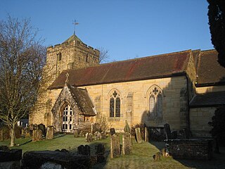
The Church of the Transfiguration is the Church of England parish church of the village of Pyecombe, in the Mid Sussex District of West Sussex, England. The mostly 12th- and 13th-century building, in an isolated setting facing the South Downs, has been designated a Grade I Listed building.

Westdene is an area of the city of Brighton and Hove, East Sussex. It is an affluent northern suburb of the city, west of Patcham, the A23 and the London to Brighton railway line, north of Withdean and northeast of West Blatchington. It is on the Brighton side of the historic parish boundary between Brighton and Hove and is served by Preston Park railway station. It is known for its greenery and woodland and is very close to the South Downs, from which it is separated by the Brighton Bypass, and was built on the slopes of two hills.

Hinton Waldrist is a village and civil parish in the Vale of White Horse, England. It was part of Berkshire until the 1974 boundary changes transferred it to Oxfordshire. The village is between Oxford and Faringdon, 9 miles (14 km) southwest of Oxford. The parish includes the hamlet of Duxford. The 2011 Census recorded the parish's population as 328.

The Ancient Priors is a medieval timber-framed hall house on the High Street in Crawley, a town and borough in West Sussex, England. It was built in approximately 1450, partly replacing an older structure—although part of this survives behind the present street frontage. It has been expanded, altered and renovated many times since, and fell into such disrepair by the 1930s that demolition was considered. It has since been refurbished and is now a restaurant, although it has been put to various uses during its existence. Secret rooms, whose purpose has never been confirmed for certain, were discovered in the 19th century. English Heritage has listed the building at Grade II* for its architectural and historical importance, and it has been described as Crawley's "most prestigious medieval building" and "the finest timber-framed house between London and Brighton".

The Fountain Inn is a 16th-century public house in the village of Ashurst, in the Horsham district of West Sussex, England. After a period as a farmhouse, it was converted into the village inn and was extended and given a Georgian façade in the 18th century. English Heritage has listed the building at Grade II for its architectural and historical importance.

Hangleton Manor Inn, the adjoining Old Manor House and associated buildings form a bar and restaurant complex in Hangleton, an ancient village which is part of the English city of Brighton and Hove. The manor house is the oldest secular building in the Hove part of the city; some 15th-century features remain, and there has been little change since the High Sheriff of Sussex rebuilt it in the mid-16th century. Local folklore asserts that a 17th-century dovecote in the grounds has been haunted since a monk placed a curse on it. The buildings that comprise the inn were acquired by Hangleton Manor Ltd in 1968, and converted to an inn under the Whitbread banner. The brewery company Hall & Woodhouse have owned and operated it since 2005. English Heritage has listed the complex at Grade II* for its architectural and historical importance, and the dovecote is listed separately at Grade II.

Littlehampton Friends Meeting House is a Religious Society of Friends (Quaker) place of worship in the town of Littlehampton, part of the Arun district of West Sussex, England. A Quaker community has worshipped in the seaside town since the 1960s, when they acquired a former Penny School building constructed in the early 19th century. The L-shaped, flint-faced structure, consisting of schoolrooms and a schoolmaster's house, has been converted into a place of worship at which weekly meetings take place. The house is a Grade II Listed building.

Bailiffscourt Chapel is a deconsecrated chapel in the grounds of Bailiffscourt Hotel, a luxury hotel near the hamlet of Atherington in West Sussex, England. Originally associated with the Norman Abbey of Séez, it was founded in the 11th century and rebuilt in its present simple Gothic form in the 13th century. It later fell out of use, but after Atherington's former church was destroyed by coastal erosion it was used again for public worship for a time—and as late as 1952 the building was again in use as a chapel of ease. Situated outside Bailiffscourt—a mock-medieval mansion built in 1935 by Lord Moyne on the site of an ancient manor house—on the only stretch of open seafront land for miles in each direction, the chapel is now used principally for wedding and civil ceremony blessings. English Heritage has listed it at Grade II* for its architectural and historical importance.

Bilsham Chapel is a deconsecrated former chapel in the hamlet of Bilsham in West Sussex, England. Founded in the 13th century as a chapel of ease to the parish church of Yapton, the nearest village, the small flint building fell out of religious use around the time of the Reformation. It has subsequently been used for storage and as labourers' cottages, and since 1972 it has been a single residential property. English Heritage has listed it at Grade II for its architectural and historical importance.

Fernhill is a hamlet close to Gatwick Airport in West Sussex, England. Its fields and farmhouses formerly straddled the county boundary between Surrey and West Sussex, but since 1990 the whole area has been part of the county of West Sussex and the borough of Crawley. Fernhill is bounded on three sides by motorways and the airport. A fatal aeroplane crash occurred here in 1969.

