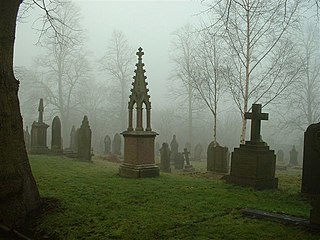
Kirkburton is a village, civil parish and ward in Kirklees in West Yorkshire, England. It is 5 miles (8 km) south-east of Huddersfield. Historically part of the West Riding of Yorkshire, the township comprises the villages of Kirkburton and Highburton and several hamlets, including Thunder Bridge, Thorncliffe, Storthes Hall, Burton Royd, Riley, Dogley, Common Side, Causeway Foot, Lane Head and Linfit. According to the 2011 census the civil parish had a population of 26,439, while the village itself had a population of 4,299.

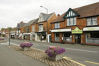
Rugby is a market town in eastern Warwickshire, England, close to the River Avon. At the 2021 census its population was 78,125, making it the second-largest town in Warwickshire. It is the main settlement within the larger Borough of Rugby, which had a population of 114,400 in 2021.

Southam is a market town and civil parish in the Stratford-on-Avon district of Warwickshire, England. Southam is situated on the River Stowe, which flows from Napton-on-the-Hill and joins Warwickshire's River Itchen at Stoneythorpe, just outside the town.

Warwickshire is a county in the West Midlands region of England. The county town is Warwick, and the largest town is Nuneaton. The county is famous for being the birthplace of William Shakespeare at Stratford-upon-Avon and Victorian novelist George Eliot,, at Nuneaton. Other significant towns include Rugby, Leamington Spa, Bedworth, Kenilworth and Atherstone. The county offers a mix of historic towns and large rural areas. It is a popular destination for international and domestic tourists to explore both medieval and more recent history.

Bulkington is a large village and former civil parish, now in the unparished area of Bedworth, in the Nuneaton and Bedworth district of Warwickshire, England. In the 2011 census the ward had a population of 6,146 and 6,303 in the 2001 census. It is located around 6 miles (10 km) northeast of Coventry, just east of the towns of Nuneaton and Bedworth and 5 miles (8 km) southwest of Hinckley. Despite historically having stronger links with Bedworth, Bulkington forms part of the Nuneaton Urban Area. Bulkington was mentioned in the Domesday Book as Bochintone, meaning "estate associated with a man called Bulca".
Studley is a large village and civil parish in the Stratford-on-Avon district of Warwickshire, England. Situated on the western edge of Warwickshire near the border with Worcestershire, it is 3.5 miles (6 km) southeast of Redditch and 13 miles (21 km) northwest of Stratford-upon-Avon. The Roman road of Ryknild Street, now the A435, passes through the village on its eastern edge, parallel to the River Arrow. The name derives from the Old English leah, being a meadow or pasture, where horses, stod, are kept.

Ansty is a village and civil parish in the Rugby Borough of Warwickshire, England, about 5 miles (8 km) northeast of Coventry city centre and 7 miles (13 km) south of Hinckley. Ansty was part of the County of the City of Coventry until that county was dissolved in 1842. Ansty is on the B4065, which used to be the main road between Coventry and Hinckley. The junction between the M6 and M69 motorways and A46 road is 1 mile (1.6 km) southwest of the village.

West Knighton is a village and civil parish in Dorset, England, situated 3 miles (4.8 km) southeast of the county town Dorchester. It has an 11th-century church and a village pub. In the 2011 census the civil parish had a population of 375.
Kingsbury is a large village and civil parish in the North Warwickshire district of the county of Warwickshire, in the West Midlands region of England. The civil parish population at the 2011 census was 7,652.

Wolston is a village and civil parish in the Rugby borough of Warwickshire, England. The village is located roughly halfway between Rugby and Coventry, and had a population of 2,692 at the 2021 census. It is close to the A45 road and the Roman road the Fosse Way.

Princethorpe is a village and civil parish in the Rugby district of Warwickshire, England. In the 2011 census the parish had a population 376, increasing to 429 at the 2021 census.
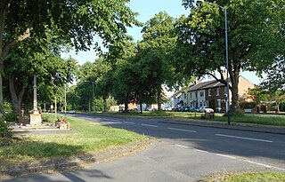
Hillmorton is a suburb of Rugby, Warwickshire, England, around 2 miles (3.2 km) south-east of Rugby town centre, forming much of the eastern half of the town. It is also a ward of the Borough of Rugby. Hillmorton was historically a village in its own right, but was incorporated into Rugby in 1932. Hillmorton also encompasses the Paddox housing estate to the west of the old village, which is shown on many maps as 'Hillmorton Paddox', this area however is part of a separate ward called 'Paddox'.

Knaptoft is a deserted medieval village and civil parish in the Harborough district of Leicestershire and lies approximately 9.7 miles (15.6 km) south of the city of Leicester, England. According to the University of Nottingham English Place-names project, the settlement name Knaptoft could mean 'cnafa' A boy, a young man, a servant, a menial, or a personal name, and 'toft' the plot of ground in which a dwelling stands. The population of the civil parish at the 2011 census was 47.

Withybrook is a rural village and civil parish in the English county of Warwickshire. Its population was 255 at the 2021 census, increased slightly from 242 at the 2011 census.

Combe Fields is a civil parish in the Rugby district, in the county of Warwickshire, England. The parish has no village, but contains Coombe Abbey, after which it is named, and a few isolated houses. In the 2001 census the parish had a population of 114 increasing to 126 at the 2011 census.

Brandon is a small village in Warwickshire, England. Along with nearby Bretford, it forms part of a joint civil parish of Brandon and Bretford. Administratively it is part of the borough of Rugby. The River Avon passes just to the east of the village. Brandon is located upon the A428 road between Coventry, 5 miles (8.0 km) to the west, and Rugby, 6 miles (9.7 km) to the east. 1 mile (1.6 km) west of Brandon is the suburban village of Binley Woods and 1.5 miles (2.4 km) to the east is the small hamlet of Bretford.

Baginton is a village and civil parish in the Warwick district of Warwickshire, England, and has a common border with the City of Coventry / West Midlands county. With a population of 801, Baginton village is 4 miles south of central Coventry, 4.5 miles northeast of Kenilworth and 7 miles north of Leamington Spa. The population had reduced slightly to 755 at the 2011 Census. The Lucy Price playing field is situated centrally in the village.

Easenhall is a small village and civil parish in Warwickshire, England, three miles north-west of the town of Rugby and a mile south of the M6 motorway. According to the 2011 Census the parish had a population of 291, reducing to 255 at the 2021 Census.

Steep is a village and civil parish in the East Hampshire district of Hampshire, England. Its nearest town is Petersfield, which lies 1.4 miles (2.3 km) south of the village, just off the A3 road. The nearest railway station is Petersfield, at 1.6 miles (2.6 km) south of the village. It has two public houses, The Harrow and the Cricketers Inn, with the former being an 18th-century Grade II listed building. According to the 2011 census, it had a population of 1,391.

Clifton-upon-Dunsmore is a village and civil parish in the Rugby borough of Warwickshire in England on the north-eastern outskirts of Rugby, approximately 2 miles (3.2 km) from Rugby town centre. The population of the parish taken at the 2011 census was 1,304. Clifton is counted as being part of the Rugby built-up area, but is considered separate from the town.

