
Google Maps is a web mapping platform and consumer application offered by Google. It offers satellite imagery, aerial photography, street maps, 360° interactive panoramic views of streets, real-time traffic conditions, and route planning for traveling by foot, car, bike, air and public transportation. As of 2020, Google Maps was being used by over one billion people every month around the world.

Google Earth is a computer program that renders a 3D representation of Earth based primarily on satellite imagery. The program maps the Earth by superimposing satellite images, aerial photography, and GIS data onto a 3D globe, allowing users to see cities and landscapes from various angles. Users can explore the globe by entering addresses and coordinates, or by using a keyboard or mouse. The program can also be downloaded on a smartphone or tablet, using a touch screen or stylus to navigate. Users may use the program to add their own data using Keyhole Markup Language and upload them through various sources, such as forums or blogs. Google Earth is able to show various kinds of images overlaid on the surface of the earth and is also a Web Map Service client. In 2019, Google has revealed that Google Earth now covers more than 97 percent of the world, and has captured 10 million miles of Street View imagery.

Google Street View is a technology featured in Google Maps and Google Earth that provides interactive panoramas from positions along many streets in the world. It was launched in 2007 in several cities in the United States, and has since expanded to include cities and rural areas worldwide. Streets with Street View imagery available are shown as blue lines on Google Maps.

Google Map Maker is a defunct map editing service launched by Google in June 2008. In geographies where it is hard to find providers of good map data, user contributions were used to increase map quality. Changes to Google Map Maker were intended to appear on Google Maps only after sufficient review by Google moderators. Google Map Maker was used at Google Mapathon events held annually.
Amdo Tibetan is the Tibetic language spoken in Amdo. It has two varieties, the farmer dialects and the nomad dialects.
Maggie Napaljarri Ross is an Aboriginal Australian artist. Her work has been collected by Artbank and the Kluge-Ruhe Museum in the United States.
Waze, formerly FreeMap Israel, is a subsidiary company of Google that provides satellite navigation software on smartphones and other computers that support the Global Positioning System (GPS). In addition to turn-by-turn navigation, it incorporates user-submitted travel times and route details while downloading location-dependent information over a cellular network. Waze describes its application as a community-driven initiative that is free to download and use.
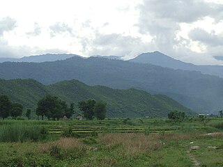
Kale Township is a township in Kale District in the Sagaing Division of Burma (Myanmar). The principal town is Kalay.
Ngapa is a village in Kale Township, Kale District, in the Sagaing Region of western Burma.
Ngapa is a village in Donggala Regency, in the province of Central Sulawesi in eastern Indonesia.
Ngapa is a Town in North Kolaka Regency, in the province of Southeast Sulawesi in eastern Indonesia.
Google Street View was first introduced in the United States on May 25, 2007, and until November 26, 2008, featured camera icon markers, each representing at least one major city or area, and usually the other nearby cities, towns, suburbs, and parks. Many areas that had coverage were represented by icons.

The Google Maps pin is the inverted-drop-shaped icon that marks locations in Google Maps. The pin is protected under a U.S. design patent as "teardrop-shaped marker icon including a shadow". Google has used the pin in various graphics, games, and promotional materials.

The Ōshima Strait is a strait between the islands of Amami Ōshima and Kakeromajima in Japan. It is part of the Amami Guntō National Park. From the western most side to the eastern most side of the strait, the strait measures 17.5 miles (28.2 km) long.

"2 Hours Doing Nothing" is a two-hour video created by YouTuber Muhammad Didit, published on his YouTube channel Sobat Miskin Official on 10 July 2020 at 11:21:44 UTC. The video features Didit staring at the camera in his bedroom for two hours. It was originally intended to be a 10-minute video. It surpassed four million views and a mobile game of the same name was later published.
This page is based on this
Wikipedia article Text is available under the
CC BY-SA 4.0 license; additional terms may apply.
Images, videos and audio are available under their respective licenses.
