
Kimberley is the capital and largest city of the Northern Cape province of South Africa. It is located approximately 110 km east of the confluence of the Vaal and Orange Rivers. The city has considerable historical significance due to its diamond mining past and the siege during the Second Anglo-Boer war. British businessmen Cecil Rhodes and Barney Barnato made their fortunes in Kimberley, and Rhodes established the De Beers diamond company in the early days of the mining town.

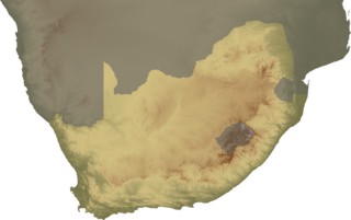
The Northern Cape is the largest and most sparsely populated province of South Africa. It was created in 1994 when the Cape Province was split up. Its capital is Kimberley. It includes the Kalahari Gemsbok National Park, part of the Kgalagadi Transfrontier Park and an international park shared with Botswana. It also includes the Augrabies Falls and the diamond mining regions in Kimberley and Alexander Bay.
Griqualand West is an area of central South Africa with an area of 40,000 km2 that now forms part of the Northern Cape Province. It was inhabited by the Griqua people – a semi-nomadic, Afrikaans-speaking nation of mixed-race origin, who established several states outside the expanding frontier of the Cape Colony. It was also inhabited by the pre-existing Tswana and Khoisan peoples.

The Karoo is a semi-desert natural region of South Africa. No exact definition of what constitutes the Karoo is available, so its extent is also not precisely defined. The Karoo is partly defined by its topography, geology and climate, and above all, its low rainfall, arid air, cloudless skies, and extremes of heat and cold. The Karoo also hosted a well-preserved ecosystem hundreds of million years ago which is now represented by many fossils.
Christiana is an agricultural town of about 3,000 inhabitants on the banks of the Vaal River in North West province, South Africa The town is located on the N12 national route between Bloemhof and Warrenton, on the way to Kimberley. It is the administrative centre and seat of Lekwa-Teemane Local Municipality.
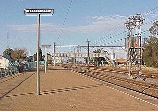
Barkly West is a town in the Northern Cape province of South Africa, situated on the north bank of the Vaal River west of Kimberley.

The Harts River is a northern tributary of the Vaal River, which in turn is the largest tributary of the Orange River. Its source is in the North West Province, but the greater part of its basin is located in the Northern Cape Province, which it enters a few kilometers downstream from the Taung Dam.

The Karoo Supergroup is the most widespread stratigraphic unit in Africa south of the Kalahari Desert. The supergroup consists of a sequence of units, mostly of nonmarine origin, deposited between the Late Carboniferous and Early Jurassic, a period of about 120 million years.

The Cape Fold Belt is a fold and thrust belt of late Paleozoic age, which affected the sequence of sedimentary rock layers of the Cape Supergroup in the southwestern corner of South Africa. It was originally continuous with the Ventana Mountains near Bahía Blanca in Argentina, the Pensacola Mountains, the Ellsworth Mountains and the Hunter-Bowen orogeny in eastern Australia. The rocks involved are generally sandstones and shales, with the shales persisting in the valley floors while the erosion resistant sandstones form the parallel ranges, the Cape Fold Mountains, which reach a maximum height of 2325 m at Seweweekspoortpiek.
Nooitgedacht is the name of several places:
Hallett Cove Conservation Park is a protected area in the Australian state of South Australia located in the suburb of Hallett Cove on the coast of Gulf St Vincent about 22 kilometres south of the centre of the state capital of Adelaide.
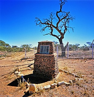
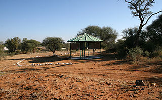
Driekops Eiland is a rock engraving or petroglyph site in the bed of the Riet River close to the town of Plooysburg, near Kimberley, Northern Cape, South Africa.

Plooysburg is a small town about 70 km west of Kimberley, Northern Cape, South Africa. It is situated close to the Riet River. With a church, school, police station and shop it serves a local farming and farm-worker community. Nearby is the rock art site of Driekops Eiland, and the Mokala National Park.
Wildebeest Kuil Rock Art Centre is a rock engraving site with visitor centre on land owned by the !Xun and Khwe San situated about 16 km from Kimberley, Northern Cape, South Africa. It is a declared Provincial Heritage Site managed by the Northern Cape Rock Art Trust in association with the McGregor Museum. The engravings exemplify one of the forms often referred to as ‘Bushman rock art’ – or Khoe-San rock art – with the rock paintings of the Drakensberg, Cederberg and other regions of South Africa being generally better known occurrences. Differing in technique, the engravings have many features in common with rock paintings. A greater emphasis on large mammals such as elephant, rhino and hippo, in addition to eland, and an often reduced concern with depicting the human form set the engravings apart from the paintings of the sub-continent.
The concept of the Northern Cape as a distinct geo-political region of South Africa coalesced in the 1940s when a "Northern Cape and Adjoining Areas Regional Development Association" was formed and the first map featuring the name "Northern Cape" was published. The geographic spread to which the term applied was not fixed until 1994, however, when it attained precise definition as the Northern Cape Province, one of South Africa's nine post-apartheid provinces. Since then there have been boundary adjustments to include parts of the former Bophuthatswana adjacent to Kuruman and Hartswater. Vryburg and Mafikeng, in the north eastern extremity of the former Cape Province - and hence regarded as part of the pre-1994 "Northern Cape" - are excluded, being part, now, of the North West Province in the North.
Canteen Kopje is an archaeological site, formally protected as a grade 2 provincial heritage site, and approved in 2017 for re-grading to national status, situated outside Barkly West in the Northern Cape, South Africa. The place was previously known as Klipdrift, meaning stony drift, a translation from a still earlier !Ora name, !a |aub. Canteen Kopje is best known for its long and exceptionally rich Earlier Stone Age sequence, spanning circa >0.5 to 1.7 million years, occurring within gravels exposed in late nineteenth/early twentieth century mining pits. Also attracting attention are more recent archaeological levels in the overlying Hutton Sands, which contain material known as Fauresmith, Middle Stone Age, Later Stone Age, and late Iron Age with evidence of protocolonial/colonial contact and interaction, probably, with nineteenth century diamond diggers.

The Dwyka Group is one of four geological groups that compose the Karoo Supergroup. It is the lowermost geological group and heralds the commencement of sedimentation of the Karoo Supergroup. Based on stratigraphic position, lithostratigraphic correlation and palynological analyses, these lowermost Karoo strata range between the Late Carboniferous (Pennsylvanian) to Early Permian in age.
The Dwyka River is located in the Karoo region, in South Africa. It flows from the North-west, joining the Gamka River as a tributary at the Gamka Dam.
The geology of Lesotho is built on ancient crystalline basement rock up to 3.6 billion years old, belonging to the Kaapvaal Craton, a section of stable primordial crust. Most of the rocks in the country are sedimentary or volcanic units, belonging to the Karoo Supergroup. The country is notable for large fossil deposits and intense erosion due to high rainfall and a rare case of southern African glaciation during the last ice age. Lesotho has extensive diamonds and other natural resources and has the highest concentration of kimberlite pipes anywhere in the world.


