
Hydraulic mining is a form of mining that uses high-pressure jets of water to dislodge rock material or move sediment. In the placer mining of gold or tin, the resulting water-sediment slurry is directed through sluice boxes to remove the gold. It is also used in mining kaolin and coal.

The Gold Country is a historic region in the northern portion of the U.S. state of California, that is primarily on the western slope of the Sierra Nevada. It is famed for the mineral deposits and gold mines that attracted waves of immigrants, known as the 49ers, during the 1849 California Gold Rush.

Malakoff Diggins State Historic Park is a state park unit preserving Malakoff Diggins, the largest hydraulic mining site in California, United States. The mine was one of several hydraulic mining sites at the center of the 1882 landmark case Woodruff v. North Bloomfield Mining and Gravel Company. The mine pit and several Gold Rush-era buildings are listed on the National Register of Historic Places as the Malakoff Diggins-North Bloomfield Historic District. The "canyon" is 7,000 feet (2,100 m) long, as much as 3,000 feet (910 m) wide, and nearly 600 feet (180 m) deep in places. Visitors can see huge cliffs carved by mighty streams of water, results of the mining technique of washing away entire mountains of gravel to wash out the gold. The park is 26 miles (42 km) north-east of Nevada City, California, in the Gold Rush country. The 3,143-acre (1,272 ha) park was established in 1965.

South Yuba River State Park is located along the South Fork of the Yuba River in the Sierra Nevada, within Nevada County, in Northern California.
You Bet is a small unincorporated community in Nevada County, California. You Bet is located in the Sierra Nevada foothills, 7 miles (11.3 km) east of Grass Valley and 5.5 miles (8.9 km) northeast of Chicago Park.
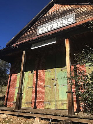
French Corral is an unincorporated community approximately five miles west of California State Highway 49 in Nevada County, California, United States.

The San Juan Ridge is a geographic feature extending approximately 24 miles (39 km) east-northeast between the South and Middle Yuba Rivers in the foothills of the northern Sierra Nevada. The elevation is approximately 790 m (2,600 ft) above sea level.
North Columbia was a California Gold Rush town on the San Juan Ridge in Nevada County, California. Originally known as Columbia, Columbia Hill, or The Hill because of its proximity to Columbia Hill, it started as a gold miners' camp around 1851. When a Post Office was established on May 29, 1860, the word "North" was added in order to differentiate the settlement from Columbia, California, another gold rush town in Tuolumne County, California.

North San Juan is a census-designated place in Nevada County, California, United States, along State Route 49 on the San Juan Ridge in Gold Country. The zip code is 95960. The population was 269 at the 2010 census.
Gold Hill in Grass Valley, California, was the site of one of the first discoveries of quartz gold in California. While quartz gold was also found in other areas of Nevada County, California during the same time, it is this find near Wolf Creek that led to quartz-mining frenzy and subsequent creation of the Gold Country quartz-mining industry. The location is honored as a California Historical Landmark.

The North Bloomfield Mining and Gravel Company of North Bloomfield, California, was established in 1866 and operated a hydraulic gold-mining operation at the Malakoff Mine subsequent to the California Gold Rush. In its day, no other company's operations matched North Bloomfield Mining and Gravel Company in size or expense. The company operated until 1910. In the years prior, its profits and procedures had been reduced due to the landmark ruling of Woodruff v. North Bloomfield Gravel Mining Company.
Lake City is an unincorporated community in Nevada County, California. It lies at an elevation of 3300 ft. about 10 miles northeast of Nevada City as the crow flies, and about three miles southeast of North Columbia, and three miles southwest of North Bloomfield. It is located at the junction of modern day North Bloomfield, Back Bone and Lake City Roads. It was an important mining and transportation center in the second half of the 19th century.
Orleans Flat was a historic mining town located on the San Juan Ridge about 20 miles northeast of Nevada City, California and about 5 miles northeast of North Bloomfield, California. The town was about 1 mile south of the Middle Yuba River at an elevation of about 4200 ft. To the west lay the mining towns of Moore's Flat and Woolsey's Flat, each about I mile apart. All three were settled around 1851 and their histories frequently intertwine. Collectively, they are sometimes referred to as "The Flats." All three were part of Eureka Township.
Omega was a former settlement in Nevada County, California, United States, first populated in 1850 by a single miner, J.A. Dixon, working a claim during the California Gold Rush. The town was located 3.25 miles (5.2 km) east-southeast of the present-day unincorporated town of Washington, California. A sister town, Alpha, located at what is now the site of the historical Omega Hydraulic Diggings, was about 1 mi (1.6 km) north of Omega. In the mid 1850s, following the introduction of hydraulic mining operations nearby, the town prospered. Omega had a post office, and needed to convert a residence into a jail in late 1858.
Snow Tent was a historic settlement in Nevada County, California. The name derives from a tent set up by the first resident in 1850. Snow Tent grew into a gold mining and lumbering center, then vanished sometime after 1880.
Birchville is a historic mining and agricultural community in Nevada County, California. Birchville is located about 10 miles northwest of Nevada City and about 2 miles northeast of French Corral. It is situated at an elevation of 1,765 ft (538 m) above sea level.
Cherokee is a former gold mining community in Nevada County, California. The community has also been known as Patterson, Melrose, and Tyler. It is located on the San Juan Ridge about 4 miles east of North San Juan. Its elevation is 2,516 ft (767 m) above sea level.
Remington Hill is a historic mining camp in Nevada County, California which prospered in the second half of the 19th century. It was named for Caleb Remington, a prominent local miner who lived mostly in neighboring Little York, where he died in 1865. It lay at an elevation of 4052 feet. It was situated around present Chalk Bluff Road about one mile south of Highway 20 and about 5.5 miles southeast of the town of Washington and 6 miles northeast of Dutch Flat, as the crow flies.

The case of Woodruff v. North Bloomfield Gravel Mining Company was a lawsuit brought to California courts in 1882 where a group of local farmers sued North Bloomfield Mining and Gravel Company over damages caused to farmland in the Central Valley. The farmers who brought the suit claimed that the company's hydraulic mining operations resulted in the disposal of excess sediment, debris, and chemicals in local rivers. Prosecutors argued that the debris raised river beds and restricted flow in the rivers leading to heavy man-made flooding. In the years prior, flooding of debris and chemicals had destroyed a large portion of the valley's agriculture.
The Pioneer Cemetery is a cemetery established in c. 1851 behind the Nevada City United Methodist Church, in Nevada City, California. This was the first cemetery in Nevada City, formed during the California Gold Rush.

