Tokeland is a census-designated place (CDP) in Pacific County, Washington, United States. The population was 151 at the 2010 census, a sharp decrease from the 194 at the 2000 census.

Coastal erosion is the loss or displacement of land, or the long-term removal of sediment and rocks along the coastline due to the action of waves, currents, tides, wind-driven water, waterborne ice, or other impacts of storms. The landward retreat of the shoreline can be measured and described over a temporal scale of tides, seasons, and other short-term cyclic processes. Coastal erosion may be caused by hydraulic action, abrasion, impact and corrosion by wind and water, and other forces, natural or unnatural.

The Chehalis people or Tsihalis are a native people of western Washington state in the United States. They should not be confused with the similarly named Chehalis First Nation of the Sts'Ailes people along the Harrison River in the Fraser Valley area of British Columbia.

Shoalwater Bay Tribe is a Native American tribe in western Washington state in the United States. They are descendants of the Willapa Chinook, Lower Chehalis, and the Northern Athabaskan speaking Willapa (Kwalhioqua). The Shoalwater Bay tribe lives on the southwest coast of Washington in northwestern Pacific County, along the shores of Willapa Bay where the 2.693 km² Shoalwater Bay Indian Reservation with 70 inhabitants is located. The reservation is just west of Tokeland, Washington.

Willapa Bay is a bay located on the southwest Pacific coast of Washington state in the United States. The Long Beach Peninsula separates Willapa Bay from the greater expanse of the Pacific Ocean. With over 120 square miles (310 km2) of surface area Willapa Bay is the second-largest riverine estuary on the Pacific coast of the continental United States. Early settlers called the bay Shoalwater Bay and this name is found on old maps and charts of the region.

Chappaquiddick Island is a peninsula and occasional island off the eastern end of Martha's Vineyard. Norton Point, a narrow barrier beach, connects Martha's Vineyard and Chappaquiddick between Katama and Wasque. Breaches occur due to hurricanes and strong storms separating the islands for periods of time. The two islands most recently reconnected on December 31, 2023. While both land forms have mostly been connected to one another in modern history, Chappaquiddick is nevertheless referred to as an island.

Beach nourishment describes a process by which sediment, usually sand, lost through longshore drift or erosion is replaced from other sources. A wider beach can reduce storm damage to coastal structures by dissipating energy across the surf zone, protecting upland structures and infrastructure from storm surges, tsunamis and unusually high tides. Beach nourishment is typically part of a larger integrated coastal zone management aimed at coastal defense. Nourishment is typically a repetitive process since it does not remove the physical forces that cause erosion but simply mitigates their effects.

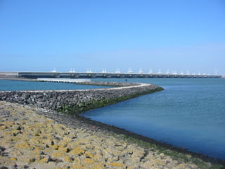
A revetment in stream restoration, river engineering or coastal engineering is a facing of impact-resistant material applied to a bank or wall in order to absorb the energy of incoming water and protect it from erosion. River or coastal revetments are usually built to preserve the existing uses of the shoreline and to protect the slope.

State Route 105 (SR 105) is a state highway in the U.S. state of Washington. It travels 48 miles (77 km) along the Pacific Coast between two junctions with U.S. Route 101 (US 101) in Raymond to the south and Aberdeen in the north. The highway also has two spur routes: a 4-mile (6 km) road serving the city of Westport on Grays Harbor and a short connector in Aberdeen.

Coastal management is defence against flooding and erosion, and techniques that stop erosion to claim lands. Protection against rising sea levels in the 21st century is crucial, as sea level rise accelerates due to climate change. Changes in sea level damage beaches and coastal systems are expected to rise at an increasing rate, causing coastal sediments to be disturbed by tidal energy.

A bay is a recessed, coastal body of water that directly connects to a larger main body of water, such as an ocean, a lake, or another bay. A large bay is usually called a gulf, sea, sound, or bight. A cove is a small, circular bay with a narrow entrance. A fjord is an elongated bay formed by glacial action. The term embayment is also used for related features, such as extinct bays or freshwater environments.
Beach evolution occurs at the shoreline where sea, lake or river water is eroding the land. Beaches exist where sand accumulated from centuries-old, recurrent processes that erode rocky and sedimentary material into sand deposits. River deltas deposit silt from upriver, accreting at the river's outlet to extend lake or ocean shorelines. Catastrophic events such as tsunamis, hurricanes, and storm surges accelerate beach erosion.

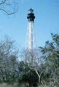
Cape Charles Lighthouse is an octagonal cast iron skeleton tower lighthouse at the mouth of the Chesapeake Bay on Smith Island which was officially removed from service in 2019. It is the tallest lighthouse in Virginia and the second tallest in the United States. This particular tower is the third lighthouse at this location. The first lighthouse at Cape Charles was a 55-foot (17 m) masonry tower completed in 1828. It was quickly deemed inadequate for its important seacoast location due to its low height and poor visibility at sea. It was soon threatened by erosion so in 1864 it was replaced by a 150-foot (46 m) masonry tower built further inland. Located a little more than a mile southwest of the old tower and 600 feet from the shoreline, the impressive 150-foot-tall conical brick tower was similar in appearance to the 1857 Cape May Lighthouse, painted white and topped with a dark brown lantern room. In 1892, a twenty-five-foot red band was painted around the white tower's midsection, about sixty feet up from the base, to make it more visible during the day. By the 1890s, it too was threatened by beach erosion which jetties built to protect it failed to halt, and with the lighthouse now only 300 feet from the ocean and the shoreline eroding at a rate of 37 feet per year it was decided that a third lighthouse needed to be built three quarters of a mile inland.
Willapa Bay is a large shallow body of water near the Pacific Ocean in southwestern Washington. For a number of years before modern roads were built in Pacific County, Washington, the bay was used as the means of travel around the county, by powered and unpowered craft, including several steamboats.

La Push Beach is a series of three beaches near the community of La Push, Washington, on the Pacific coast of the United States. The beach's most prominent natural vegetation the Sitka, spruce, and evergreen trees that populate the shore.
Clifton is a coastal beach reserve motor camp in Hawke's Bay, New Zealand. It is located eighteen kilometres southeast of the city centre of Napier and eight kilometres west of the tip of Cape Kidnappers. Clifton marks the start of the walk or ride around to the Cape Kidnappers gannet colony.

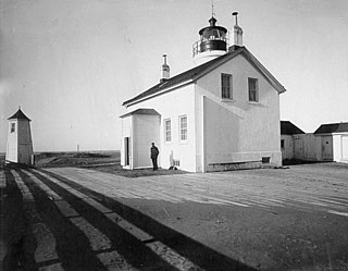
The Willapa Bay Light, originally the Shoalwater Bay Light, was a lighthouse at the north side of the entrance to Willapa Bay in the U.S. state of Washington. It was demolished when shore erosion threatened to topple it.
The Cedar River is a short stream flowing into the north end of Willapa Bay in the U.S. state of Washington.

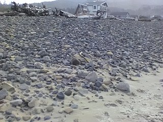
Dynamic revetments, also known as "cobble berms" or "dynamic cobble berm revetments", use gravel or cobble-sized rocks to mimic a natural cobble storm beach for the purpose of reducing wave energy and stopping or slowing coastal erosion. Unlike seawalls, dynamic revetment is designed to allow wave action to rearrange the stones into an equilibrium profile, disrupting wave action and dissipating wave energy as the cobbles move. This can reduce the wave reflection which often contributes to beach scouring.


